Home
States
Colorado
Connecticut
Maine
Massachusetts
New Hampshire
New York
Rhode Island
Utah
Vermont
View All
Lists
NE 4,000 Footers
NE 100 Highest
NH 4,000 Footers
NH 100 Highest
NH 52 With A View
NH Belknap Range
NH Ossipee 10
Links
Trail Conditions
Trip Log
Sunrises
Sunsets
About
|
West Royce Mountain
Chatham, NH, Stow, ME, Batchelders Grant, ME, Beans Purchase, NH
Trailheads, measurements, times, distances, and maps are all approximate and relative to the hike(s) as shown below.
The lower Royce Trail
Route: Basin access road, Route 113, Royce Trail, Basin Rim Trail, Basin Trail
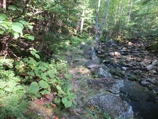
Royce Trail was fairly smooth sailing until near the Laughing Lion Trail junction. Rough from there up to the Connector, then relatively smooth again (some nice quasi-recent Level 2 trail work) until the Burnt Mill Brook junction.
Basin Rim Trail was rugged in places, but there were some nice views along the way. Basin Trail was quite rugged above the falls spur. Steep, eroded, and loaded with old, large blowdowns to climb over.
First time to the Basin area - very neat!
| Hike Ratings |
|
Getting To Trailhead: |
Easy |
| Destination: |
West Royce Mountain |
|
Length: |
Moderate |
|
Steepness: |
Very Difficult |
|
Navigation: |
Easy |
|
Views: |
Excellent |
|
Crowds: |
Minimal |
|
| Hike Stats |
|
Date Hiked: |
Sunday, August 26, 2012 |
| Time to Trailhead: |
00:12 |
| Parking Elevation: |
680' |
| Destination: |
West Royce Mountain |
| Time Elapsed: |
02:21 |
| Trailhead Elevation: |
600' |
| Summit Elevation: |
3,210' |
| Distance: |
4.3 miles |
| Vertical Gain: |
2,760' |
|
|
| Hike Time Elapsed: |
05:38 |
| Hike Vertical Gain: |
3,010' |
|
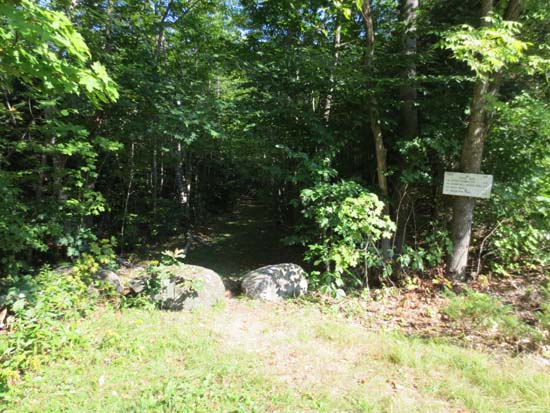
The Royce Trail trailhead on Route 113
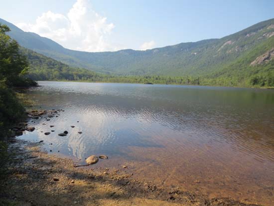
Basin Pond
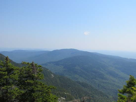
Looking at Speckled Mountain from near the summit of West Royce
Directions to trailhead: The Royce Trail trailhead is located adjacent to Bickford Place on Route 113 in Evans Notch, just north of the access road to the Basin.
Back to West Royce Mountain Profile
|

