Home
States
Colorado
Connecticut
Maine
Massachusetts
New Hampshire
New York
Rhode Island
Utah
Vermont
View All
Lists
NE 4,000 Footers
NE 100 Highest
NH 4,000 Footers
NH 100 Highest
NH 52 With A View
NH Belknap Range
NH Ossipee 10
Links
Trail Conditions
Trip Log
Sunrises
Sunsets
About
|
Whitcomb Mountain - East Peak
Millsfield, NH
Trailheads, measurements, times, distances, and maps are all approximate and relative to the hike(s) as shown below.

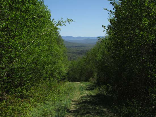
Looking down one of the logging roads
Route: Logging roads
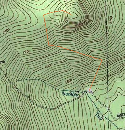
From the open area on Trio Ponds Road (just before it crosses Number Two Brook), we followed the grassier logging road (left of a gravel one), then beared left at a landing at about 0.3 miles, passed through another landing, then around 0.8 miles, took a right turn (just before another landing) onto an ATV trail. Gaining the ridge, we beared right and eventually found ourselves at the tower.
Snow free and mostly dry with one area of mud at the start of the ATV trail.
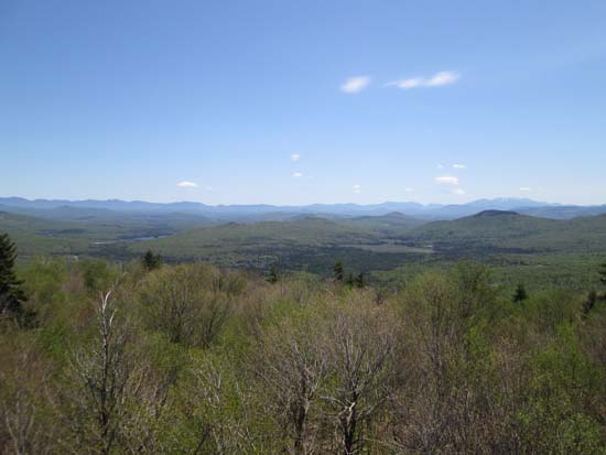
Fantastic views from the tower (none from the ground), especially of the Mahoosucs and Presis.
| Hike Ratings |
|
Getting To Trailhead: |
Moderate |
| Destination: |
Whitcomb Mountain - East Peak |
|
Length: |
Moderate |
|
Steepness: |
Moderate |
|
Navigation: |
Moderate |
|
Views: |
Excellent |
|
Crowds: |
Minimal |
|
| Hike Stats |
|
Date Hiked: |
Saturday, May 23, 2015 |
| Parking Elevation: |
1,660' |
| Destination: |
Whitcomb Mountain - East Peak |
| Time Elapsed: |
00:39 |
| Trailhead Elevation: |
1,660' |
| Summit Elevation: |
2,510' |
| Vertical Gain: |
865' |
|
|
| Hike Time Elapsed: |
01:21 |
| Hike Vertical Gain: |
880' |
|

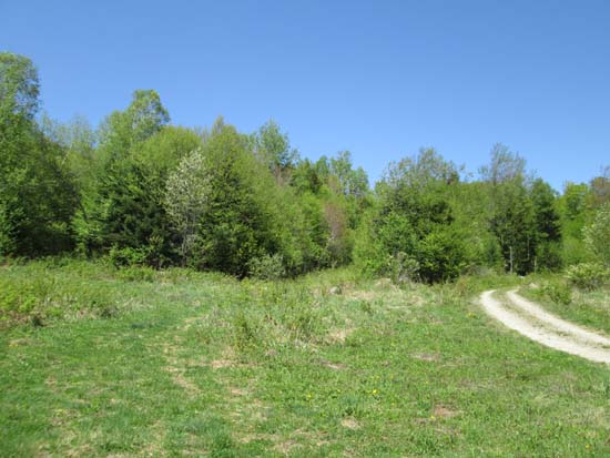
The start of the grassy logging road (center)

Looking southeast from the East Whitcomb fire tower


Directions to trailhead: From Phillips Brook Road north of Stark, go west on Trio Ponds Road. There is a landing just prior to the Number Two Brook crossing. To the north side of Trio Ponds Road, start up a grassy road (a gravel road is to its right).
Back to Whitcomb Mountain - East Peak Profile
|