Home
States
Colorado
Connecticut
Maine
Massachusetts
New Hampshire
New York
Rhode Island
Utah
Vermont
View All
Lists
NE 4,000 Footers
NE 100 Highest
NH 4,000 Footers
NH 100 Highest
NH 52 With A View
NH Belknap Range
NH Ossipee 10
Links
Trail Conditions
Trip Log
Sunrises
Sunsets
About
|
Whiteface Mountain
Gilford, NH
Trailheads, measurements, times, distances, and maps are all approximate and relative to the hike(s) as shown below.
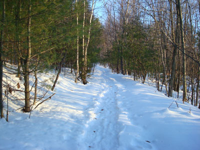
Looking up the Piper Whiteface Trail
Route: Piper Whiteface Trail, Whiteface Trail, (Whiteface Mountain summit), Whiteface Trail, Piper Whiteface Trail
I finally made it to Whiteface Mountain. I had intended to hike this peak a few months earlier, however the end of the public road confused me - come to find out, the trailhead is a very short walk past this.
I was the first person up this trail since the previous day's rain. I wore my snowshoes the entire way for traction.
The Piper Whiteface Trail wasn't heavily marked, at least as much as I could notice, however it was very obvious. After the trail splits off from the trail to Piper Mountain, Whiteface becomes visible in the distance. I found this portion of the trail a bit confusing, as there were multiple foot and snowmobile tracks. Nonetheless, I was able to find the peak with decent ease.
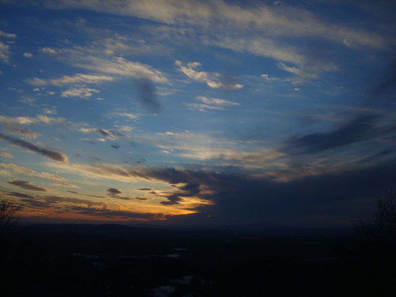
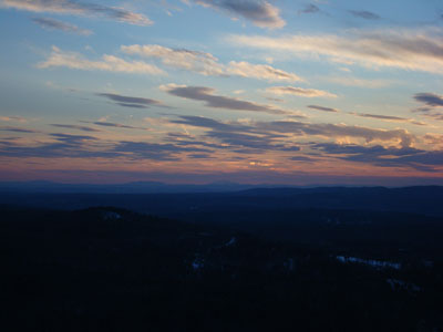
The Whiteface summit is fairly open, with decent views in nearly every direction. Though the forecast was good, the sunset was somewhat obscured by a small storm looming over Kearsarge Mountain. Nonetheless, there were some decent colors.
| Hike Ratings |
|
Getting To Trailhead: |
Easy |
| Destination: |
Whiteface Mountain |
|
Length: |
Moderate |
|
Steepness: |
Moderate |
|
Navigation: |
Moderate |
|
Views: |
Excellent |
|
Crowds: |
Minimal |
|
| Hike Stats |
|
Date Hiked: |
Thursday, January 31, 2008 |
| Hike Commenced: |
4:09 PM |
| Parking Elevation: |
1,050' |
| Destination: |
Whiteface Mountain |
| Ascent Commenced: |
4:12 PM |
| Summit Reached: |
4:45 PM |
| Time Elapsed: |
00:32 |
| Trailhead Elevation: |
1,060' |
| Summit Elevation: |
1,664' |
| Vertical Gain: |
739' |
|
|
| Hike Vertical Gain: |
794' |
|
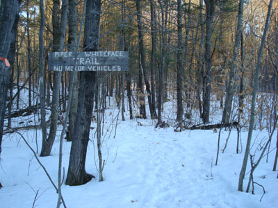
The Piper Whiteface Trail trailhead on Belknap Mountain Road
Looking at Mt. Monadnock from the Whiteface Mountain summit

The sunset as seen from the Whiteface Mountain summit
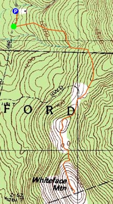

Directions to trailhead: From Route 11A East (from Route 3), take a right on Hoyt Road. Continue down this road as it becomes Belknap Mountain Road. At the end of this road, take a left. There will eventually be a turnaround area with a private road sign. Park here, and continue up the road on foot. The Piper Whiteface Trail trailhead will be on the left side of the road.
Back to Whiteface Mountain Profile
|