Home
States
Colorado
Connecticut
Maine
Massachusetts
New Hampshire
New York
Rhode Island
Utah
Vermont
View All
Lists
NE 4,000 Footers
NE 100 Highest
NH 4,000 Footers
NH 100 Highest
NH 52 With A View
NH Belknap Range
NH Ossipee 10
Links
Trail Conditions
Trip Log
Sunrises
Sunsets
About
|
Whiteface Mountain
Gilford, NH
Trailheads, measurements, times, distances, and maps are all approximate and relative to the hike(s) as shown below.
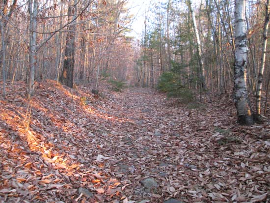
Late afternoon light on the Piper Whiteface Trail
Route: Piper Whiteface Trail, Whiteface Trail, (Whiteface Mountain summit), Whiteface Trail, Piper Whiteface Trail
Trail was dry with a tiny patch of minimal snow up high. Breakable crust over the large puddles on the jeep road portion. Otherwise, no ice to deal with - no need to carry traction for this trail right now.
Don't forget blaze orange! Encountered a friendly hunter on my jog out.
| Hike Ratings |
|
Getting To Trailhead: |
Easy |
| Destination: |
Whiteface Mountain |
|
Length: |
Moderate |
|
Steepness: |
Moderate |
|
Navigation: |
Moderate |
|
Views: |
Excellent |
|
Crowds: |
Minimal |
|
| Hike Stats |
|
Date Hiked: |
Thursday, November 14, 2013 |
| Parking Elevation: |
1,050' |
| Destination: |
Whiteface Mountain |
| Time Elapsed: |
00:22 |
| Trailhead Elevation: |
1,060' |
| Summit Elevation: |
1,664' |
| Vertical Gain: |
739' |
|
|
| Hike Time Elapsed: |
01:00 |
| Hike Vertical Gain: |
794' |
|
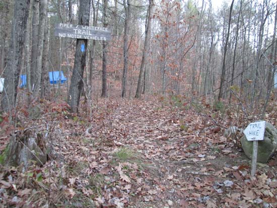
The Piper Whiteface Trail trailhead on Belknap Mountain Road
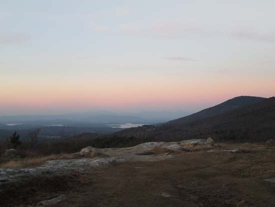
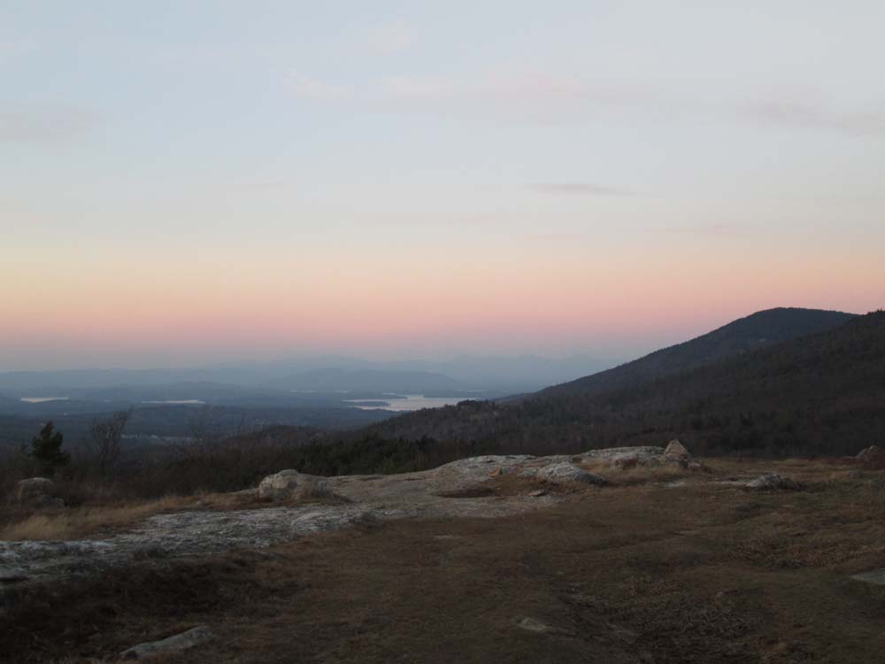
Looking north from Whiteface Mountain
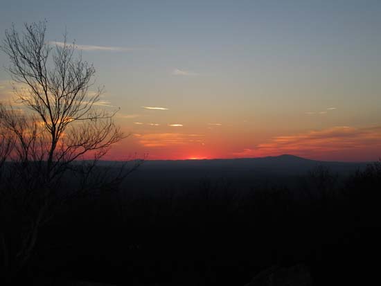
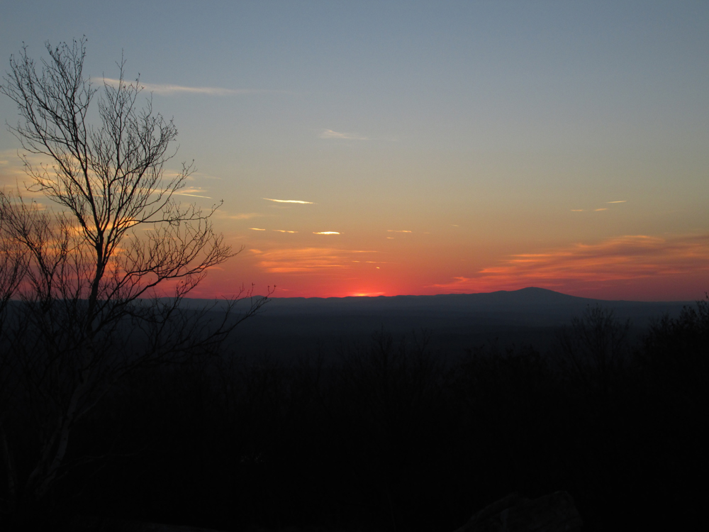
The sunset as seen from Whiteface Mountain
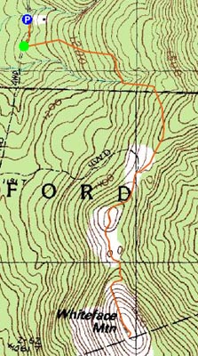

Directions to trailhead: From Route 11A East (from Route 3), take a right on Hoyt Road. Continue down this road as it becomes Belknap Mountain Road. At the end of this road, take a left. There will eventually be a turnaround area with a private road sign. Park here, and continue up the road on foot. The Piper Whiteface Trail trailhead will be on the left side of the road.
Back to Whiteface Mountain Profile
|