Home
States
Colorado
Connecticut
Maine
Massachusetts
New Hampshire
New York
Rhode Island
Utah
Vermont
View All
Lists
NE 4,000 Footers
NE 100 Highest
NH 4,000 Footers
NH 100 Highest
NH 52 With A View
NH Belknap Range
NH Ossipee 10
Links
Trail Conditions
Trip Log
Sunrises
Sunsets
About
|
White Horse Ledge
North Conway, NH, Hale's Location, NH
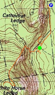
Trailheads, measurements, times, distances, and maps are all approximate and relative to the hike(s) as shown below.
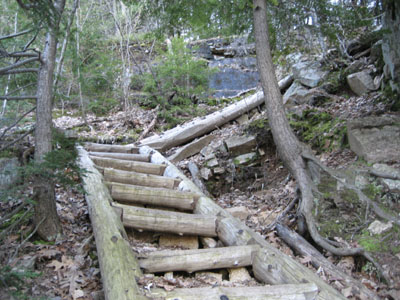
Set of stairways up the Bryce Trail
Route: Various to Bryce Path, Bryce Path, White Horse Ledge Trail
This hike was supposed to be Mt. Israel, but the need to go to the bank overrode previous plans, so I chose something in the North Conway area. Wanting to get back in time for the first Republican debate and The Office, I opted for a somewhat brief hike up White Horse Ledge.
Arriving in the park, I realized the gate was closed and I would have to go around Echo Lake in order to get to where I wanted to go. After figuring out the weird map of mostly unlabelled trails, I found a more direct route via Cathedral Ledge.
Arriving at the base of the ledge, I sent out looking for the Bryce Path. This was not quite as easy as I had hoped, as the trails weren't really marked. At one point, I followed a well worn path up to a random cliff in the woods.
After awhile, I was able to find the Bryce Path (once found, its easy to follow), and ascent up between White Horse Ledge and Cathedral Ledge.
The trail itself was steep in parts, as it climbed up a bunch of stairs. Once it flattened out, the White Horse Ledge trail went off to the left. After a short, steep ascent, things opened up as the trail followed along a set of cliffs. Eventually, I was at the top, which offered good views into Maine, decent views toward Kearsarge North-Middle Mountain, and a view of the Moats.
Though I toyed with heading over to Cathedral Ledge, time was not on my side. The French in me gave up and called it a night.
All in all, a nice somewhat short hike...sort of like a bad indie movie - hard to follow beginning, bland middle, and an interesting conclusion.
| Hike Ratings |
|
Getting To Trailhead: |
Moderate |
| Destination: |
White Horse Ledge |
|
Length: |
Moderate |
|
Steepness: |
Difficult |
|
Navigation: |
Easy |
|
Views: |
Excellent |
|
Crowds: |
Minimal |
|
| Hike Stats |
|
Date Hiked: |
Thursday, May 3, 2007 |
| Hike Commenced: |
4:27 PM |
| Parking Elevation: |
520' |
| Destination: |
White Horse Ledge |
| Ascent Commenced: |
4:52 PM |
| Summit Reached: |
5:19 PM |
| Time Elapsed: |
00:27 |
| Trailhead Elevation: |
580' |
| Summit Elevation: |
1,440' |
| Vertical Gain: |
880' |
|
|
| Hike Ended: |
6:01 PM |
| Hike Time Elapsed: |
01:34 |
| Hike Vertical Gain: |
1,080' |
|
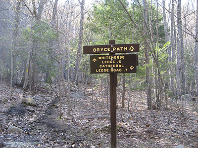
Bryce Trail trailhead
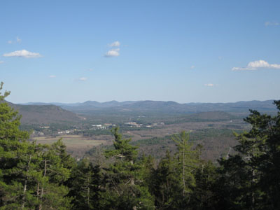
Looking southeast into Maine from the summit of White Horse Ledge.

Directions to trailhead: Follow the signs for Cathedral Ledge State Park from North Conway. Entrance way is next to the West Side Road stop sign, northwest of downtown. Parking is a bit tricky due to private property, however there is space near Cathedral Ledge.
Back to White Horse Ledge Profile
|

