Home
States
Colorado
Connecticut
Maine
Massachusetts
New Hampshire
New York
Rhode Island
Utah
Vermont
View All
Lists
NE 4,000 Footers
NE 100 Highest
NH 4,000 Footers
NH 100 Highest
NH 52 With A View
NH Belknap Range
NH Ossipee 10
Links
Trail Conditions
Trip Log
Sunrises
Sunsets
About
|
Zealand Mountain
Bethlehem, NH, Franconia, NH, Lincoln, NH, Livermore, NH
Trailheads, measurements, times, distances, and maps are all approximate and relative to the hike(s) as shown below.
The abandoned Little River Trail
Route: North Twin Trail, herd paths, bushwhacks, Zealand Spur, Twinway, Zealand Trail
Zealand Mountain via the western talus slopes.
The North Twin Trail was wet with some minor mud this morning after last night's rain. Herd path between crossings 1 and 2 wasn't too bad.
After the third crossing, we followed the North Twin Trail a brief distance further, until it turned uphill to the right to pull away from the river. We instead wet straight on an overgrown railgrade, which was apparently once known as the Little River Trail.
The grade came and went, perhaps due to crossings and Irene damage. The woods were generally not bad, as there is a decent shelf along that side of the river. It was pretty wet going, though, as the sun took its time to come out.
We soon picked up some old faint blazes high up on the trees (yellow and blue) and followed this, which eventually pulled away from the river. There's no established footbed, but it appears this may lead up to the slide on the east side of North Twin, staying on the north side of that drainage at least as far as we followed it (perhaps 100 vertical above the river). Also interesting was that that drainage had old wire in it.
After crossing that drainage, we headed back toward Little River and picked up the railgrade again (still on the west side), which was sometimes good, sometimes mushy, and sometimes muddy. Not too too much blowdown, and the adjacent woods were generally not too bad. We followed it to just past the drainage of the slides of Southeast Twin, but soon the spruce seemed to close in. We crossed to the east side of the river near here, then slabbed diagonally up to the talus slopes in sometimes scrappy, but never overly terrible woods.
We initially stayed at the base of the talus and headed south until we reached the base of the finger that goes up the highest, at which point we ascended. The rocks were generally quite large and weren't always terribly stable. There were also some deep crevasses. Near where the lower field almost connects to the upper field, we had to bail into the scrub to avoid some borderline vertical climbing on what looked to be pretty loose material. Eventually reaching the top of the talus field, there was an area of quasi-alpine growth that transitioned into the normal Zealand-esque woods. Fantastic views.
Initially the woods weren't too bad, especially if one stayed a bit east. We eventually ended up just west of the highpoint, which was scrappy
.
The Twinway was wet with lots of areas of standing water. The Zealand Trail was pretty smooth sailing though.
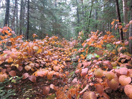
In terms of foliage, there was still some nice golden birch foliage in the Little River valley, as well as some nice orange and gold near Zealand Notch.
| Hike Ratings |
|
Getting To Trailhead: |
Easy |
| Destination: |
Zealand Mountain |
|
Length: |
Difficult |
|
Steepness: |
Very Difficult |
|
Navigation: |
Difficult |
|
Views: |
Excellent |
|
Crowds: |
Heavy |
|
| Hike Stats |
|
Date Hiked: |
Sunday, October 5, 2014 |
| Parking Elevation: |
1,800' |
| Destination: |
Zealand Mountain |
| Time Elapsed: |
07:18 |
| Trailhead Elevation: |
1,800' |
| Summit Elevation: |
4,260' |
| Vertical Gain: |
2,560' |
|
|
| Hike Time Elapsed: |
09:14 |
| Hike Vertical Gain: |
2,790' |
|
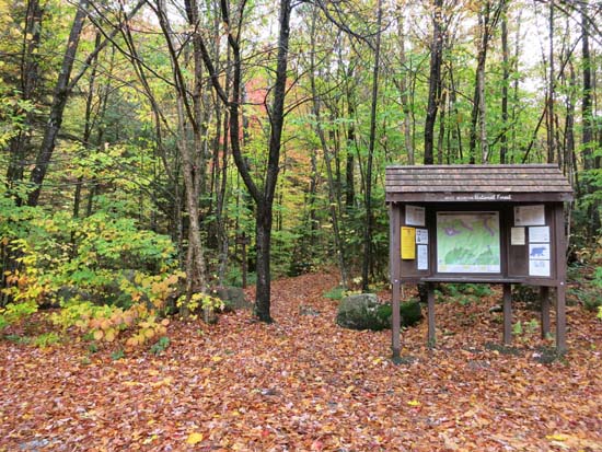
The North Twin Trail trailhead at the end of Haystack Road
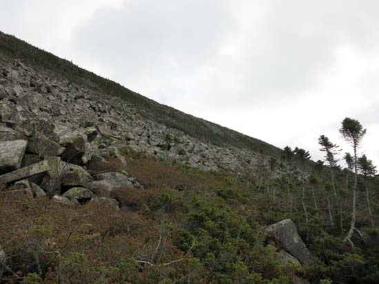
Approaching the Zealand talus slope
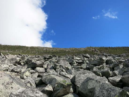
Looking up the Zealand talus slope
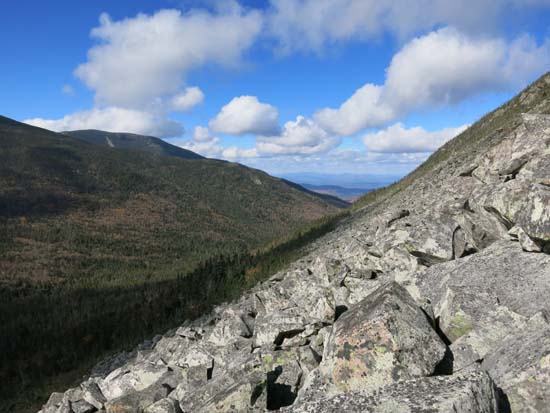
Looking across the Zealand talus slope
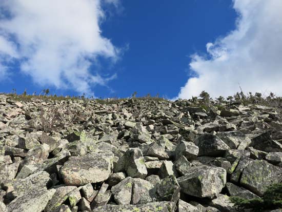
Looking up the Zealand talus slope

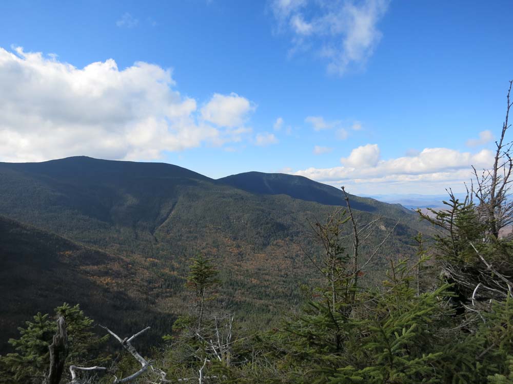
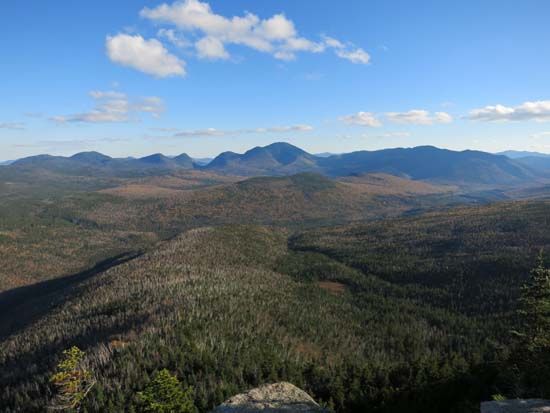
Looking at the Twins from an outlook north of the Zealand Mountain summit
Zeacliff
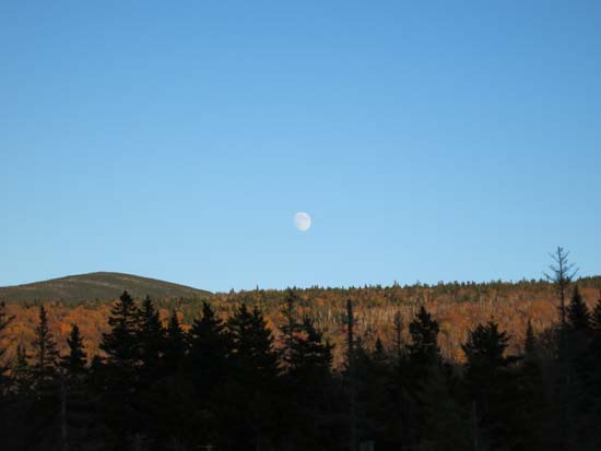
The moonrise on the Zealand Trail
Directions to trailhead: From Route 302, take Route 3 South. Almost immediately after the Entering White Mountain National Forest, take a left onto Haystack Road. The WMNF fee parking area is at the end of the road, and the North Twin Trail trailhead is at the back of the lot.
Back to Zealand Mountain Profile
|