Home
States
Colorado
Connecticut
Maine
Massachusetts
New Hampshire
New York
Rhode Island
Utah
Vermont
View All
Lists
NE 4,000 Footers
NE 100 Highest
NH 4,000 Footers
NH 100 Highest
NH 52 With A View
NH Belknap Range
NH Ossipee 10
Links
Trail Conditions
Trip Log
Sunrises
Sunsets
About
|
Mt. Ascutney
Windsor, VT, West Windsor, VT
Trailheads, measurements, times, distances, and maps are all approximate and relative to the hike(s) as shown below.
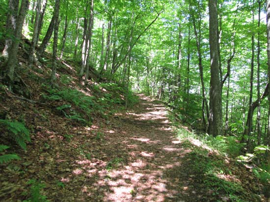
Looking up the lower Brownsville Trail
Route: Brownsville Trail, herd paths, ski trails
Brownsville Trail was mostly dry and in good shape. Quarry was pretty neat to see partway up. Multiple nice viewpoints, as well as some extended areas of nice footing (also some rugged areas though too).
For the descent, I found a herd path near North Peak that dropped down the abandoned ski area. Neat to see the remains (remaining chairlifts scheduled to come out very soon), but growth on trails was a bit unpleasant in shorts. Found a herd path not too far down the ski area that led back to the Brownsville Trail at a switchback.
Mostly sunny skies, temperatures climbing to low 80s.
| Hike Ratings |
|
Getting To Trailhead: |
Easy |
| Destination: |
Mt. Ascutney |
|
Length: |
Moderate |
|
Steepness: |
Difficult |
|
Navigation: |
Easy |
|
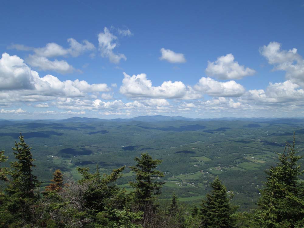
Views: |
Excellent |
|
Crowds: |
Moderate |
|
| Hike Stats |
|
Date Hiked: |
Saturday, June 7, 2014 |
| Parking Elevation: |
740' |
| Destination: |
Mt. Ascutney |
| Time Elapsed: |
01:09 |
| Trailhead Elevation: |
740' |
| Summit Elevation: |
3,150' |
| Distance: |
3.2 miles |
| Vertical Gain: |
2,470' |
|
|
| Hike Time Elapsed: |
03:00 |
| Hike Vertical Gain: |
2,540' |
|
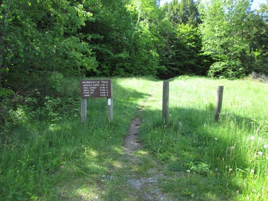
The Brownsville Trail trailhead
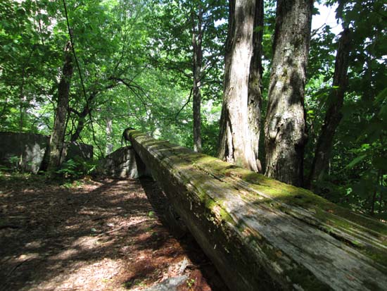
A large beam at the old quarry site

Looking northwest toward Killington from the Ascutney observation tower
Directions to trailhead: Take Route Route 44 southwest from Windsor. Shortly after passing the Route 44A junction, the Brownsville Trail trailhead and parking lot will be on the left.
Back to Mt. Ascutney Profile
|