Home
States
Colorado
Connecticut
Maine
Massachusetts
New Hampshire
New York
Rhode Island
Utah
Vermont
View All
Lists
NE 4,000 Footers
NE 100 Highest
NH 4,000 Footers
NH 100 Highest
NH 52 With A View
NH Belknap Range
NH Ossipee 10
Links
Trail Conditions
Trip Log
Sunrises
Sunsets
About
|
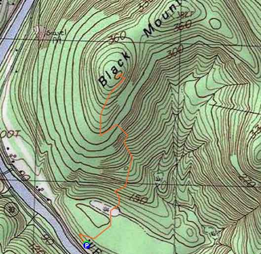
Black Mountain
Dummerston, VT
Trailheads, measurements, times, distances, and maps are all approximate and relative to the hike(s) as shown below.
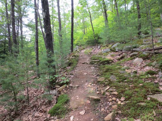
Looking up the Black Mountain Trail
Route: Monadnock Mountain Trail
Black Mountain Natural Area Nature Conservancy northwest of Brattleboro.
Trail was mostly dry and in good shape. Lots of advanced trail work has been done in the lower elevations to preserve the footing.
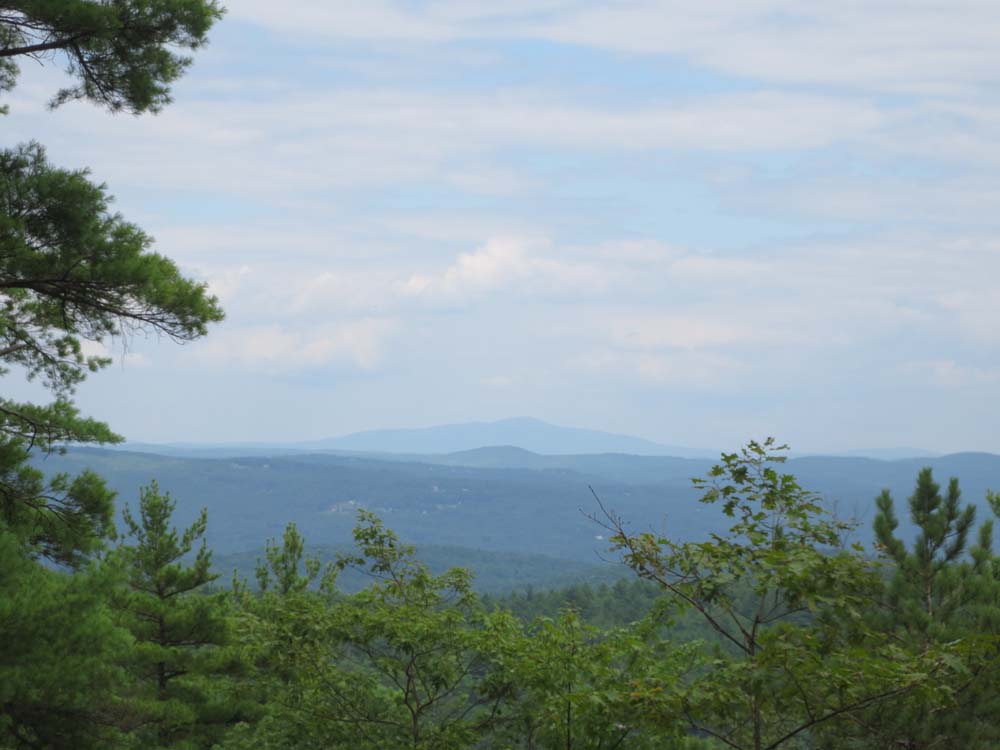
Decent amount of blueberries on the summit. Views were underwhelming, but poking around the ledges revealed Mt. Monadnock and Wantastiquet Mountain.
| Hike Ratings |
|
Getting To Trailhead: |
Easy |
| Destination: |
Black Mountain |
|
Length: |
Moderate |
|
Steepness: |
Moderate |
|
Navigation: |
Easy |
|
Views: |
Moderate |
|
Crowds: |
Minimal |
|
| Hike Stats |
|
Date Hiked: |
Sunday, July 14, 2013 |
| Parking Elevation: |
300' |
| Destination: |
Black Mountain |
| Time Elapsed: |
00:42 |
| Trailhead Elevation: |
300' |
| Summit Elevation: |
1,290' |
| Vertical Gain: |
1,010' |
|
|
| Hike Time Elapsed: |
01:48 |
| Hike Vertical Gain: |
1,030' |
|
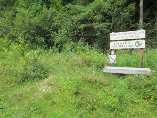
The Black Mountain Trail trailhead

Looking at Mt. Monadnock from near the summit of Black Mountain

Directions to trailhead: Take Route 30 northwest from Brattleboro toward West Dummerston, then take a right onto the iron bridge. After crossing the river, take a right onto Rice Farm Road. The Black Mountain Natural Area parking lot and trailhead will eventually be on the left, under the powerlines.
Back to Black Mountain Profile
|