Home
States
Colorado
Connecticut
Maine
Massachusetts
New Hampshire
New York
Rhode Island
Utah
Vermont
View All
Lists
NE 4,000 Footers
NE 100 Highest
NH 4,000 Footers
NH 100 Highest
NH 52 With A View
NH Belknap Range
NH Ossipee 10
Links
Trail Conditions
Trip Log
Sunrises
Sunsets
About
|
Burke Mountain
Burke, VT
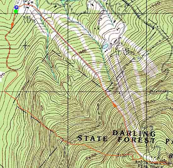
Trailheads, measurements, times, distances, and maps are all approximate and relative to the hike(s) as shown below.
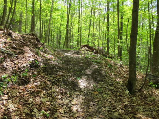
Looking up the Red Trail
Route: Red Trail, West Peak Trail, Summit Trail, ski trails, (Burke Mountain), Summit Trail, ski trails
Red Trail was in nice shape with good footing and some nice wild flowers. The Blue Trail is a little bit more rugged, but otherwise nice, with some decent ledge views. Unfortunately the top of it, at West Peak where there is a leanto, is littered with empties. There was too much for us to even consider trying to pick up and pack out.
We then dropped down the ski trails and took them up to the top of the ski area and around the access road to the fire tower. If you don't like heights, you won't like this tower. Otherwise, it provides superb views, especially of the Whites.
In the interest of time, we beelined down the ski trails, which were mostly bare but a little moist in places from scattered showers today.
| Hike Ratings |
|
Getting To Trailhead: |
Easy |
| Destination: |
Burke Mountain |
|
Length: |
Moderate |
|
Steepness: |
Difficult |
|
Navigation: |
Easy |
|
Views: |
Excellent |
|
Crowds: |
Minimal |
|
| Hike Stats |
|
Date Hiked: |
Sunday, May 12, 2013 |
| Parking Elevation: |
1,800' |
| Destination: |
Burke Mountain |
| Time Elapsed: |
01:26 |
| Trailhead Elevation: |
1,170' |
| Summit Elevation: |
3,267' |
| Vertical Gain: |
2,227' |
|
|
| Hike Time Elapsed: |
02:38 |
| Hike Vertical Gain: |
2,227' |
|
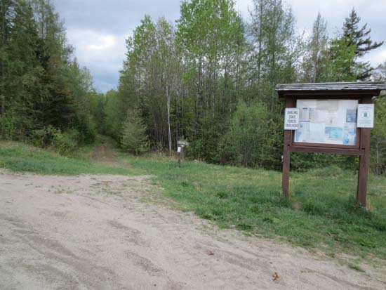
The Red Trail trailhead at the lowest ski area parking lot
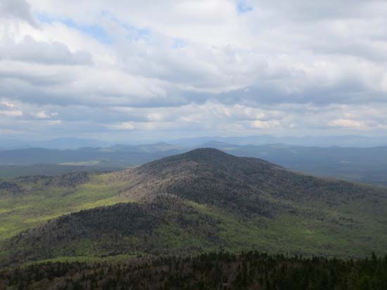
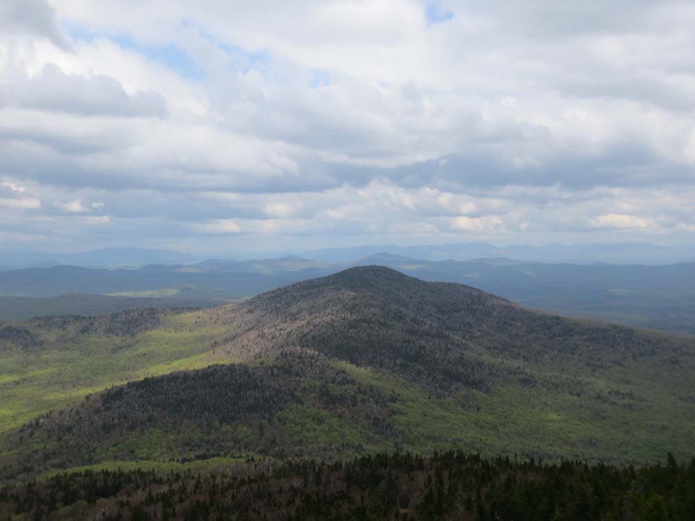
Looking east at Umpire Mountain from the fire tower

Directions to trailhead: Take Interstate 91 North to Exit 23. Take a right onto US 5 through Lyndonville for 2 miles. Bear right onto Route 114 for 4 miles through East Burke Village and take a right onto Mountain Road. The Sherburne Base Lodge entrance road will be on the right shortly thereafter. The Red Trail starts at the back of the lowest parking lot.
Back to Burke Mountain Profile
|