Home
States
Colorado
Connecticut
Maine
Massachusetts
New Hampshire
New York
Rhode Island
Utah
Vermont
View All
Lists
NE 4,000 Footers
NE 100 Highest
NH 4,000 Footers
NH 100 Highest
NH 52 With A View
NH Belknap Range
NH Ossipee 10
Links
Trail Conditions
Trip Log
Sunrises
Sunsets
About
|
Camel's Hump
Duxbury, VT, Huntington, VT
Trailheads, measurements, times, distances, and maps are all approximate and relative to the hike(s) as shown below.
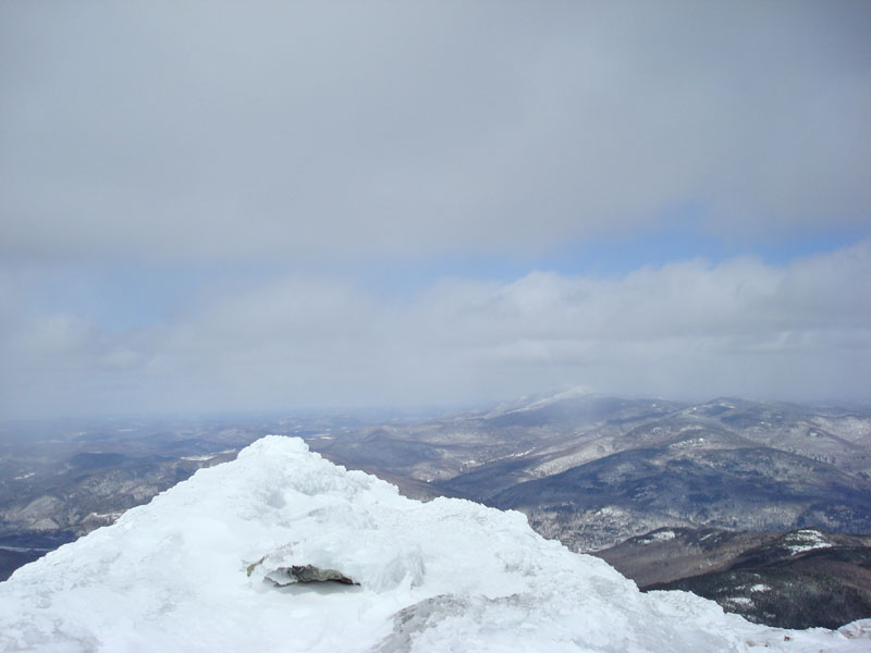
Looking down the Long Trail near the Camel's Hump summit
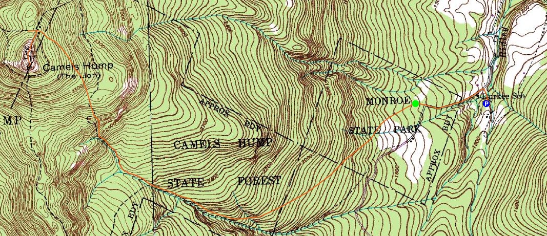
Route: Monroe Trail, Burrows Trail, Long Trail, (Camel's Hump), Long Trail, Monroe Trail
Camel's Hump had been on my to do list for years, however things never quite lined up. Finally, the weather forecast and driving energy together provided me the necessary persuasion to get 'r done.
Using some sort of Map Adventures map, I had a hard time finding the parking lot - the map made it seem as if there were no streets in Waterbury, amongst other things - after multiple wasted attempts, I finally found River Road and was on my way.
The winter parking lot for Camel's Hump had not been plowed since the recent powder, however it seemed cars were still able to make it up the narrow access road.
The hike started as a road walk - retracing the route driven to the parking lot, then ascending up the road to the summer parking area and Monroe Trail trailhead.
The first part of the Monroe Trail I found to be rather boring and not overly steep. Great glade skiing potential, but nothing inspiring for snowshoeing.
Once the trail neared a neat cliff, however, the scenery became a bit more interesting. The trail was still pretty gradual, however. In fact, the entire Monroe Trail was, in my opinion, pretty tame.
Once reaching the Long Trail junction, I chose the wrong trail and went off a few hundred feet in the direction of the Burrows Trail. It had the same color blazes as the Monroe Trail and was heading uphill, hence my choice. I knew I was probably going the wrong way, but the Long Trail south entrance wasn't signed and looked like possibly a spur to a pitstop. Nonetheless, it was the Long Trail, and I ascended up that when I gave up on the Burrows Trail. Too stubborn to look at my map, as usual.
The Long Trail to the summit isn't overly challenging, but there are a few short steeper portions, as well as long areas with lots of exposure. Nonetheless, it was pretty neat.
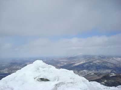
As I cleared the treeline, I was hit hard by the wind. The top of the peak was covered in snow drifts, as well as the occasional patch of ice - my MSR snowshoes were perfect.
Despite the clear forecast, I was surrounded by clouds when I reached the summit. I spent about 10 minutes waiting them out, but finally gave up and headed down, as I was starting to get cold from the intense winds.
Sure enough, as I reached the treeline again, blue sky started to break out. I was done, though, and was ready to head home. By the time I reached the parking lot, it had turned into a bluebird day. Talk about bad timing!
| Hike Ratings |
|
Getting To Trailhead: |
Moderate |
| Destination: |
Camel's Hump |
|
Length: |
Moderate |
|
Steepness: |
Difficult |
|
Navigation: |
Easy |
|
Views: |
Excellent |
|
Crowds: |
Moderate |
|
| Hike Stats |
|
Date Hiked: |
Saturday, March 29, 2008 |
| Hike Commenced: |
11:16 AM |
| Parking Elevation: |
1,260' |
| Destination: |
Camel's Hump |
| Ascent Commenced: |
11:27 AM |
| Summit Reached: |
1:14 PM |
| Time Elapsed: |
01:47 |
| Trailhead Elevation: |
1,430' |
| Summit Elevation: |
4,083' |
| Distance: |
3.4 miles |
| Vertical Gain: |
2,743' |
|
|
| Hike Ended: |
3:07 PM |
| Hike Time Elapsed: |
03:51 |
| Hike Vertical Gain: |
2,873' |
|
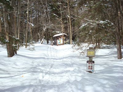
The Monroe Trail trailhead
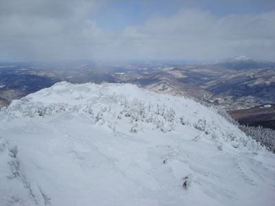
Looking north at Mt. Mansfield from the Camel's Hump summit
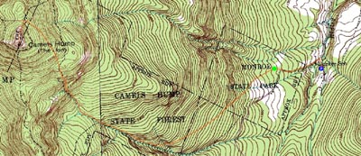

Directions to trailhead: Take I-89 to Exit 10 in Waterbury. Take 100 south, then take a right onto Winsooki Street. Cross over the river, then take a right onto River Road. A few miles later, take a left onto Camel's Hump Road. The winter parking area entrance will be a few minutes up the road on the left.
Back to Camel's Hump Profile
|