Home
States
Colorado
Connecticut
Maine
Massachusetts
New Hampshire
New York
Rhode Island
Utah
Vermont
View All
Lists
NE 4,000 Footers
NE 100 Highest
NH 4,000 Footers
NH 100 Highest
NH 52 With A View
NH Belknap Range
NH Ossipee 10
Links
Trail Conditions
Trip Log
Sunrises
Sunsets
About
|
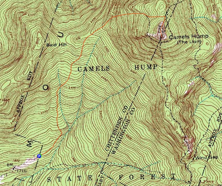
Camel's Hump
Duxbury, VT, Huntington, VT
Trailheads, measurements, times, distances, and maps are all approximate and relative to the hike(s) as shown below.
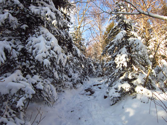
Looking up the Burrows Trail
Route: Burrows Trail, Long Trail, (Camel's Hump), Long Trail, Burrows Trail
A few inches of snow on the ground, some ice, but no issues with Microspikes.
| Hike Ratings |
|
Getting To Trailhead: |
Easy |
| Destination: |
Camel's Hump |
|
Length: |
Moderate |
|
Steepness: |
Moderate |
|
Navigation: |
Easy |
|
Views: |
Excellent |
|
Crowds: |
Moderate |
|
| Hike Stats |
|
Date Hiked: |
Saturday, December 10, 2011 |
| Parking Elevation: |
1,800' |
| Destination: |
Camel's Hump |
| Time Elapsed: |
01:25 |
| Trailhead Elevation: |
1,800' |
| Summit Elevation: |
4,083' |
| Distance: |
2.4 miles |
| Vertical Gain: |
2,333' |
|
|
| Hike Time Elapsed: |
02:32 |
| Hike Distance: |
4.8 miles |
| Hike Vertical Gain: |
2,363' |
|
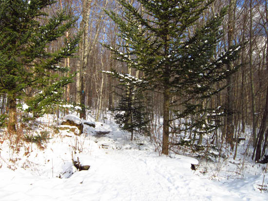
The Burrows Trail trailhead
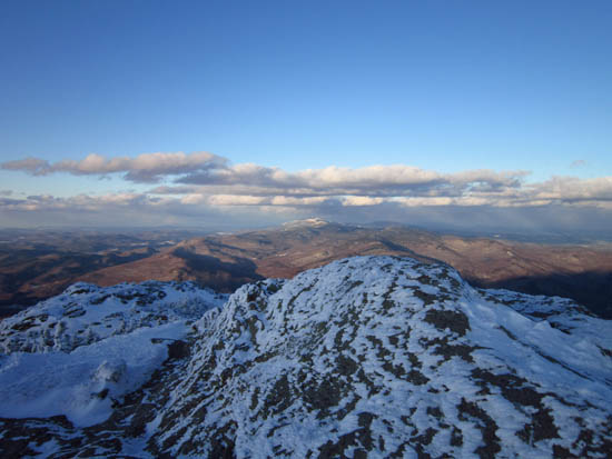
Looking at Mt. Mansfield from Camel's Hump
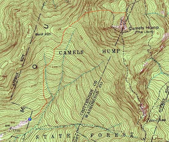

Directions to trailhead: From US 2 in Richmond, take Bridge Street south over the river, then take a right onto Huntington Road (eventually becoming Main Road). Continue through Huntington Village, eventually reaching Huntington Center. Take a left onto Camel's Hump Road. Continue on Camel's Hump Road to its end, where there is a dirt parking lot. The Burrows Trail starts at the back of the parking lot.
Back to Camel's Hump Profile
|