Home
States
Colorado
Connecticut
Maine
Massachusetts
New Hampshire
New York
Rhode Island
Utah
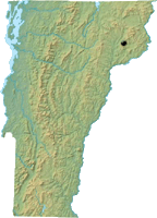
Vermont
View All
Lists
NE 4,000 Footers
NE 100 Highest
NH 4,000 Footers
NH 100 Highest
NH 52 With A View
NH Belknap Range
NH Ossipee 10
Links
Trail Conditions
Trip Log
Sunrises
Sunsets
About
|
East Mountain
East Haven, VT
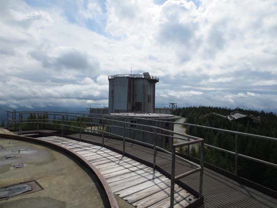
The abandoned Air Force radar station on East Mountain
 Summary Summary
Located in the Northeast Kingdom of Vermont, East Mountain is best known to being home to a military base. As of 2013, the summit is covered in decaying buildings and other remains.
With the Cold War in full gear in the mid 1950s, the military looked to cover a gap in its Soviet bomber detection capabilities. East Mountain in Vermont was chosen due to its relatively proximity to the St. Lawrence River Valley. Construction reportedly started in 1954, at an alleged price tag of $21 million. Going into operation in 1956, the North Concord Air Force Aircraft Control and Warning Station was considered by some to be the last line of defense in the event of a sneak attack on New York City.
Multiple radar systems were installed in large buildings at the summit. A sizable base facility was constructed at the western foot of the mountain, housing over 100 service members of the 911th Radar Squadron and providing them with a mess hall, store, gym, barber shop, and bowling alley. Finally, homes for families were constructed a few miles west of the facility in a village that would be called Hartwellville.
In 1961, a UFO sighting was allegedly observed from the radar station. Shortly thereafter, Barney and Betty Hill famously reported being abducted by aliens in nearby Franconia Notch.
On March 1, 1962, the North Concord Radar Station's name was changed to the Lyndonville Air Force Station.
With technology quickly advancing, the Department of Defense announced the closure of the Lyndonville Air Force Station as part of a Defense Department realignment in the spring of 1963. The radar base was shut down on August 1, 1963, allegedly before its final build out had been completed. After the State of Vermont declined to buy the land for $1, the Federal government sold the facility to Princeton graduate Ed Sawyer for $41,500 in 1965. Sawyer reportedly made back his investment quickly by selling surplus materials left on site, while also living in one of the huts with his family and operating his Old Tyme Toy Co. business from the base camp.
While Sawyer initially made good use of the facility, it soon became a magnet for crime. Trespassing, theft, and destruction quickly became issues. In subsequent decades, two people died (one from snowmobiling into a cable, another from falling from a building), while at least one shooting took place.
In November of 2001, EMDC, LLC, under the name East Haven Windfarm, purchased the East Mountain radar site with the hopes of constructing a wind farm. While there have been numerous roadblocks, data gathering continues.
Summit Elevation
3,439 feet
Summit Facilities
Abandoned military base.
Trip Reports:
Click on the date for photos, timestamps, and maps.
More Information
The East Mountain Experience - photos from 1989
East Mountain, VT - NHMountainHiking.com
East Mountain, Vermont: The Most Unusual Hike I've Ever Done! - 1HappyHiker Blog
Lyndonville Air Force Station - Wikipedia
Photos of Lyndonville AFS (North Concord), VT - The Air Defense Radar Veterans' Association - photos from the 1960s
|
