Home
States
Colorado
Connecticut
Maine
Massachusetts
New Hampshire
New York
Rhode Island
Utah
Vermont
View All
Lists
NE 4,000 Footers
NE 100 Highest
NH 4,000 Footers
NH 100 Highest
NH 52 With A View
NH Belknap Range
NH Ossipee 10
Links
Trail Conditions
Trip Log
Sunrises
Sunsets
About
|
Gile Mountain
Norwich, VT
Trailheads, measurements, times, distances, and maps are all approximate and relative to the hike(s) as shown below.
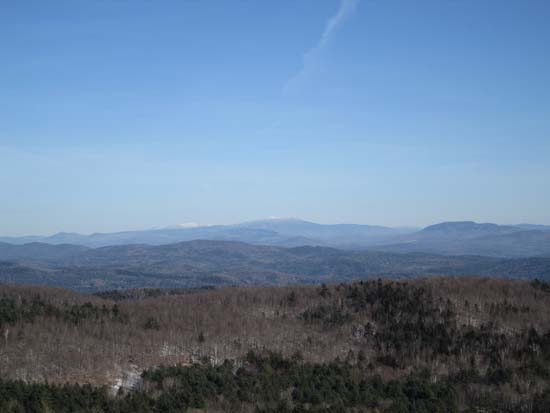
Looking up the Gile Mountain Tower Trail
Route: Gile Mountain Tower Trail
Fantastic views with relatively minimal effort. Not too far from the Lebanon/Hanover area. There are also some mountain biking trails to the summit.
Trail was generally packed snow on top of black and blue ice. I barebooted uphill without much issue, however I used Microspikes for the entire descent, as there was enough ice (and snowcover to not wear them down) to justify it.
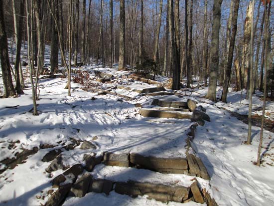
Very impressive rock steps and waterbars being built above the powerline crossing. Quick possibly the fanciest I've seen on a hiking trail - smooth, cut stone with crushed rock around it. Will need to check it out when the snow is melted to see it all. To paraphrase MacArthur, "I'll be back."
| Hike Ratings |
|
Getting To Trailhead: |
Easy |
| Destination: |
Gile Mountain |
|
Length: |
Easy |
|
Steepness: |
Easy |
|
Navigation: |
Easy |
|
Views: |
Excellent |
|
Crowds: |
Minimal |
|
| Hike Stats |
|
Date Hiked: |
Saturday, November 30, 2013 |
| Parking Elevation: |
1,460' |
| Destination: |
Gile Mountain |
| Time Elapsed: |
00:13 |
| Trailhead Elevation: |
1,460' |
| Summit Elevation: |
1,873' |
| Vertical Gain: |
413' |
|
|
| Hike Time Elapsed: |
00:32 |
| Hike Vertical Gain: |
413' |
|
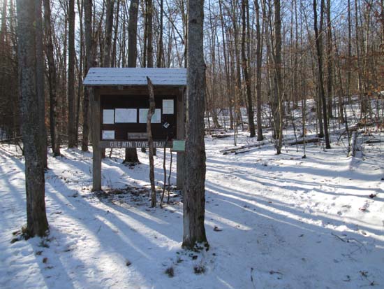
The Gile Mountain Tower Trail trailhead
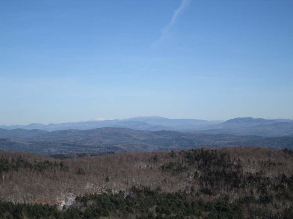
Looking northeast at Mt. Moosilauke and the White Mountains from the Gile Mountain fire tower
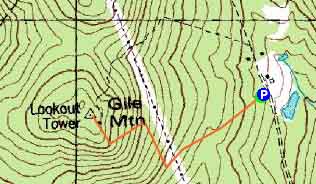

Directions to trailhead: From Exit 13 of I-91, take US 5 North into Norwich, continuing straight into the village (while US 5 turns right). Soon thereafter, take a left onto Turnpike Road. Turnpike Road eventually turns to dirt and will pass under high tension lines. The Gile Mountain Tower Trail parking lot and trailhead will eventually be on the left.
Back to Gile Mountain Profile
|