Home
States
Colorado
Connecticut
Maine
Massachusetts
New Hampshire
New York
Rhode Island
Utah
Vermont
View All
Lists
NE 4,000 Footers
NE 100 Highest
NH 4,000 Footers
NH 100 Highest
NH 52 With A View
NH Belknap Range
NH Ossipee 10
Links
Trail Conditions
Trip Log
Sunrises
Sunsets
About
|
Glebe Mountain (Magic Mountain)
Londonderry, VT
Windham, VT
Trailheads, measurements, times, distances, and maps are all approximate and relative to the hike(s) as shown below.
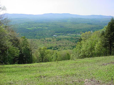
Late spring greens
Curious to check out how steep the Magic Mountain ski area really is, I hiked it in late spring 2002. Despite the weather being hazy and the ground being muddy and wet, the hike was nice and peaceful.
| Hike Ratings |
|
Getting To Trailhead: |
Easy |
| Destination: |
Glebe Mountain (ski area summit) |
|
Length: |
Moderate |
|
Steepness: |
Difficult |
|
Navigation: |
Easy |
|
Views: |
Excellent |
|
Crowds: |
Minimal |
|
| Hike Stats |
|
Date Hiked: |
Saturday, May 25, 2002 |
| Hike Commenced: |
3:55 PM |
| Parking Elevation: |
1,332' |
| Destination: |
Glebe Mountain (ski area summit) |
| Summit Reached: |
4:44 PM |
| Trailhead Elevation: |
1,389' |
| Summit Elevation: |
2,825' |
| Vertical Gain: |
1,493' |
| Hike Vertical Gain: |
1,693' |
|

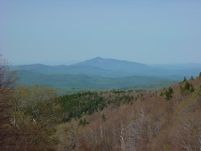
View below the Glebe Mountain summit looking northeast at Mount Ascutney.
Directions to trailhead: Take Route 11 to Magic Mountain entrance, parking lots near the base lodge of the ski area.
Back to Glebe Mountain profile
|