Home
States
Colorado
Connecticut
Maine
Massachusetts
New Hampshire
New York
Rhode Island
Utah
Vermont
View All
Lists
NE 4,000 Footers
NE 100 Highest
NH 4,000 Footers
NH 100 Highest
NH 52 With A View
NH Belknap Range
NH Ossipee 10
Links
Trail Conditions
Trip Log
Sunrises
Sunsets
About
|
Lincoln Peak, Mt. Abraham
Warren, VT, Lincoln, VT
Trailheads, measurements, times, distances, and maps are all approximate and relative to the hike(s) as shown below.
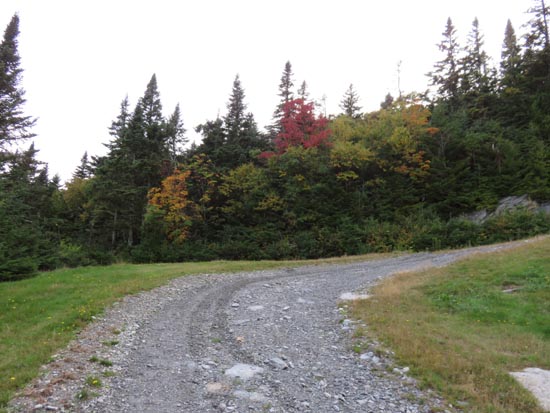
Looking up the ski trails
Route: Access road, Long Trail, (Lincoln Peak), Long Trail, (Mt. Abraham), Long Trail, (Lincoln Peak), access road
In the interest of time and wanting to descend without a headlamp, I opted to take the ski trails up to Lincoln Peak and over to Mt. Abraham. The gravel access road (starting to the right of the main chairlift) was generally dry by late afternoon. Having aerial imagery handy is a good idea (e.g. having Google Maps on your phone) so that you don't end up going to one of the subpeak chairlifts at the junctions. My phone determined the ascent to Lincoln Peak was 2.7 miles.
From Lincoln Peak to Mt. Abraham was a combination of wet trail, mud, and slippery rocks. Overall, my phone said from the bottom of the chairlift to Mt. Abraham was just under 3.5 miles.
Clouds rolled over Mt. Abraham, obscuring the sunset. However, the couple dozen less vertical feet on Lincoln Peak made all of the difference, as there was an excellent post-sunset display.
Saw an amazing number of rabbits/hares on the descent - well over a dozen.
Birch trees taking on a yellow tint. Also noted an orange tint on the west side of Roxbury Gap.
| Hike Ratings |
|
Getting To Trailhead: |
Easy |
| Destination: |
Lincoln Peak |
|
Length: |
Moderate |
|
Steepness: |
Difficult |
|
Navigation: |
Moderate |
|
Views: |
Excellent |
|
Crowds: |
Minimal |
| Destination: |
Mt. Abraham |
|
Length: |
Moderate |
|
Steepness: |
Difficult |
|
Navigation: |
Moderate |
|
Views: |
Excellent |
|
Crowds: |
Minimal |
|
| Hike Stats |
|
Date Hiked: |
Monday, September 19, 2016 |
| Parking Elevation: |
1,585' |
| Destination: |
Lincoln Peak |
| Time Elapsed: |
00:57 |
| Trailhead Elevation: |
1,620' |
| Summit Elevation: |
3,975' |
| Vertical Gain: |
2,355' |
| Destination: |
Mt. Abraham |
| Time Elapsed: |
00:15 |
| Trailhead Elevation: |
3,975' |
| Summit Elevation: |
4,006' |
| Distance: |
0.8 miles |
| Vertical Gain: |
226' |
|
|
| Hike Time Elapsed: |
02:38 |
| Hike Vertical Gain: |
2,776' |
|
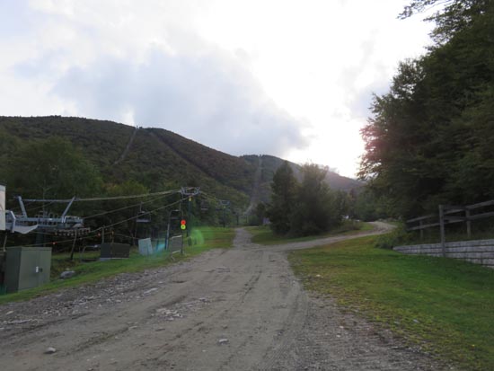
The beginning of the access road next to the Super Bravo lift at Sugarbush
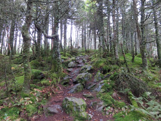
The Long Trail between Lincoln Peak and Mt. Abraham
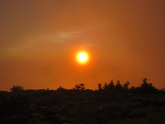
The sunset from Mt. Abraham
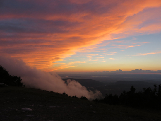
Post sunset colors from Lincoln Peak
Directions to trailhead: From Warren, VT, take Route 100 North to the Sugarbush Access Road (Sugarbush South-Lincoln Peak). There is parking at the end of the road at the ski area.
Back to Lincoln Peak Profile
Back to Mt. Abraham Profile
|


