Home
States
Colorado
Connecticut
Maine
Massachusetts
New Hampshire
New York
Rhode Island
Utah
Vermont
View All
Lists
NE 4,000 Footers
NE 100 Highest
NH 4,000 Footers
NH 100 Highest
NH 52 With A View
NH Belknap Range
NH Ossipee 10
Links
Trail Conditions
Trip Log
Sunrises
Sunsets
About
|
Lincoln Peak, Mt. Abraham
Warren, VT, Lincoln, VT
Trailheads, measurements, times, distances, and maps are all approximate and relative to the hike(s) as shown below.
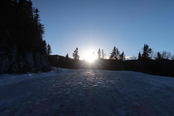
Looking up the ski trails
Route: Access road, Long Trail, (Lincoln Peak), Long Trail, (Mt. Abraham), Long Trail, (Lincoln Peak), access road
Ascended the ski trails late afternoon (ski area was closed today, but will be open Saturday, Sunday, and possibly Monday). Found continuous snow almost all the way to the top of the Super Bravo quad (Spring Fling > Snowball > Valley House Traverse), then patchy snow up Jester (enough to continue to warrant the snowshoes, but an increasing number of 100 foot bare sections). In another week's time, I suspect one will be able to take the work road access on mostly bare ground, as the bulk of the trails closed to skiing now are bare.
Less snow than I would have expected on the Long Trail (technically closed for mud season, but I rolled the dice on this high elevation section still being winter like instead of muddy). The sun exposed sections were bare and dry, but other sections had either unstable monorail or else full spring snow cover upwards of 3 feet deep. Basically, the descent off Lincoln Peak was bare, part of the descent off Little Abe was bare, the summit of Abraham was bare, and the balance was mostly snow. Even though I had to take them off multiple times due to the bare sections, snowshoes were a must, as the snowpack was nowhere nearly firm enough to warrant barebooting (and the postholing after one or two steps was extremely taxing).
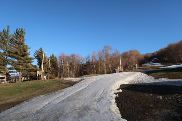
Lower half of Mt. Ellen ski trails are mostly bare.
Nice sunset colors from Abraham and Lincoln Peak.
| Hike Ratings |
|
Getting To Trailhead: |
Easy |
| Destination: |
Lincoln Peak |
|
Length: |
Moderate |
|
Steepness: |
Difficult |
|
Navigation: |
Moderate |
|
Views: |
Excellent |
|
Crowds: |
Minimal |
| Destination: |
Mt. Abraham |
|
Length: |
Moderate |
|
Steepness: |
Difficult |
|
Navigation: |
Moderate |
|
Views: |
Excellent |
|
Crowds: |
Minimal |
|
| Hike Stats |
|
Date Hiked: |
Friday, April 28, 2017 |
| Parking Elevation: |
1,585' |
| Destination: |
Lincoln Peak |
| Time Elapsed: |
00:58 |
| Trailhead Elevation: |
1,620' |
| Summit Elevation: |
3,975' |
| Vertical Gain: |
2,355' |
| Destination: |
Mt. Abraham |
| Time Elapsed: |
00:21 |
| Trailhead Elevation: |
3,975' |
| Summit Elevation: |
4,006' |
| Distance: |
0.8 miles |
| Vertical Gain: |
226' |
|
|
| Hike Time Elapsed: |
02:26 |
| Hike Vertical Gain: |
2,776' |
|
The beginning of the access road next to the Super Bravo lift at Sugarbush
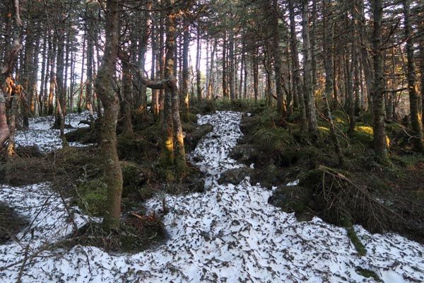
The Long Trail between Lincoln Peak and Mt. Abraham
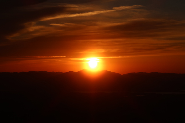
The sunset from Mt. Abraham
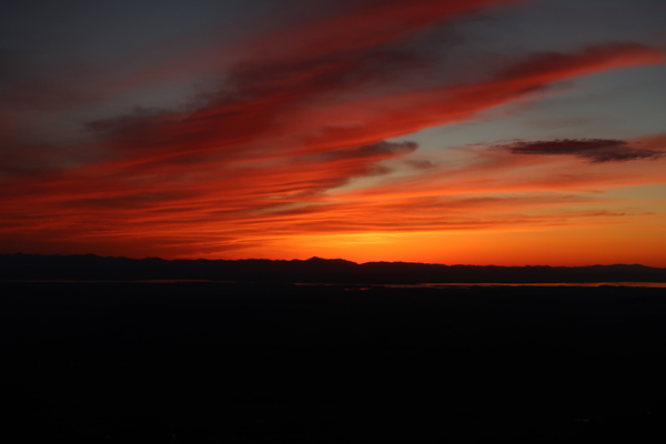
Post sunset colors from Lincoln Peak
Directions to trailhead: From Warren, VT, take Route 100 North to the Sugarbush Access Road (Sugarbush South-Lincoln Peak). There is parking at the end of the road at the ski area.
Back to Lincoln Peak Profile
Back to Mt. Abraham Profile
|


