Home
States
Colorado
Connecticut
Maine
Massachusetts
New Hampshire
New York
Rhode Island
Utah
Vermont
View All
Lists
NE 4,000 Footers
NE 100 Highest
NH 4,000 Footers
NH 100 Highest
NH 52 With A View
NH Belknap Range
NH Ossipee 10
Links
Trail Conditions
Trip Log
Sunrises
Sunsets
About
|
Mt. Mansfield
Underhill, VT, Stowe, VT
Trailheads, measurements, times, distances, and maps are all approximate and relative to the hike(s) as shown below.
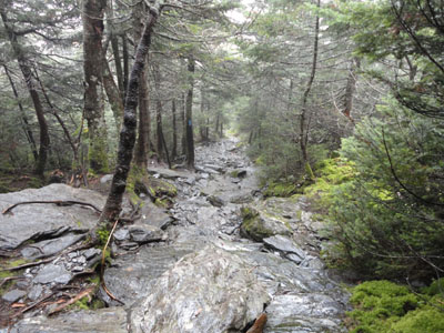
Looking down the Laura Cowles Trail
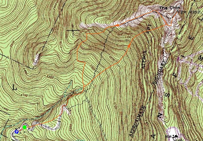
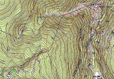
Route: Eagle Cut Trail, CCC Road, Sunset Ridge Trail, Laura Cowles Trail, Sunset Ridge Trail, Long Trail, (Mt. Mansfield - The Chin), Long Trail, Sunset Ridge Trail, CCC Road, Eagle Cut Trail
For the first of two Vermont hikes, I headed to the west side of Mt. Mansfield. While there were plenty of clouds in the region, the forecast called for them to clear during the morning.
After paying the entrance fee, I set foot up the road from the main office, then turned right to the upper lot and Eagle Cut Trail trailhead. This short trail crossed the road multiple times and had excellent footing and gradual grades. After this trail ended, the roadwalk continued, soon reaching the next trail junction.
From here, I took the Sunset Ridge Trail for a few hundred feet, then turned onto the Laura Cowles Trail. Though rated on the map as a double diamond, it didn't seem overly bad - a bit rocky and a few minor scrambles. Breaking out at treeline just before the upper Sunset Ridge Trail junction, the fog had still not yet lift.
From there, I headed to the Long Trail north, passing through the alpine zones to the summit and benchmark. After unsuccessfully waiting a few minutes for the fog to lift, I headed back down, this time staying on the Sunset Ridge Trail.
The Sunset Ridge Trail looked to be quite impressive - and, as I dropped in eleveation, it was indeed impressive as the fog started to lift, revealing views of Lake Champlain and the Adirondacks. The trail was exposed for some distance and, around treeline, had a few minor scrambles.
By the time I returned to the parking area, it had turned into a sunny day.
| Hike Ratings |
|
Getting To Trailhead: |
Easy |
| Destination: |
Mt. Mansfield - The Chin |
|
Length: |
Moderate |
|
Steepness: |
Difficult |
|
Navigation: |
Easy |
|
Views: |
Minimal (due to weather)
|
|
Crowds: |
Minimal |
|
| Hike Stats |
|
Date Hiked: |
Friday, August 27, 2010 |
| Hike Commenced: |
9:10 AM |
| Parking Elevation: |
1,820' |
| Destination: |
Mt. Mansfield (The Chin) |
| Ascent Commenced: |
9:13 AM |
| Summit Reached: |
10:36 AM |
| Time Elapsed: |
01:23 |
| Trailhead Elevation: |
1,870' |
| Summit Elevation: |
4,393' |
| Distance: |
2.4 miles |
| Vertical Gain: |
2,543' |
|
|
| Hike Ended: |
12:29 PM |
| Hike Time Elapsed: |
3:19 |
| Hike Vertical Gain: |
2,663' |
|
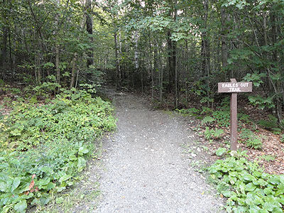
The Eagle Cut Trail trailhead
Looking down the Sunset Ridge Trail
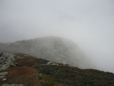
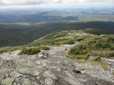
Looking south from near the summit of Mt. Mansfield in the fog

Directions to trailhead: From Underhill Center, take Pleasant Valley Road north 1.0 mile, then take a right onto Mountain Road. Upon entering Underhill State Park, there will be a parking lot on the left and the office on the right ($3 per person fee as of summer 2010).
Back to Mt. Mansfield Profile
|