Home
States
Colorado
Connecticut
Maine
Massachusetts
New Hampshire
New York
Rhode Island
Utah
Vermont
View All
Lists
NE 4,000 Footers
NE 100 Highest
NH 4,000 Footers
NH 100 Highest
NH 52 With A View
NH Belknap Range
NH Ossipee 10
Links
Trail Conditions
Trip Log
Sunrises
Sunsets
About
|
Mt. Mansfield - The Chin, Mt. Mansfield - The Nose
Stowe, VT, Underhill, VT
Trailheads, measurements, times, distances, and maps are all approximate and relative to the hike(s) as shown below.
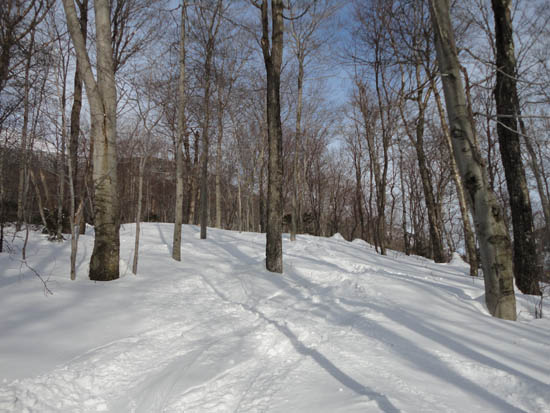
Looking up a backcountry ski glade
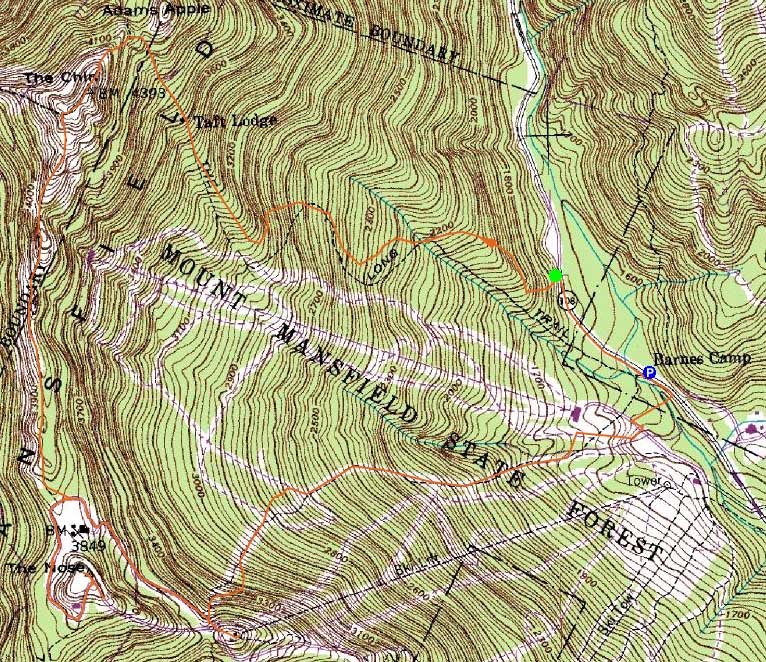
Route: Route 108, Long Trail, ski glade, Long Trail, snowfield, Long Trail, (The Chin), Long Trail, auto road, unknown trail, (The Nose), unknown trail, auto road, ski trails
While I had intended to hike Mt. Mansfield via the Sunset Ridge Trail in winter, the wind forecast didn't look particularly compatible. Thusly, I decided to ascend via the east.
After a short road walk, I turned into the woods and followed the Long Trail (trailhead seemingly easy to miss in winter for whatever reason) for a bit. The faded white blazes didn't do me too much good, however, as a large number of ski tracks made things hard to follow. Assuming the tracks came from either the ski area or Taft Lodge, I opted to follow them for awhile. Sure enough, they led back to the Long Trail, just before its nearest point to the ski area.
Shortly thereafter, I arrived at the Taft Lodge. Unfortunately for me in my post-flu weakened state, the trail was not broken out above there. Thusly, I started breaking trail up to Eagle Pass in 1-3 feet of powder. Seeing that the Profanity Trail wasn't broken out, I opted to take a look at the pass and perhaps give it a go, even with the steepness.
Nearing the pass, the drifts made for slow going. Rather than continue into what looked to be a powder stash, I opted to angle up toward to where I know the Long Trail was. Though slow going due to the powder on top of a frozen granular crust, I was able to make it up to the vicinity of the Long Trail without too much trouble. From there, though, things were very steep - I was wishing I had my mountaineering axe in case of a slip. Fortunately, with a few shaky steps around some covered up ledge scrambles, I found my way up to the cold, windy ridge.
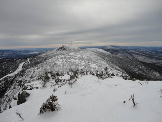
After a brief stop at the highpoint on Mansfield, I continued along the ridge, trying to stay as true to the Long Trail as possible. Being marked with white blazes on the ledges, however, it was easier said than done. Nontheless, I was able to continue my way along the windy ridge, alternating between exposed ledge and snow drifts.
Once on the sheltered work road, I worked my way up past the communications towers and followed some ski tracks up to the summit of the Nose. From there, I decided to see if I could find the abandoned top of the old Nose Dive ski trail. After falling into a spruce trap up to my neck, I decided I'd save that expedition for another day.
Back on the groomed auto road, I headed down to the ski area and made my way down the steep Nose Dive trail, then to the gondola base and back to the parking lot on Route 108.
| Hike Ratings |
|
Getting To Trailhead: |
Easy |
| Destination: |
Mt. Mansfield - The Chin |
|
Length: |
Moderate |
|
Steepness: |
Very Difficult |
|
Navigation: |
Difficult |
|
Views: |
Excellent |
|
Crowds: |
Moderate |
| Destination: |
Mt. Mansfield - The Nose |
|
Length: |
Moderate |
|
Steepness: |
Difficult |
|
Navigation: |
Difficult |
|
Views: |
Excellent |
|
Crowds: |
Minimal |
|
| Hike Stats |
|
Date Hiked: |
Wednesday, February 16, 2011 |
| Hike Commenced: |
8:30 AM |
| Parking Elevation: |
1,540' |
| Destination: |
Mt. Mansfield - The Chin |
| Ascent Commenced: |
8:37 AM |
| Summit Reached: |
10:50 AM |
| Time Elapsed: |
02:13 |
| Trailhead Elevation: |
1,620' |
| Summit Elevation: |
4,393' |
| Vertical Gain: |
2,793' |
| Destination: |
Mt. Mansfield - The Nose |
| Ascent Commenced: |
10:54 AM |
| Summit Reached: |
11:41 AM |
| Time Elapsed: |
00:47 |
| Trailhead Elevation: |
4,393' |
| Summit Elevation: |
4,060' |
| Vertical Gain: |
410' |
|
|
| Hike Ended: |
1:05 PM |
| Hike Time Elapsed: |
4:35 |
| Hike Vertical Gain: |
3,263' |
|
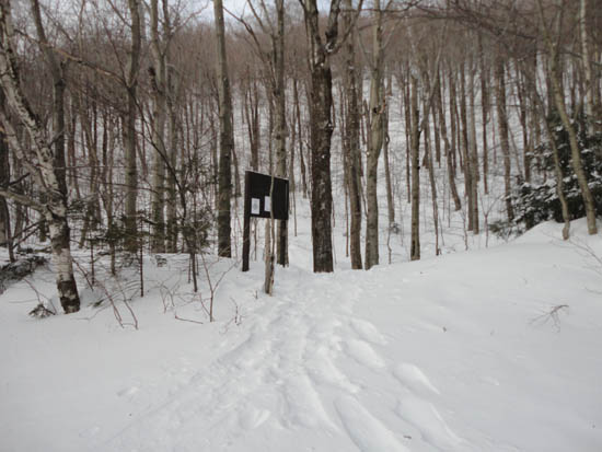
The Long Trail trailhead off Route 108

Looking down into Eagle Pass
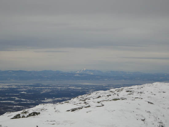
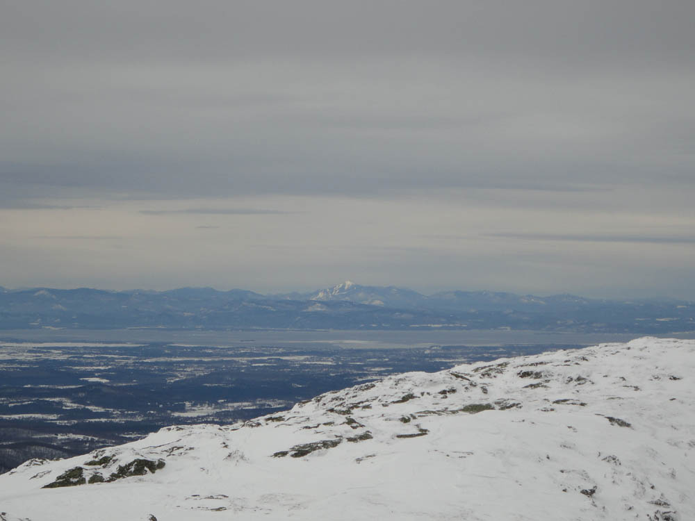
Looking at Whiteface from near the Mt. Mansfield summit
Looking up a backcountry ski glade
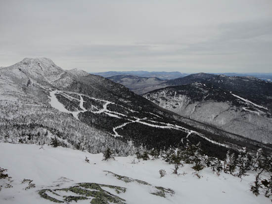
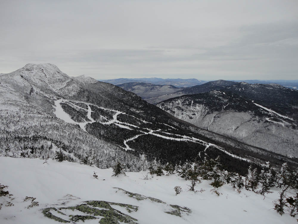
Looking up toward Smugglers Notch from the Nose


Directions to trailhead: Take Route 108 North from Stowe. In winter, the road is gated just past the ski area gondola parking lot entrance. There is plowed parking just past that entrance, on the right. The Long Trail will eventually be on the left.
Back to Mt. Mansfield - The Chin Profile
Back to Mt. Mansfield - The Nose Profile
|