Home
States
Colorado
Connecticut
Maine
Massachusetts
New Hampshire
New York
Rhode Island
Utah
Vermont
View All
Lists
NE 4,000 Footers
NE 100 Highest
NH 4,000 Footers
NH 100 Highest
NH 52 With A View
NH Belknap Range
NH Ossipee 10
Links
Trail Conditions
Trip Log
Sunrises
Sunsets
About
|
Mt. Abraham
Lincoln, VT
Trailheads, measurements, times, distances, and maps are all approximate and relative to the hike(s) as shown below.

Long Trail to Mt. Abraham
With the exception of the last few hundred vertical feet (which may require some minor climbing), Mt. Abraham is an easy to moderate hike from Lincoln Gap. Though the trail was quiet in the morning, it seemed like a parade near lunchtime, as I passed likely over one hundred people total.
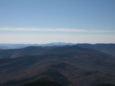
The bare summit provides views in all directions, as well as easy access to Lincoln Peak (which, due to time and increasing crowds, I decided to skip).
| Hike Ratings |
|
Getting To Trailhead: |
Easy |
| Destination: |
Mt. Abraham |
|
Length: |
Moderate |
|
Steepness: |
Difficult |
|
Navigation: |
Easy |
|
Views: |
Excellent |
|
Crowds: |
Heavy |
|
| Hike Stats |
|
Date Hiked: |
Saturday, October 7, 2006 |
| Hike Commenced: |
9:06 AM |
| Parking Elevation: |
2,414' |
| Destination: |
Mt. Abraham |
| Ascent Commenced: |
9:07 AM at Long Trail trailhead |
| Summit Reached: |
10:24 AM |
| Trailhead Elevation: |
2,424' |
| Summit Elevation: |
4,006' |
| Vertical Gain: |
1,762' |
| Hike Ended: |
12:05 PM |
| Hike Distance: |
5.2 miles |
| Hike Vertical Gain: |
1,942' |
|
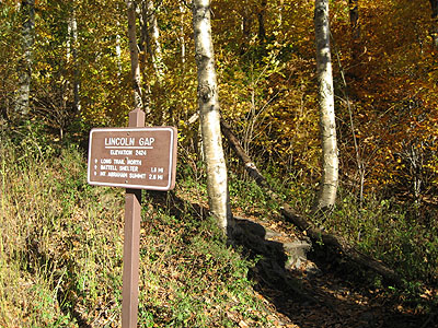
Long Trail North trailhead
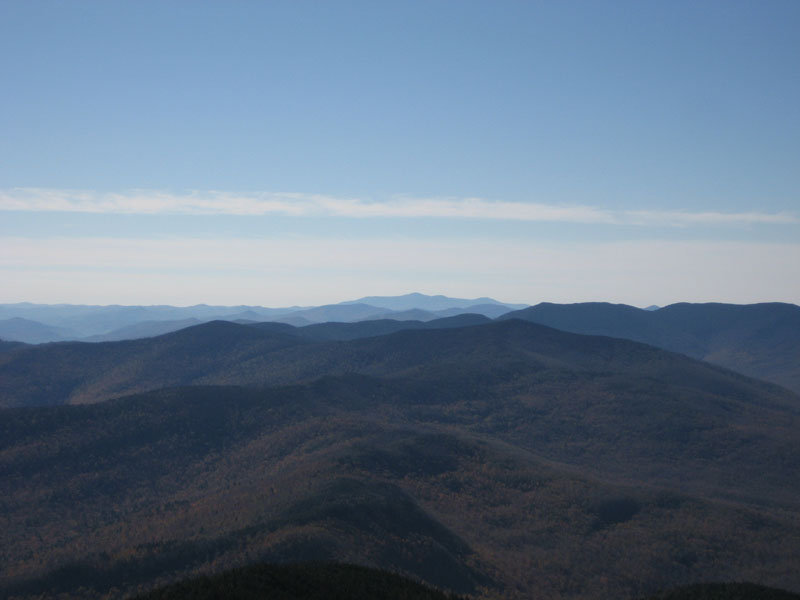
Looking south toward Killington Peak
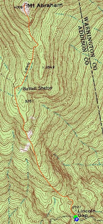

Directions to trailhead: Follow the sign for Lincoln Gap from Route 100 before Sugarbush. Parking lots available at the top of Lincoln Gap, where the trailhead is.
Back to Mt. Abraham Profile
|