Home
States
Colorado
Connecticut
Maine
Massachusetts
New Hampshire
New York
Rhode Island
Utah
Vermont
View All
Lists
NE 4,000 Footers
NE 100 Highest
NH 4,000 Footers
NH 100 Highest
NH 52 With A View
NH Belknap Range
NH Ossipee 10
Links
Trail Conditions
Trip Log
Sunrises
Sunsets
About
|
Mt. Pisgah
Westmore, VT
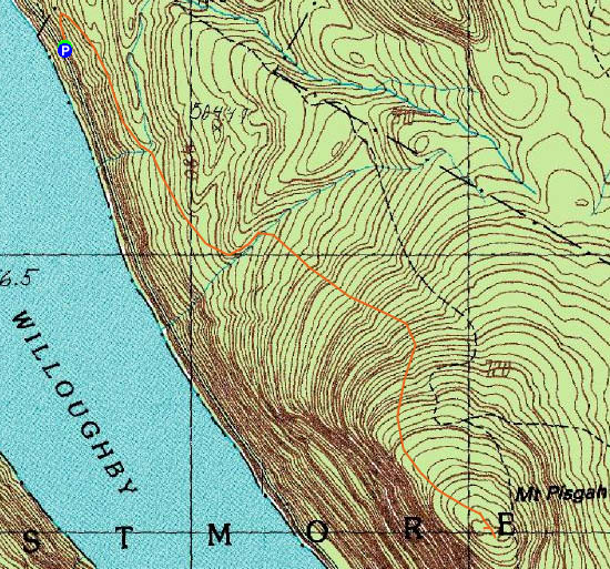
Trailheads, measurements, times, distances, and maps are all approximate and relative to the hike(s) as shown below.
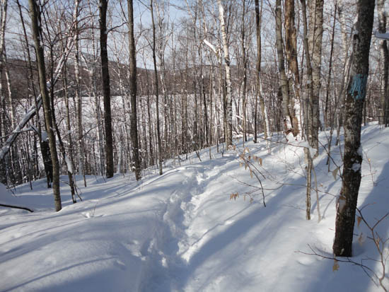
Looking down the North Trail
Route: North Trail
With a very cold, windy day forecasted for the higher summits, I decided to stay in the lower elevations. Starting on Route 5A, I headed up the unbroken North Trail, breaking out 6" of powder (with some knee deep areas up high). While the trail was generally gradual, there was a short, somewhat steep part prior to reaching the first set of viewpoints.
The western viewpoints provided superb vistas of Willoughby Gap from the top of some cliffs.
Continuing over a few false bumps, I eventually reached what I believed to be the highpoint (a few feet to the west of the trail), then continued a few dozen feet to what would have been a superb southeastern viewpoint (due to incoming snow flurries, only Burke was visible).
| Hike Ratings |
|
Getting To Trailhead: |
Easy |
| Destination: |
Mt. Pisgah |
|
Length: |
Moderate |
|
Steepness: |
Difficult |
|
Navigation: |
Moderate |
|
Views: |
Excellent |
|
Crowds: |
Minimal |
|
| Hike Stats |
|
Date Hiked: |
Saturday, February 26, 2011 |
| Parking Elevation: |
1,210' |
| Destination: |
Mt. Pisgah |
| Time Elapsed: |
01:45 |
| Trailhead Elevation: |
1,210' |
| Summit Elevation: |
2,751' |
| Distance: |
2.2 miles |
| Vertical Gain: |
1,591 |
|
|
| Hike Time Elapsed: |
03:04 |
| Hike Vertical Gain: |
1,691' |
|
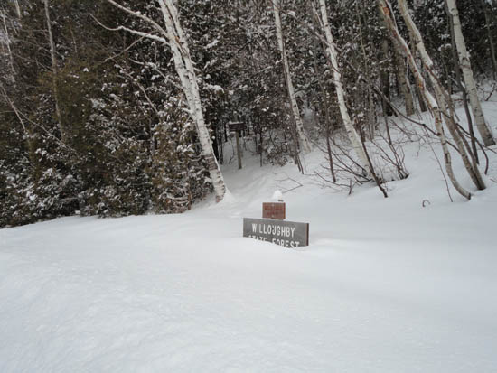
The North Trail trailhead off Route 5A
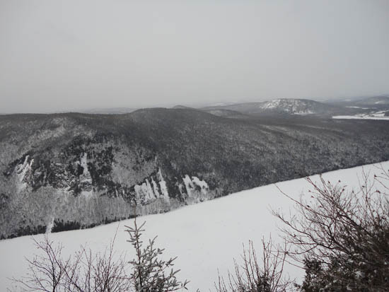
Looking at Lake Willoughby from one of the western vistas near the summit of Mt. Pisgah

Directions to trailhead: Take Interstate 91 North to Exit 23. Take US 5 North to West Burke, then take a right onto Route 5A. Shortly after passing the cliffs of Mt. Pisgah on the right (Lake Willoughby on the left), the North Trail trailhead and roadside parking area will be on the right, prior to Old Route 5A.
Back to Mt. Pisgah Profile
|

