Home
States
Colorado
Connecticut
Maine
Massachusetts
New Hampshire
New York
Rhode Island
Utah
Vermont
View All
Lists
NE 4,000 Footers
NE 100 Highest
NH 4,000 Footers
NH 100 Highest
NH 52 With A View
NH Belknap Range
NH Ossipee 10
Links
Trail Conditions
Trip Log
Sunrises
Sunsets
About
|
Pico Peak
Killington, VT
Trailheads, measurements, times, distances, and maps are all approximate and relative to the hike(s) as shown below.
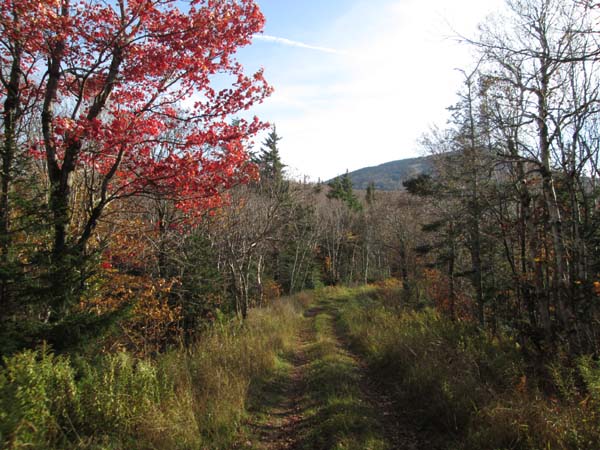
Ascending the ski slopes
Route: Ski trails
Trails were mostly dry. Some ski trails have not yet been mowed, but most have been. The gravel access road up the ski area is fairly smooth sailing as well.
Not much in way of foliage left on the higher elevation trees, but some past-peak colors at the base and at the pass. Nice colors in the valleys down low. Could see a few patches of snow on Killington from the snowmaking test a few nights ago.
Beautiful, relatively warm weather.
| Hike Ratings |
|
Getting To Trailhead: |
Easy |
| Destination: |
Pico Peak |
|
Length: |
Moderate |
|
Steepness: |
Difficult |
|
Navigation: |
Easy |
|
Views: |
Excellent |
|
Crowds: |
Moderate |
|
| Hike Stats |
|
Date Hiked: |
Saturday, October 21, 2017 |
| Parking Elevation: |
2,000' |
| Destination: |
Pico Peak |
| Time Elapsed: |
00:57 |
| Trailhead Elevation: |
2,000' |
| Summit Elevation: |
3,957' |
| Vertical Gain: |
2,007' |
|
|
| Hike Time Elapsed: |
02:05 |
| Hike Vertical Gain: |
2,157' |
|
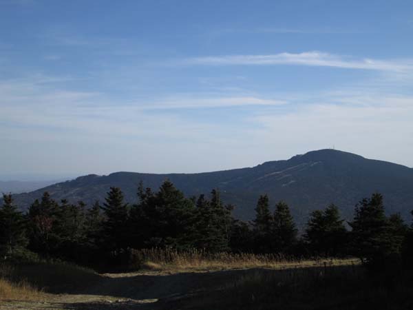
Killington as seen from near the summit of Pico
Directions to trailhead: Pico ski area is located off US 4, just west of Sherburne Pass.
Back to Pico Peak Profile
|

