Home
States
Colorado
Connecticut
Maine
Massachusetts
New Hampshire
New York
Rhode Island
Utah
Vermont
View All
Lists
NE 4,000 Footers
NE 100 Highest
NH 4,000 Footers
NH 100 Highest
NH 52 With A View
NH Belknap Range
NH Ossipee 10
Links
Trail Conditions
Trip Log
Sunrises
Sunsets
About
|
Elephant Mountain
Township C, ME
Trailheads, measurements, times, distances, and maps are all approximate and relative to the hike(s) as shown below.

Bushwhacking up Elephant Mountain
Route: Logging road, bushwhack, (Elephant Mountain), bushwhack, logging road
On our way up to Rangeley, we stopped at Elephant for our first objective. Starting at about 2,700 feet in elevation, we followed a wide, grassy logging road to its landing, then followed a narrower logging road at the far back corner. Following herd paths through these cuts, we ended up crossing the upper old logging road near a swamp, then bushwhacked to the canister atop Elephant Mountain.
While we had a herd path for a bit on the initial descent, we lost it in some thick junk and ended up bushwhacking again for awhile, until picking it up above the upper logging road. From there, it was relatively smooth sailing back to where we had parked.
| Hike Ratings |
|
Getting To Trailhead: |
Moderate |
| Destination: |
Elephant Mountain |
|
Length: |
Moderate |
|
Steepness: |
Difficult |
|
Navigation: |
Difficult |
|
Views: |
Minimal |
|
Crowds: |
Minimal |
|
| Hike Stats |
|
Date Hiked: |
Friday, July 8, 2011 |
| Parking Elevation: |
2,690' |
| Destination: |
Elephant Mountain |
| Time Elapsed: |
00:50 |
| Trailhead Elevation: |
2,700' |
| Summit Elevation: |
3,772' |
| Vertical Gain: |
1,092' |
|
|
| Hike Time Elapsed: |
02:37 |
| Hike Vertical Gain: |
1,142' |
|

The beginning of the logging road walk

Hawkweed along the logging road

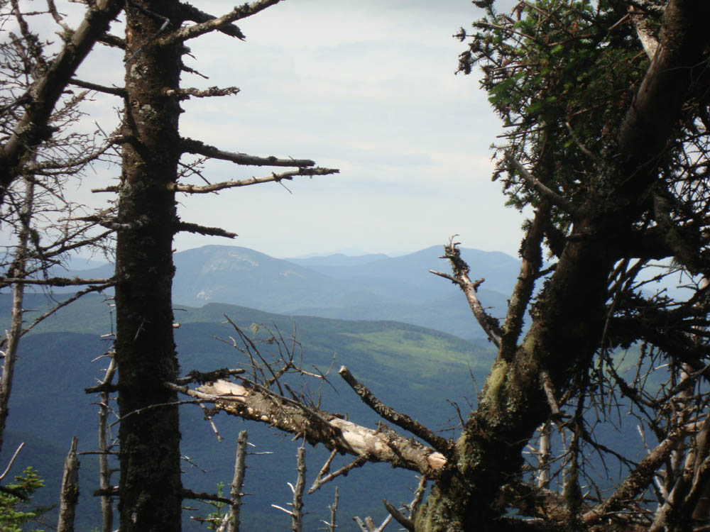
Slight views toward the Grafton Notch area from near the summit of Elephant Mountain


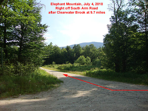
Directions to trailhead: Take Route 5 North from Bethel, Maine (will correspond for US 2 for awhile). At the end of Route 5 in Andover, take a right onto Route 120. After crossing a bridge, Route 120 will take a sharp right turn. Almost immediately after that turn, take a left onto South Arm Road (0.6 miles from Route 5).
Starting at 0.0 miles on South Arm Road, the Appalachian Trail crossing will be passed between 7.4 and 7.5 miles. Just before 9.7 miles, Clearwater Brook will be crossed (sign). Just after this bridge, take a right onto an unmarked logging road (Old Country Road). If you cross Grindstone Road, you went too far on South Arm Road.
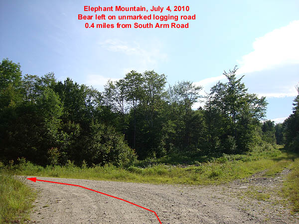
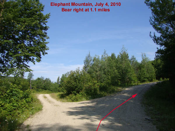
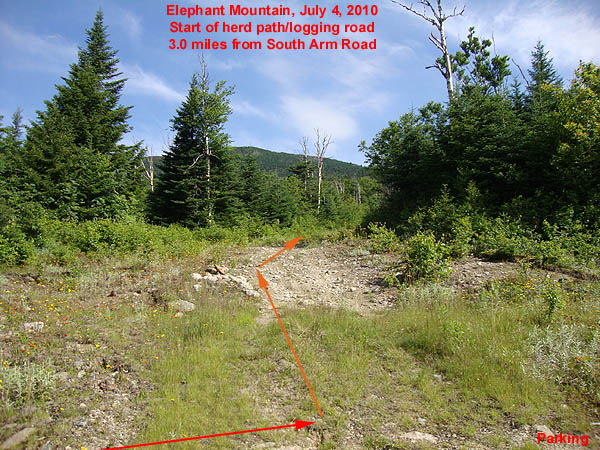
Starting at 0.0 miles, head up the logging road. Bear left at 0.4 miles onto the unmarked Elephant Mountain Road. Bear right at 1.1 miles to stay on Elephant Mountain Road. Just prior to 3 miles, the road will go downhill briefly, prior to climbing back uphill at 3.0 miles. There is limited room for parking here. The herd path starts on a grassy logging road on the left, marked with a cairn.
Back to Elephant Mountain Profile
|
