Home
States
Colorado
Connecticut
Maine
Massachusetts
New Hampshire
New York
Rhode Island
Utah
Vermont
View All
Lists
NE 4,000 Footers
NE 100 Highest
NH 4,000 Footers
NH 100 Highest
NH 52 With A View
NH Belknap Range
NH Ossipee 10
Links
Trail Conditions
Trip Log
Sunrises
Sunsets
About
|
Mt. Agamenticus
York, ME
Trailheads, measurements, times, distances, and maps are all approximate and relative to the hike(s) as shown below.
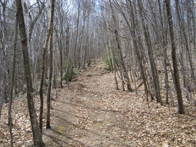
Looking up the Hairpin Turn trail
Route: Ring Trail, Hairpin Turn Trail, auto road
Hiking Mt. Agamenticus was probably Plan D. Initially, my plan was to be hiking Camel's Hump on this day. Then the snow came and delayed my Sunday River/Old Speck trip, which pushed those back a week. Then, with Katahdin pushed back, I planned to do some of the Ossipee Mountains. Then, after getting soaked on my last two hikes in the region, I decided I'd do a tour of some smaller ones down south (and check out a closed ski area in the process). This fell through partially, as the road to Mt. Prospect was closed and there was not enough time left to do Blue Job and see the Red Sox. But that's another story.
I arrived at the trailhead to find cars parked everywhere - come to find out, it was a cleanup day. I chose the Ring Trail to the Hairpin Turn trail to the summit road for my ascent - a quick, but nice summerlike stroll.
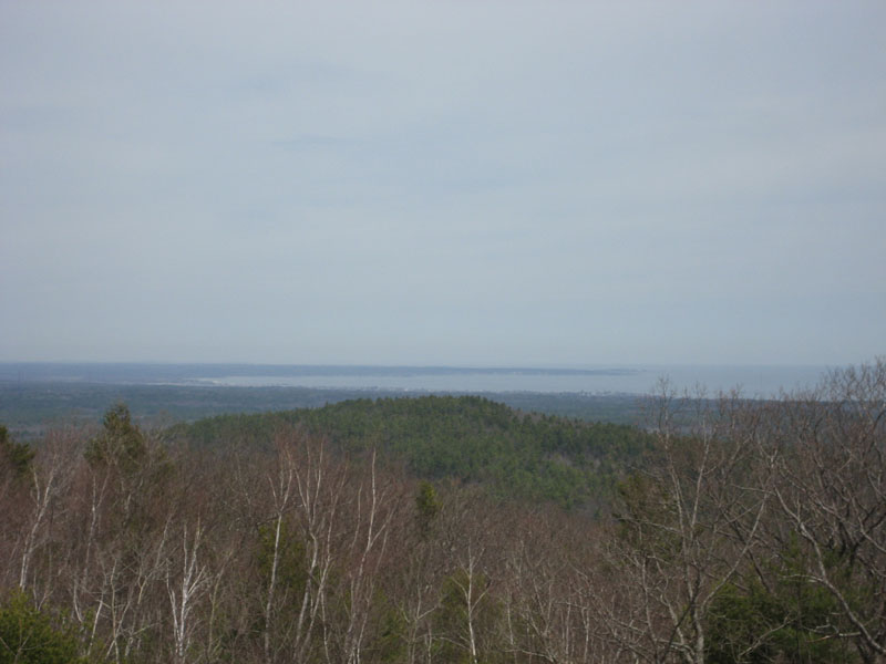
The views from the summit are great - the mountains of New Hampshire (including Mount Washington) from an observation deck built on an old chairlift terminal and the Atlantic Ocean as seen from the deck of the summit lodge.
I intended to take the Blueberry Ledge trail to the Ring Trail from the summit, however it seemed like the former was going the wrong way or that I had missed a turn...not wanting to spend much time looking around, I cut back out to the summit road and walked down on the side of that.
| Hike Ratings |
|
Getting To Trailhead: |
Easy |
| Destination: |
Mount Agamenticus |
|
Length: |
Easy |
|
Steepness: |
Easy |
|
Navigation: |
Easy |
|
Views: |
Excellent |
|
Crowds: |
Heavy |
|
| Hike Stats |
|
Date Hiked: |
Sunday, April 22, 2007 |
| Hike Commenced: |
12:34 PM |
| Parking Elevation: |
345' |
| Destination: |
Mt. Agamenticus |
| Ascent Commenced: |
12:35 PM |
| Summit Reached: |
12:53 PM |
| Time Elapsed: |
00:18 |
| Trailhead Elevation: |
347' |
| Summit Elevation: |
691' |
| Vertical Gain: |
384' |
|
|
| Hike Ended: |
1:24 PM |
| Hike Time Elapsed: |
00:50 |
| Hike Vertical Gain: |
434' |
|

Ring Trail trailhead

Looking northeast at the Atlantic Ocean


Directions to trailhead: From Route 1 North, take Mountain Road. If the road turns to dirt, you just missed the trailhead (on the right).
Back to Mt. Agamenticus Profile
|