Home
States
Colorado
Connecticut
Maine
Massachusetts
New Hampshire
New York
Rhode Island
Utah
Vermont
View All
Lists
NE 4,000 Footers
NE 100 Highest
NH 4,000 Footers
NH 100 Highest
NH 52 With A View
NH Belknap Range
NH Ossipee 10
Links
Trail Conditions
Trip Log
Sunrises
Sunsets
About
|
Mt. Agamenticus
York, ME
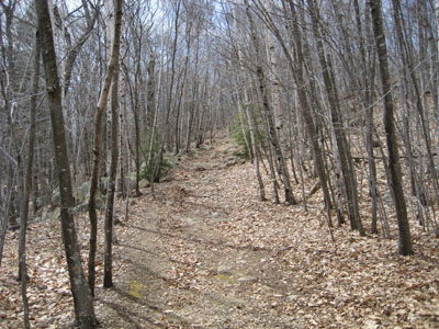
Looking up the Hairpin Turn trail on Mt. Agamenticus
 Summary Summary
Mt. Agamenticus, once home to a ski area by the same name, is located just a few miles inland from the Atlantic Ocean. There are multiple viewpoints near the open summit, featuring views of the ocean and of the White Mountains.
Summit Elevation
691 feet
Summit Facilities
Firetower (closed), observation deck, seasonal summit lodge, auto road.
Trip Reports:
Click on the date for photos, timestamps, and maps.
More Information
- Mount Agamenticus Conservation Region - official site with history and trail map
- Mt. Agamenticus - NELSAP - profile of the defunct alpine ski area
- Mt. Agamenticus - NewEnglandSkiHistory.com
|
