Home
States
Colorado
Connecticut
Maine
Massachusetts
New Hampshire
New York
Rhode Island
Utah
Vermont
View All
Lists
NE 4,000 Footers
NE 100 Highest
NH 4,000 Footers
NH 100 Highest
NH 52 With A View
NH Belknap Range
NH Ossipee 10
Links
Trail Conditions
Trip Log
Sunrises
Sunsets
About
|
Mt. Agamenticus
York, ME
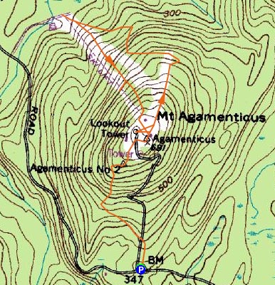
Trailheads, measurements, times, distances, and maps are all approximate and relative to the hike(s) as shown below.

Looking up the Blueberry Bluff trail
Route: Ring Trail, Blueberry Bluff, (Mt. Agamenticus), Sweet Fern, Goosefoot, Vulture's View, (Mt. Agamenticus), Blueberry Bluff, Ring Trail
Not one to miss a NELSAP (New England Lost Ski Areas Project) hike, I headed down to Mt. Agamenticus for mid day Saturday hike. Parking at the Mountain Road trailhead, I headed up the Ring Trail to the Blueberry Bluff trail and then to the rendevous point at the summit. The Blueberry Bluff trail was surprisingly scenic and interesting, and even had a few slippery (due to the previous day's rain) ledgy sections.
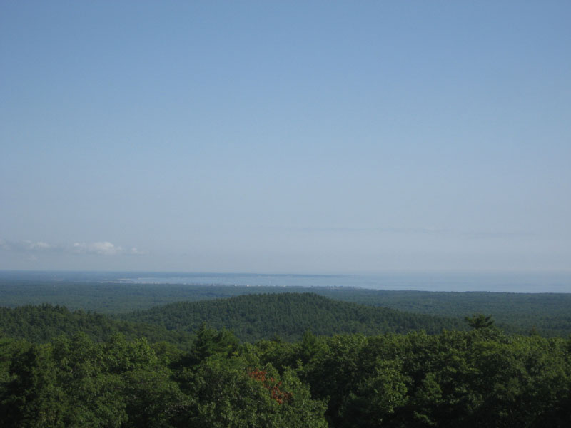
Once the group was together, we headed down the old T-Bar lift line, then down the Goosefoot Trail to the bottom of the old double chairlift. After that, we ascended via the Vulture's View Trail, and then hung out on the deck of the old lodge. While the weather forecast had called for clouds and rain, the weather was rather pleasant, providing good views of the ocean and of southern New Hampshire (other than Mt. Chocorua, the White Mountains weren't visisble).
| Hike Ratings |
|
Getting To Trailhead: |
Easy |
| Destination: |
Mount Agamenticus |
|
Length: |
Easy |
|
Steepness: |
Moderate |
|
Navigation: |
Easy |
|
Views: |
Excellent |
|
Crowds: |
Moderate |
|
| Hike Stats |
|
Date Hiked: |
Saturday, September 13, 2008 |
| Hike Commenced: |
10:18 AM |
| Parking Elevation: |
345' |
| Destination: |
Mt. Agamenticus |
| Ascent Commenced: |
10:18 AM |
| Summit Reached: |
10:33 AM |
| Time Elapsed: |
00:15 |
| Trailhead Elevation: |
347' |
| Summit Elevation: |
691' |
| Vertical Gain: |
359' |
|
|
| Hike Ended: |
3:05 PM |
| Hike Time Elapsed: |
04:47 |
| Hike Vertical Gain: |
875' |
|

Ring Trail trailhead

Looking northeast at the Atlantic Ocean from the fire tower

Directions to trailhead: From Route 1 North, take Mountain Road. If the road turns to dirt, you just missed the trailhead (on the right).
Back to Mt. Agamenticus Profile
|