Home
States
Colorado
Connecticut
Maine
Massachusetts
New Hampshire
New York
Rhode Island
Utah
Vermont
View All
Lists
NE 4,000 Footers
NE 100 Highest
NH 4,000 Footers
NH 100 Highest
NH 52 With A View
NH Belknap Range
NH Ossipee 10
Links
Trail Conditions
Trip Log
Sunrises
Sunsets
About
|
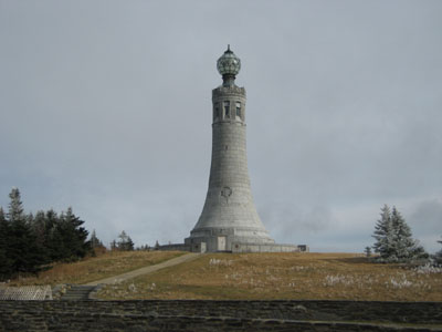
Rounds Rock, Saddle Ball Mountain, Mt. Greylock
Lanesborough, MA, New Ashford, MA, Cheshire, MA, Williamstown, MA, Adams, MA
Trailheads, measurements, times, distances, and maps are all approximate and relative to the hike(s) as shown below.
Appalachian Trail to the Mt. Greylock summit
I was originally planning to drive up to the Jones Nose parking lot and start the hike from there. Two closed gates and one muddy road later, I decided to start the hike at the Visitors Center in Lanesborough, doubling the mileage.
Once again (that's three for those of you counting, mainly me), I went on a forecasted partly sunny day that was cloudy for nearly the entire duration of the hike. My Greylock curse.
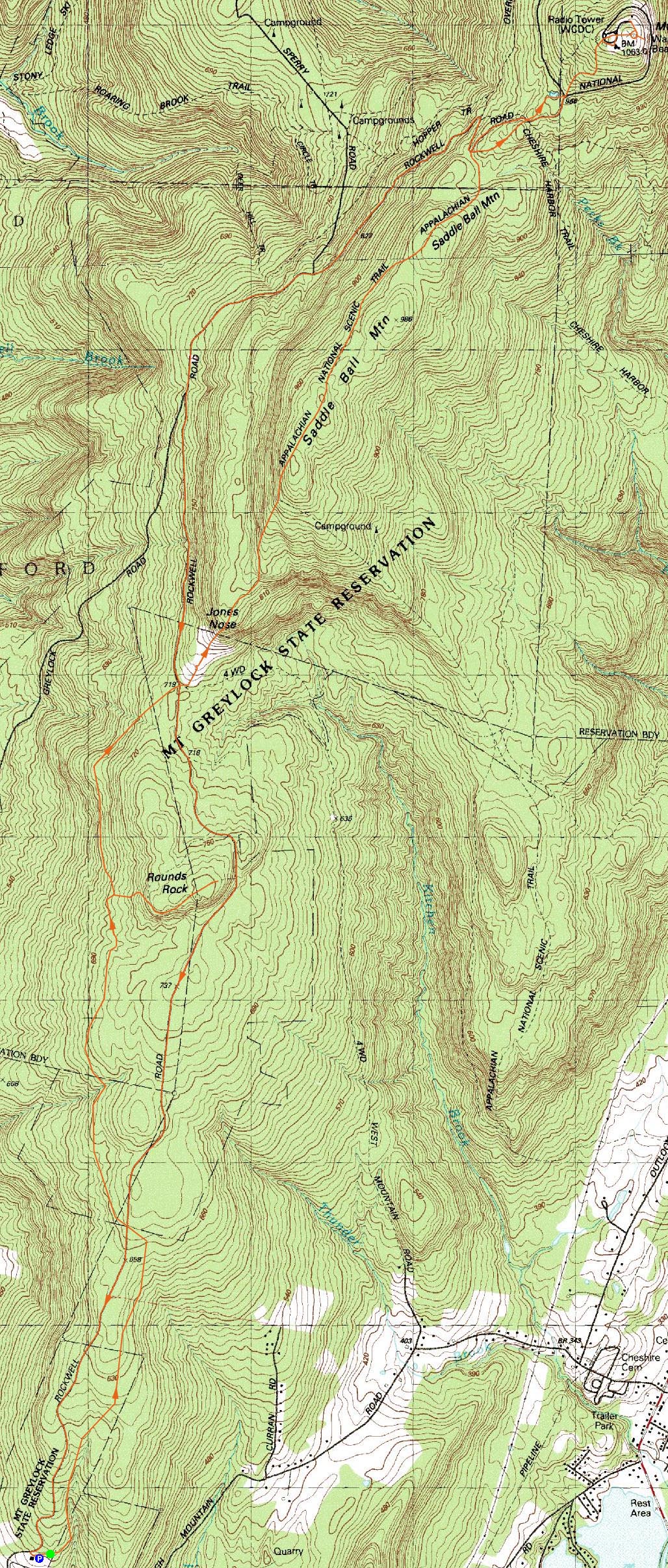
This hike is rather flat. I took the Brook and Berry Trail to the Northrup Trail to the Rounds Rock Trail to the Northrup Trail to the Appalachian Trail. In the interest of time, I took Rockwell Road back (this saved me nearly two hours, however it certainly didn't feel good on the feet by the time the 17th mile of the hike approached).
I encountered a rather large bear on Rounds Rock. I heard movement about 20 feet in front of me on the the trail (in a maze of softwood). I clapped and saw a big head look at me from around the corner at my eye level. I was preparing to grab my camera (thinking it was a deer) until I realized it was a huge bear on all fours - and it was coming my way! I was able to make a calm exit and get the heck out of there without him (her?) pursuing.
The Mt. Greylock summit (as well as parts of Saddle Ball Mountain) was covered in rime - the trees, the bushes, even some of the grass.
| Hike Ratings |
|
Getting To Trailhead: |
Easy |
| Destination: |
Rounds Rock |
|
Length: |
Moderate |
|
Steepness: |
Easy |
|
Navigation: |
Easy |
|
Views: |
Excellent |
|
Crowds: |
Minimal |
| Destination: |
Saddle Ball Mountain |
|
Length: |
Difficult |
|
Steepness: |
Moderate |
|
Navigation: |
Easy |
|
Views: |
Moderate |
|
Crowds: |
Minimal |
| Destination: |
Mt. Greylock |
|
Length: |
Difficult |
|
Steepness: |
Moderate |
|
Navigation: |
Easy |
|
Views: |
Excellent |
|
Crowds: |
Moderate |
|
| Hike Stats |
|
Date Hiked: |
Saturday, November 18, 2006 |
| Hike Commenced: |
9:07 AM |
| Parking Elevation: |
1,660' |
| Destination: |
Rounds Rock |
| Ascent Commenced: |
9:08 AM |
| Summit Reached: |
10:25 AM |
| Time Elapsed: |
01:17 |
| Trailhead Elevation: |
1,660' |
| Summit Elevation: |
2,581' |
| Vertical Gain: |
1,021' |
| Destination: |
Saddle Ball Mountain |
| Ascent Commenced: |
10:28 AM |
| Summit Reached: |
11:42 AM |
| Time Elapsed: |
01:14 |
| Trailhead Elevation: |
2,581' |
| Summit Elevation: |
3,238' |
| Vertical Gain: |
1,114' |
| Destination: |
Mt. Greylock |
| Ascent Commenced: |
11:42 AM |
| Summit Reached: |
12:48 PM |
| Time Elapsed: |
01:06 |
| Trailhead Elevation: |
3,247' |
| Summit Elevation: |
3,491' |
| Vertical Gain: |
641' |
|
|
| Hike Ended: |
3:29 PM |
| Hike Time Elapsed: |
06:22 |
| Hike Vertical Gain: |
2,906' |
|
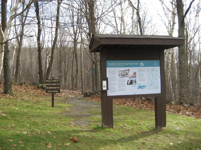
Trailhead near Visitors Center
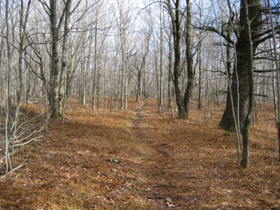
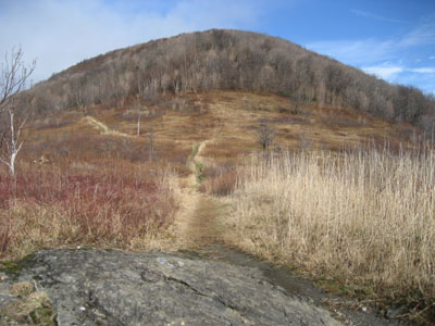
Northrup Trail to Rounds Rock
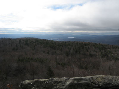
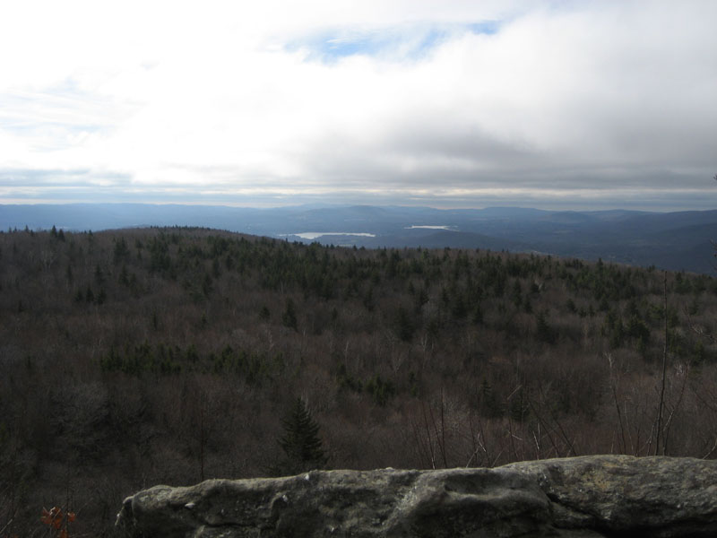
Rounds Rock, looking south
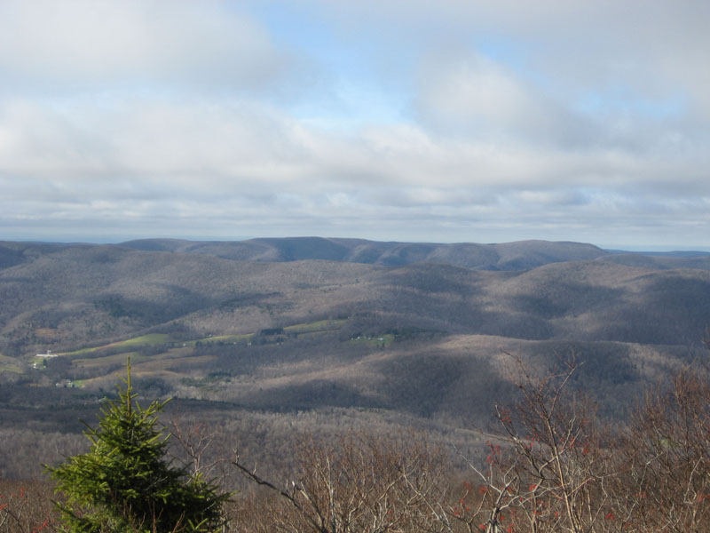
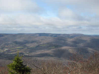
Looking up the field toward Jones Nose and Saddle Ball Mountain
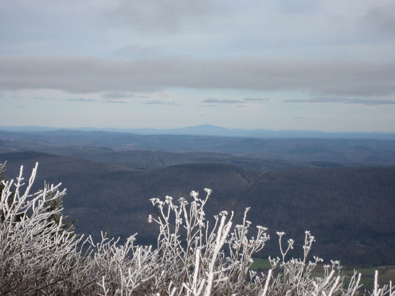
Looking west into New York, from a viewpoint south of the Saddle Ball Mountain summit
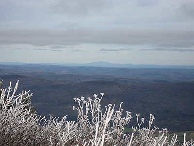
Mt. Greylock summit, looking northeast at Mt. Monadnock

Directions to trailhead: Take Rockwell Road to the Visitors Center in Lanesborough. Trailhead is at edge of parking lot.
Back to Rounds Rock Profile
Back to Saddle Ball Mountain Profile
Back to Mt. Greylock Profile
|