Home
States
Colorado
Connecticut
Maine
Massachusetts
New Hampshire
New York
Rhode Island
Utah
Vermont
View All
Lists
NE 4,000 Footers
NE 100 Highest
NH 4,000 Footers
NH 100 Highest
NH 52 With A View
NH Belknap Range
NH Ossipee 10
Links
Trail Conditions
Trip Log
Sunrises
Sunsets
About
|
Mt. Greylock
Adams, MA
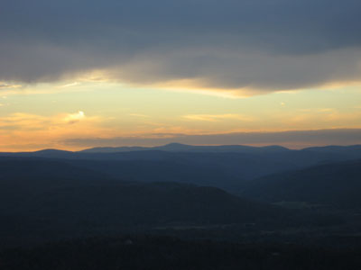
Mt. Greylock as seen from Massaemett Mountain
 Summary Summary
At 3,491 feet, Mt. Greylock is the highest point in all of Massachusetts. There are numerous trails to the summit including the Appalachian Trail. The summit features multiple view points, including panoramic views from the seasonal lookout tower.
Summit Elevation
3,491 feet
Summit Facilities
Auto road, lookout tower, restrooms, cafeteria, running water, when in season.
Relics
Abandoned, partially constructed alpine ski area (Greylock Glen) located near end of Thunderbolt Trail.
Trip Reports:
Click on the date for photos, timestamps, and maps.
| Date of Hike |
Trail(s) |
Length |
Steepness |
Vertical |
|
| July 13, 2013 |
Hopper Trail, more |
Moderate |
Moderate |
3,184' |
| October 18, 2008 |
Thunderbolt Trail |
Moderate |
Difficult |
2,426' |
| November 18, 2006 |
Appalachian Trail, more |
Difficult |
Moderate |
2,906' |
| November 11, 2006 |
Appalachian Trail |
Difficult |
Difficult |
3,706' |
| July 30, 2006 |
Thunderbolt Trail, more |
Difficult |
Very Difficult |
3,023' |
|
More Information
- Mt. Greylock - New England's Alpine CCC Ski Trails
- Greylock Glen - New England's Cancelled Ski Areas
- Mt. Greylock - Massachusetts DCR
- Greylock Glen - New England Lost Ski Areas Project
- Mount Greylock - Wikipedia
|
