Home
States
Colorado
Connecticut
Maine
Massachusetts
New Hampshire
New York
Rhode Island
Utah
Vermont
View All
Lists
NE 4,000 Footers
NE 100 Highest
NH 4,000 Footers
NH 100 Highest
NH 52 With A View
NH Belknap Range
NH Ossipee 10
Links
Trail Conditions
Trip Log
Sunrises
Sunsets
About
|
Bondcliff, Mt. Bond, Mt. Bond (West Peak), South Twin Mountain, North Twin Mountain
Lincoln, NH, Bethlehem, NH, Franconia, NH, Livermore, NH
Trailheads, measurements, times, distances, and maps are all approximate and relative to the hike(s) as shown below.
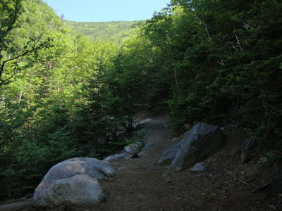
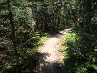
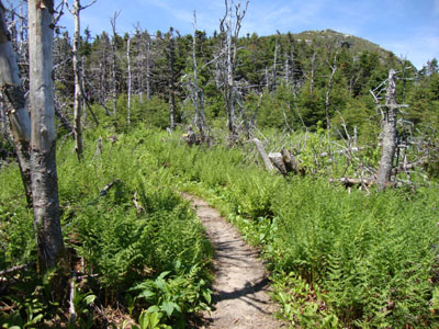
Looking up the Bondcliff Trail
Route: Lincoln Woods Trail, Wilderness Trail, Bondcliff Trail, (Bondcliff), Bondcliff Trail, (Mt. Bond), Bondcliff Trail, West Bond Trail, (West Bond), West Bond Trail, Bondcliff Trail, Twinway, (South Twin Mountain), North Twin Spur, spur trail, (North Twin Mountain), spur trail, North Twin Trail, herd path, North Twin Trail
After getting generous help with a car spot, I started at Lincoln Woods. The temperature was already starting to climb, but nonetheless I was able to make it partway up the Bondcliff Trail before things became rather hot. While the first two water crossings on the Bondcliff Trail were rock hoppable, the top two were completely dry. Eventually reaching the summit of Bondcliff, I had strong, though hazy, views in all directions.
The next stop was Bond - the steep climb was a bit of a slog in the heat with direct sunlight, however a breeze started to kick in, making things a bit more tolerable.
The views from Bond were also nice, as usual. After a quick snack, I headed to the West Bond Spur, dropped my pack, and soon found myself on West Bond. By this point the heat was starting to take it's toll on me, however the light breeze was definitely appreciated.
Checking my water rations, I was still ahead of the game, so I tried to increase my intake a bit as I worked my way over South Guyot and into the woods of the Twinway. A new-to-me section of trail, the footing was never superb but also never bad. The woods were also quite nice - and it was nice to be out of the sun for a bit. After some ups and downs, I soon reached the somewhat steep climb up to South Twin.
Taking an extended break here for lunch, it was nice to be back into familiar territory. I was struggling to drink enough water, as the sun seemed to be sucking it out faster than I could replenish it. Nonetheless, I was able to throw it into autopilot and head over to North Twin, then down the North Twin Trail (skipping the last two crossings via the herdpath). It was certainly a nice change of pace to be able to call it a day at the North Twin parking lot, as my previous four visits had required walks due to seasonal road closures.
| Hike Ratings |
|
Getting To Trailhead: |
Easy |
| Destination: |
Bondcliff |
|
Length: |
Very Difficult |
|
Steepness: |
Difficult |
|
Navigation: |
Easy |
|
Views: |
Excellent |
|
Crowds: |
Minimal |
| Destination: |
Mt. Bond |
|
Length: |
Very Difficult |
|
Steepness: |
Difficult |
|
Navigation: |
Easy |
|
Views: |
Excellent |
|
Crowds: |
Minimal |
| Destination: |
Mt. Bond (West Peak) |
|
Length: |
Very Difficult |
|
Steepness: |
Difficult |
|
Navigation: |
Easy |
|
Views: |
Excellent |
|
Crowds: |
Heavy |
| Destination: |
South Twin Mountain |
|
Length: |
Very Difficult |
|
Steepness: |
Difficult |
|
Navigation: |
Easy |
|
Views: |
Excellent |
|
Crowds: |
Moderate |
| Destination: |
North Twin Mountain |
|
Length: |
Very Difficult |
|
Steepness: |
Difficult |
|
Navigation: |
Easy |
|
Views: |
Excellent |
|
Crowds: |
Moderate |
|
| Hike Stats |
|
Date Hiked: |
Saturday, June 19, 2010 |
| Hike Commenced: |
7:12 AM |
| Parking Elevation: |
1,170' |
| Destination: |
Bondcliff |
| Ascent Commenced: |
7:14 AM |
| Summit Reached: |
10:18 AM |
| Time Elapsed: |
03:04 |
| Trailhead Elevation: |
1,170' |
| Summit Elevation: |
4,265' |
| Distance: |
9.1 miles |
| Vertical Gain: |
3,245' |
| Destination: |
Mt. Bond |
| Ascent Commenced: |
10:20 AM |
| Summit Reached: |
10:58 PM |
| Time Elapsed: |
00:38 |
| Trailhead Elevation: |
4,265' |
| Summit Elevation: |
4,698' |
| Distance: |
1.2 miles |
| Vertical Gain: |
718' |
| Destination: |
Mt. Bond (West Peak) |
| Ascent Commenced: |
11:13 AM |
| Summit Reached: |
11:40 AM |
| Time Elapsed: |
00:27 |
| Trailhead Elevation: |
4,698' |
| Summit Elevation: |
4,540' |
| Distance: |
1 mile |
| Vertical Gain: |
420' |
| Destination: |
South Twin Mountain |
| Ascent Commenced: |
11:48 AM |
| Summit Reached: |
1:26 PM |
| Time Elapsed: |
01:38 |
| Trailhead Elevation: |
4,540' |
| Summit Elevation: |
4,902' |
| Distance: |
3.3 miles |
| Vertical Gain: |
1,161' |
| Destination: |
North Twin Mountain |
| Ascent Commenced: |
1:45 PM |
| Summit Reached: |
2:14 PM |
| Time Elapsed: |
00:29 |
| Trailhead Elevation: |
4,902' |
| Summit Elevation: |
4,761' |
| Distance: |
1.3 miles |
| Vertical Gain: |
321' |
|
|
| Hike Ended: |
4:15 PM |
| Hike Time Elapsed: |
9:03 |
| Hike Vertical Gain: |
5,590' |
|
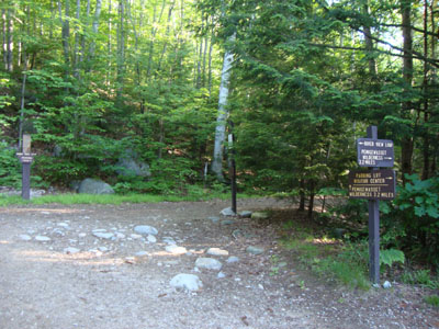
The Lincoln Woods Trail trailhead
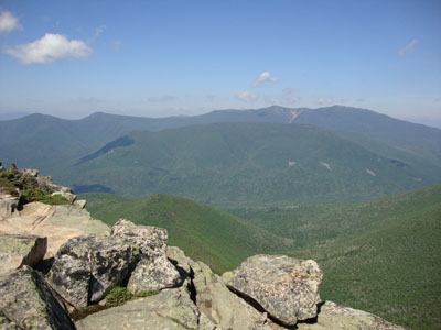
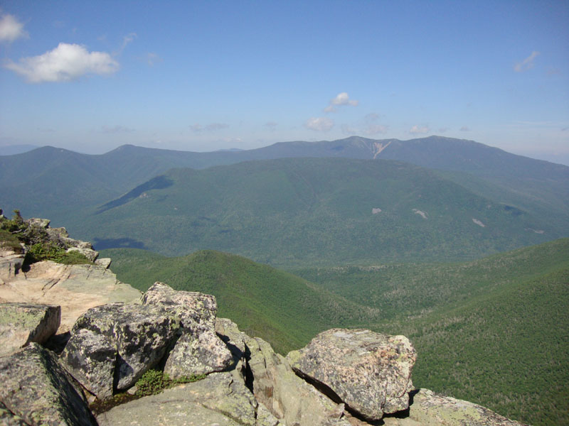
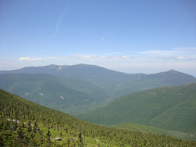
Looking at the Franconia Ridge from Bondcliff
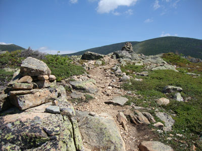
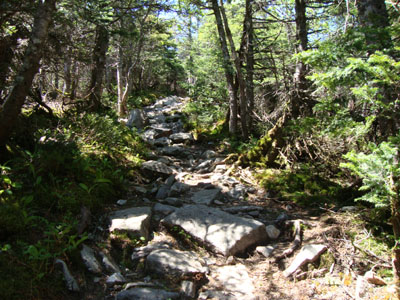
Looking up the Bondcliff Trail on the way to Mt. Bond
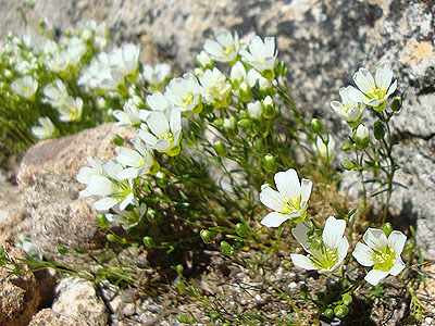
Alpine flowers on the way to Mt. Bond
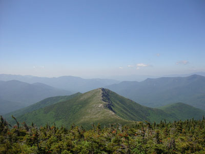
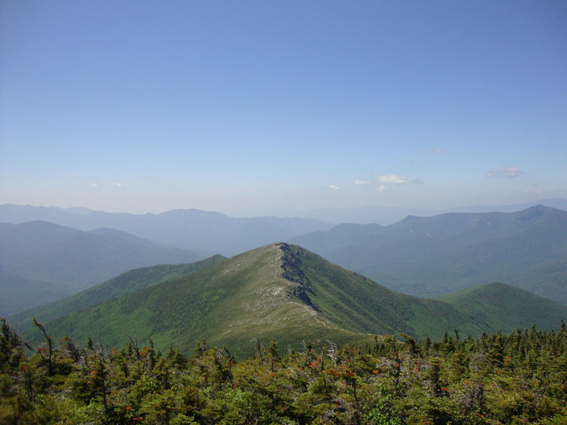
Looking at Bondcliff from Mt. Bond
The Bondcliff Trail on the way to West Bond
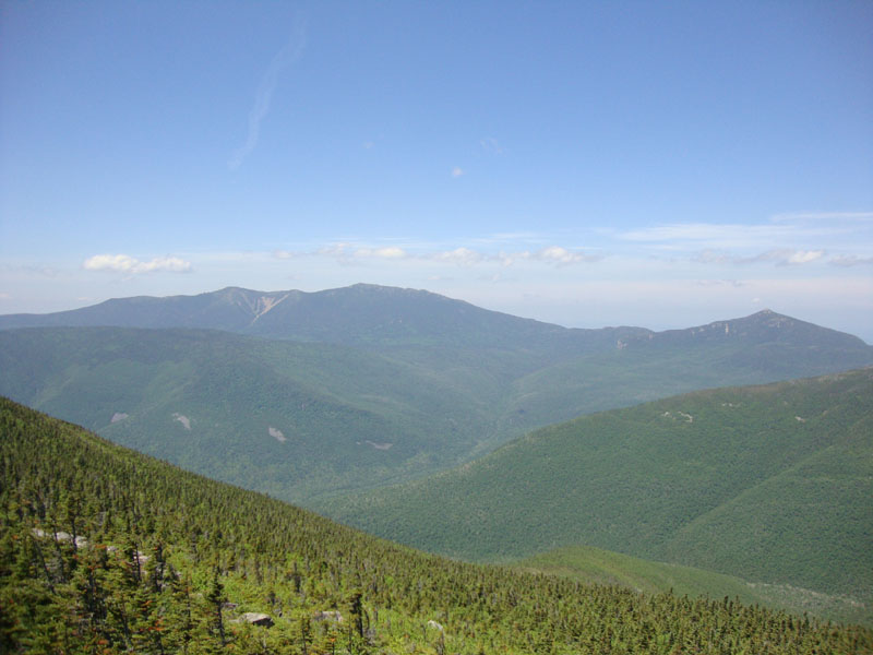
The Franconias and Garfield as seen from West Bond
The Twinway on the way to South Twin
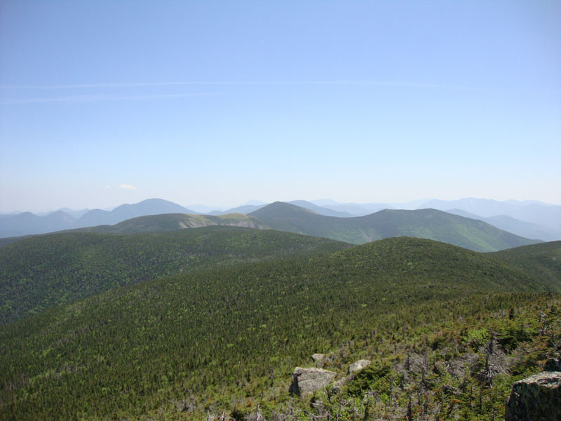
Looking back at the Bonds from South Twin
The North Twin Spur in the col between the Twins
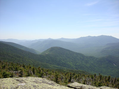
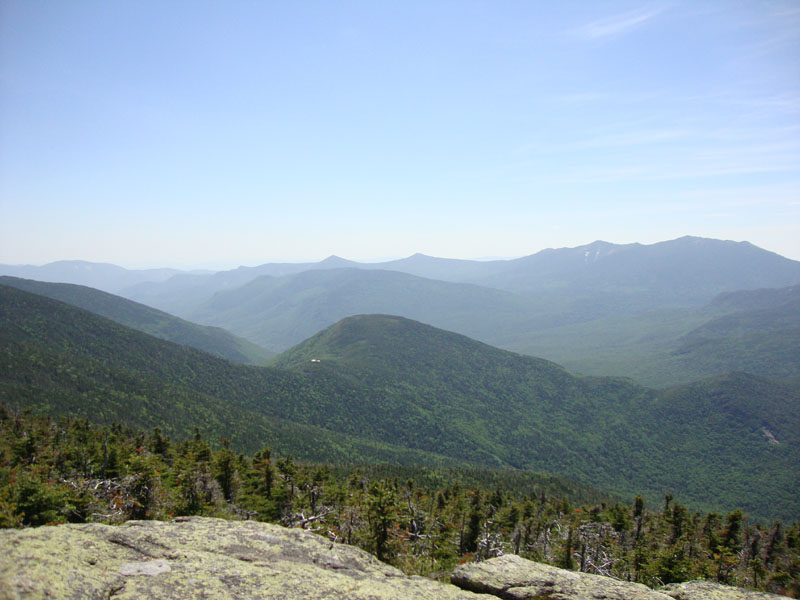
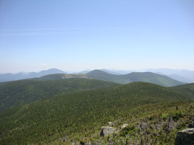
Looking into the Pemi from the North Twin ledges


Directions to trailhead: To get to Lincoln Woods, take Route 112 East from I-93 past Loon to the Lincoln Woods WMNF fee parking area (left side of road). From Route 302, take Route 3 South. Almost immediately after the Entering White Mountain National Forest, take a left onto Haystack Road. The WMNF fee parking area is at the end of the road.
Back to Bondcliff Profile
Back to Mt. Bond Profile
Back to Mt. Bond (West Peak) Profile
Back to South Twin Mountain Profile
Back to North Twin Mountain Profile
|