Home
States
Colorado
Connecticut
Maine
Massachusetts
New Hampshire
New York
Rhode Island
Utah
Vermont
View All
Lists
NE 4,000 Footers
NE 100 Highest
NH 4,000 Footers
NH 100 Highest
NH 52 With A View
NH Belknap Range
NH Ossipee 10
Links
Trail Conditions
Trip Log
Sunrises
Sunsets
About
|
Mt. Agassiz
Bethlehem, NH
Trailheads, measurements, times, distances, and maps are all approximate and relative to the hike(s) as shown below.
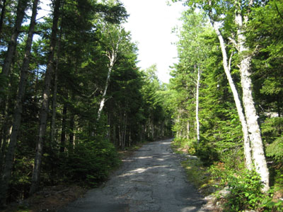
Looking up the road to Mt. Agassiz
Route: Auto road and herd path combination
On my way to a presentation in Lancaster, I stopped in Bethlehem to check out Mt. Agassiz.
We generally took the old auto road to the top, using a herd path to bypass a few sections. It wasn't particularly scenic by any means, however the views from the summit vista were tremendous. We avoided going to the highpoint, as the summit is now a private residence (polite foot traffic welcome).
| Hike Ratings |
|
Getting To Trailhead: |
Moderate |
| Destination: |
Mt. Agassiz |
|
Length: |
Easy |
|
Steepness: |
Moderate |
|
Navigation: |
Easy |
|
Views: |
Excellent |
|
Crowds: |
Minimal |
|
| Hike Stats |
|
Date Hiked: |
Thursday, July 30, 2009 |
| Hike Commenced: |
4:42 PM |
| Parking Elevation: |
1,800' |
| Destination: |
Mt. Agassiz |
| Ascent Commenced: |
4:42 PM |
| Summit Reached: |
4:58 PM |
| Time Elapsed: |
00:16 |
| Trailhead Elevation: |
1,800' |
| Summit Elevation: |
2,370' |
| Vertical Gain: |
575' |
|
|
| Hike Ended: |
5:19 PM |
| Hike Time Elapsed: |
00:37 |
| Hike Vertical Gain: |
580' |
|

The beginning of the Mt. Agassiz road

Flowers near the road to Mt. Agassiz

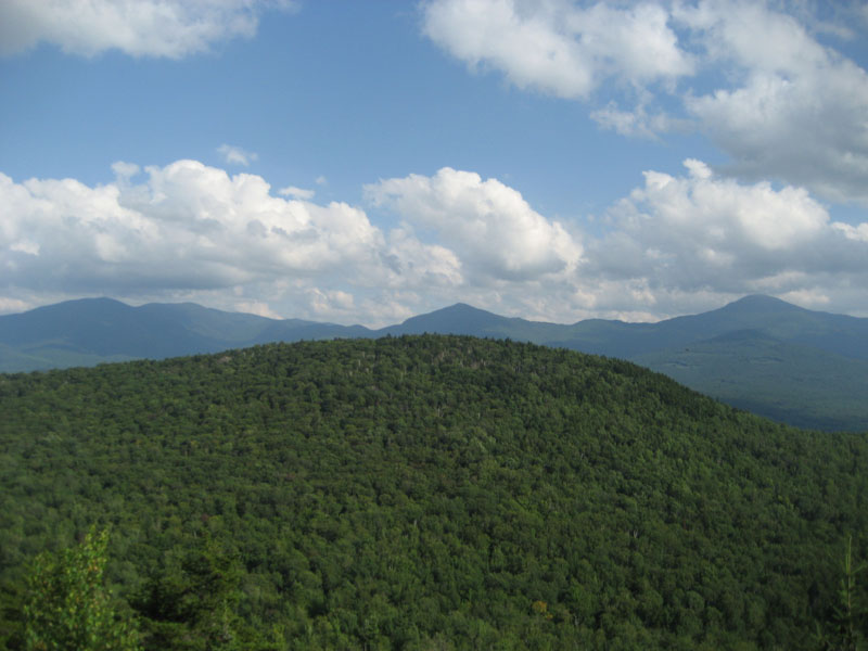
Looking south over Cleveland Mountain at the Twins, Garfield Ridge, and Mt. Lafayette from near the summit of Mt. Agassiz


Directions to trailhead: Take Route 142 southwest from Bethlehem. The road to Mt. Agassiz will be on the left, just prior to the height of land (just after Mt. View Lane). There is some room to park on the side of Route 142.
Back to Mt. Agassiz Profile
|