Home
States
Colorado
Connecticut
Maine
Massachusetts
New Hampshire
New York
Rhode Island
Utah
Vermont
View All
Lists
NE 4,000 Footers
NE 100 Highest
NH 4,000 Footers
NH 100 Highest
NH 52 With A View
NH Belknap Range
NH Ossipee 10
Links
Trail Conditions
Trip Log
Sunrises
Sunsets
About
|
Mt. Eisenhower, Mt. Pierce
Harts Location, NH, Cutts Grant, NH, Sargents Purchase, NH, Chandlers Purchase, NH, Beans Grant, NH
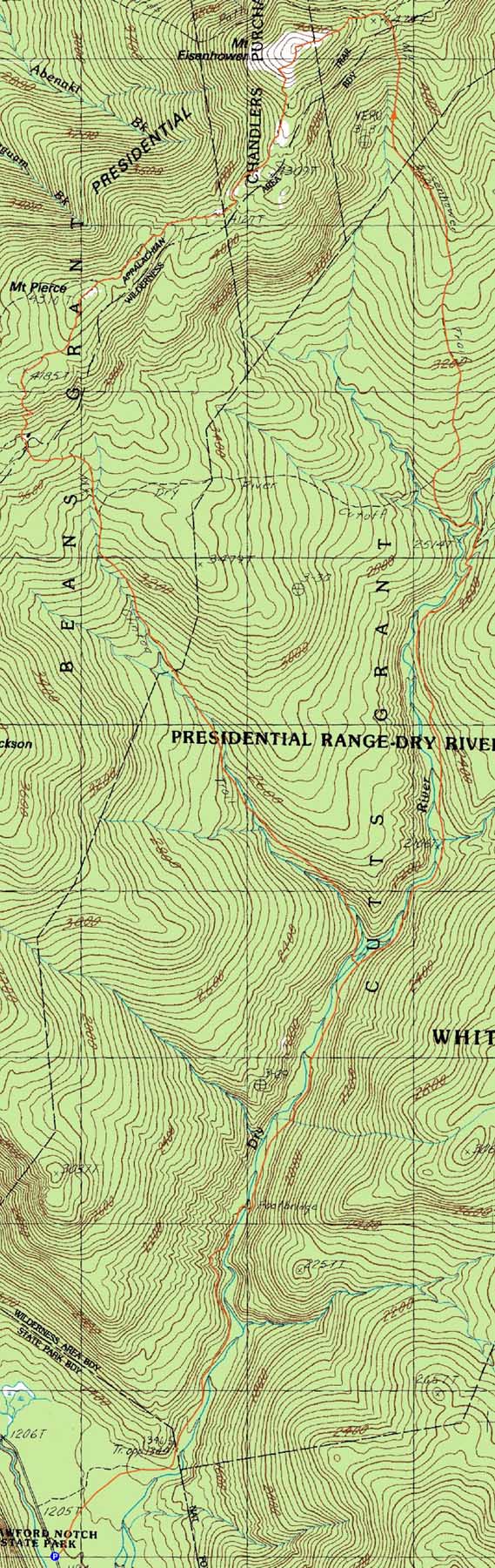
Trailheads, measurements, times, distances, and maps are all approximate and relative to the hike(s) as shown below.

Looking up the Mt. Eisenhower Trail
Route: Dry River Trail, Mt. Eisenhower Trail, Crawford Path, Eisenhower Loop, (Mt. Eisenhower), Eisenhower Loop, Crawford Path, Webster Cliff Trail, (Mt. Pierce), Webster Cliff Trail, Mt. Clinton Trail, Dry River Trail
The Dry River Trail was a long walk with plenty of ups and downs and stepover blowdowns. The Mt. Eisenhower Trail was generally tame, but also somewhat grown in. An extended portion of it struck me as bland, however the last few tenths of it was rather scenic.
After passing over Mt. Pierce and stopping at the Mizpah Hut to get water, we headed down the Mt. Clinton Trail. Though initially fine, the trail turned into an alleged trail below the Dry River Cutoff - blowdowns, significant brush, no markings, etc. With numerous water crossings and mud bogs, it was slow going. The Dry River Trail junction was a welcome sight.
| Hike Ratings |
|
Getting To Trailhead: |
Easy |
| Destination: |
Mt. Eisenhower |
|
Length: |
Difficult |
|
Steepness: |
Difficult |
|
Navigation: |
Moderate |
|
Views: |
Excellent |
|
Crowds: |
Heavy |
| Destination: |
Mt. Pierce |
|
Length: |
Difficult |
|
Steepness: |
Difficult |
|
Navigation: |
Easy |
|
Views: |
Excellent |
|
Crowds: |
Heavy |
|
| Hike Stats |
|
Date Hiked: |
Sunday, July 17, 2011 |
| Parking Elevation: |
1,205' |
| Destination: |
Mt. Eisenhower |
| Time Elapsed: |
04:33 |
| Trailhead Elevation: |
1,205' |
| Summit Elevation: |
4,780' |
| Distance: |
8.5 miles |
| Vertical Gain: |
3,875' |
| Destination: |
Mt. Pierce |
| Time Elapsed: |
00:49 |
| Trailhead Elevation: |
4,780' |
| Summit Elevation: |
4,310' |
| Vertical Gain: |
420' |
|
|
| Hike Time Elapsed: |
02:44 |
| Hike Vertical Gain: |
4,595' |
|

The Dry River Trail trailhead

Looking up the Mt. Eisenhower Trail

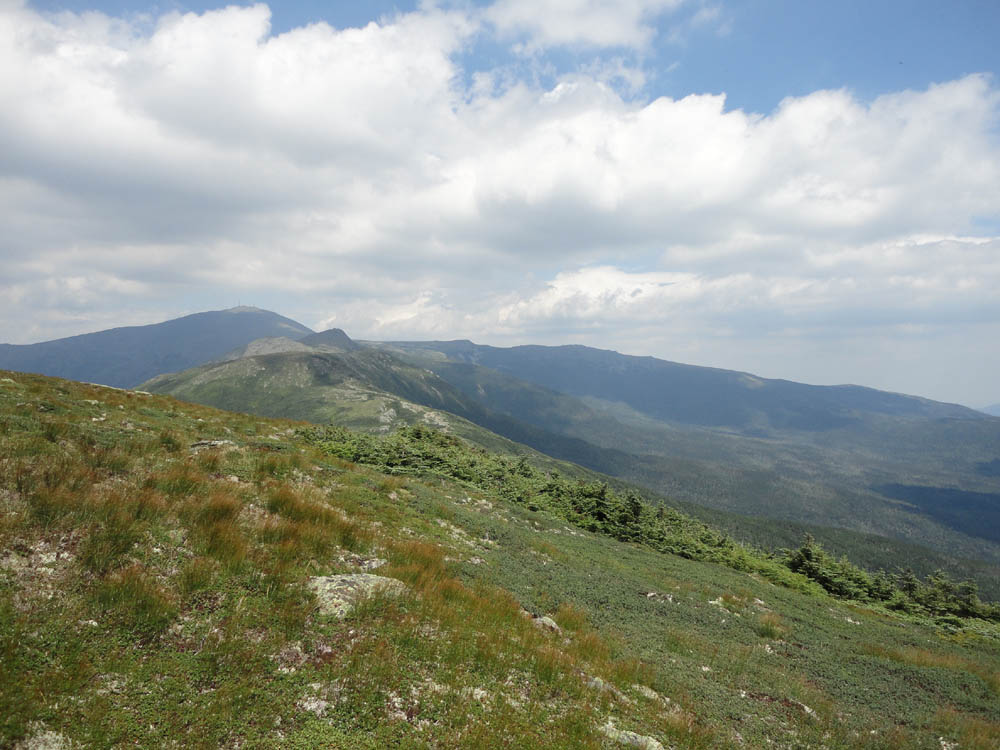
Looking at Mt. Washington, and Mt. Monroe from Mt. Eisenhower

The Eisenhower Loop

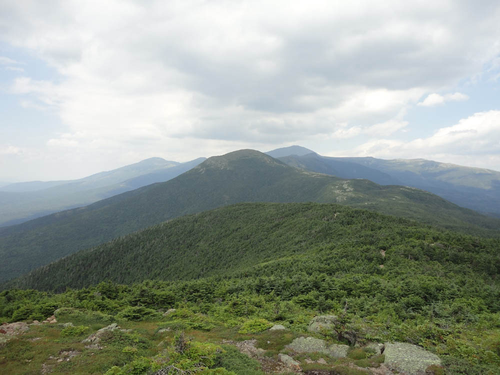
Looking at Mt. Eisenhower from Mt. Pierce

The alleged Mt. Clinton Trail


Directions to trailhead: The Dry River Trail trailhead is located east of the Appalachian Trail crossing on US 302, with roadside parking
Back to Mt. Eisenhower Profile
Back to Mt. Pierce Profile
|