Home
States
Colorado
Connecticut
Maine
Massachusetts
New Hampshire
New York
Rhode Island
Utah
Vermont
View All
Lists
NE 4,000 Footers
NE 100 Highest
NH 4,000 Footers
NH 100 Highest
NH 52 With A View
NH Belknap Range
NH Ossipee 10
Links
Trail Conditions
Trip Log
Sunrises
Sunsets
About
|
Mt. Hale
Bethlehem, NH
Trailheads, measurements, times, distances, and maps are all approximate and relative to the hike(s) as shown below.
The Firewarden's Trail
Route: North Twin Trail, herd path, Firewarden's Trail, (Mt. Hale), Firewarden's Trail, herd path, North Twin Trail
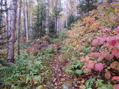
With birch trees and hobblebush becoming quite colorful, I decided to head up to the vast birch glades of the old Firewarden's Trail.
After hopping on the herd path off the North Twin Trail, I almost zoomed by the entrance to the Firewarden's Trail. Fortunately, I recognized a certain tree stump out of the corner of my eye.
The trail started off a bit muddy, however it improved as I climbed a bit. Also, as I climbed up the generally gentle trail, the colors improved.
Nearing the top of the switchbacks, I reached snow. On October 1st. Come on.
There weren't any views from the summit, due to the clouds.
I was able to get back out to the North Twin Trail just before it became too dark to continue without a headlamp. Since I was now on that old railgrade, I was able to continue without a headlamp back to the parking area.
| Hike Ratings |
|
Getting To Trailhead: |
Easy |
| Destination: |
Mt. Hale |
|
Length: |
Moderate |
|
Steepness: |
Moderate |
|
Navigation: |
Moderate |
|
Views: |
Excellent |
|
Crowds: |
Minimal |
|
| Hike Stats |
|
Date Hiked: |
Thursday, October 1, 2009 |
| Hike Commenced: |
4:23 PM |
| Parking Elevation: |
1,800' |
| Destination: |
Mt. Hale |
| Ascent Commenced: |
4:23 PM |
| Summit Reached: |
5:43 PM |
| Time Elapsed: |
01:20 |
| Trailhead Elevation: |
1,800' |
| Summit Elevation: |
4,054' |
| Vertical Gain: |
2,324' |
|
|
| Hike Ended: |
7:05 PM |
| Hike Time Elapsed: |
02:42 |
| Hike Vertical Gain: |
2,394' |
|
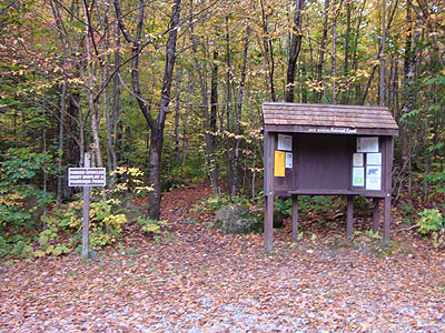
The North Twin Trail trailhead at the end of Haystack Road
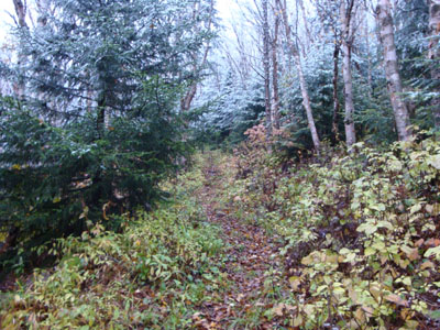
The Firewarden's Trail

Looking into the clouds at the summit of Mt. Hale


Directions to trailhead: From Route 302, take Route 3 South. Almost immediately after the Entering White Mountain National Forest, take a left onto Haystack Road. The WMNF fee parking area is at the end of the road, and the North Twin Trail trailhead is at the back of the lot.
Back to Mt. Hale Profile
|


