Home
States
Colorado
Connecticut
Maine
Massachusetts
New Hampshire
New York
Rhode Island
Utah
Vermont
View All
Lists
NE 4,000 Footers
NE 100 Highest
NH 4,000 Footers
NH 100 Highest
NH 52 With A View
NH Belknap Range
NH Ossipee 10
Links
Trail Conditions
Trip Log
Sunrises
Sunsets
About
|
Mt. Pierce, Mt. Eisenhower
Bean's Grant, NH, Chandler's Purchase, NH
Trailheads, measurements, times, distances, and maps are all approximate and relative to the hike(s) as shown below.

Looking up the Crawford Path
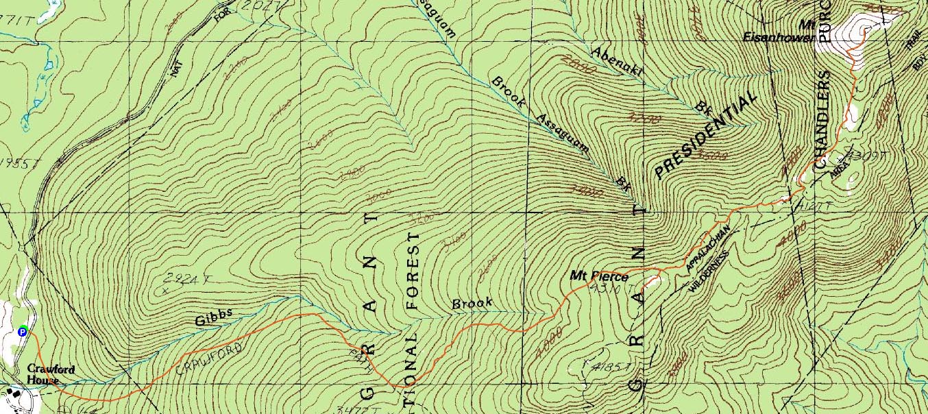
Route: Crawford Connector, Crawford Path, Webster Cliff Trail, (Mt. Pierce), Webster Cliff Trail, Crawford Path, Mt. Eisenhower Loop, (Mt. Eisenhower), Mt. Eisenhower Loop, Crawford Path, Crawford Connector
Though the forecast called for a somewhat chilly, windy day, it seemed like a nice opportunity to take a half day and go to the Southern Presidentials.
Arriving at a somewhat empty Crawford Path parking area, I quickly set foot up the Connector and up the Crawford Path. Though a bit wet and muddy in places, it was still pretty good going. Up to the Cut Off junction, there was a moderate amount of downhill traffic, all dressed up in light winter gear.
Upon reaching the Webster Cliff Trail junction, I dropped my pack and headed up to Mt. Pierce. Taking a few photos - great visibility thanks to the weather - I was getting slightly chilled in my shortsleeve shirt, thanks to the wind. Nonetheless, I refused to add layers, and was soon on my way to Eisenhower.
I found the section of trail between Pierce and Ike to be nice - lots of above treeline hiking with some short, wind protected areas. A few of the low spots were muddy, but other than that, the terrain was in good shape.
The bald summit of Mt. Eisenhower was rather windy - I almost was knocked over at one point when I wasn't paying attention to what I was doing. Though cold, I still stuck with the short sleeve shirt, was I wanted to get used to the colder weather.
Back at the Webster Cliff Trail junction, I decided to take a snack break, put on a long sleeve shirt, and enjoy the views. What a nice day!
I didn't see a single person on the entire descent - a quiet end to a nice hike.
| Hike Ratings |
|
Getting To Trailhead: |
Easy |
| Destination: |
Mt. Pierce |
|
Length: |
Moderate |
|
Steepness: |
Moderate |
|
Navigation: |
Easy |
|
Views: |
Excellent |
|
Crowds: |
Moderate |
| Destination: |
Mt. Eisenhower |
|
Length: |
Moderate |
|
Steepness: |
Difficult |
|
Navigation: |
Easy |
|
Views: |
Excellent |
|
Crowds: |
Minimal |
|
| Hike Stats |
|
Date Hiked: |
Thursday, September 18, 2008 |
| Hike Commenced: |
1:16 PM |
| Parking Elevation: |
1,920' |
| Destination: |
Mt. Pierce |
| Ascent Commenced: |
1:17 PM |
| Summit Reached: |
2:46 PM |
| Time Elapsed: |
01:29 |
| Trailhead Elevation: |
1,920' |
| Summit Elevation: |
4,310' |
| Distance: |
3.2 miles |
| Vertical Gain: |
2,430' |
| Destination: |
Mt. Eisenhower |
| Ascent Commenced: |
2:47 PM |
| Summit Reached: |
3:36 PM |
| Time Elapsed: |
00:49 |
| Trailhead Elevation: |
4,310' |
| Summit Elevation: |
4,780' |
| Distance: |
1.7 miles |
| Vertical Gain: |
920' |
|
|
| Hike Ended: |
6:09 PM |
| Hike Time Elapsed: |
04:53 |
| Hike Vertical Gain: |
3,770' |
|

Crawford Connector trailhead

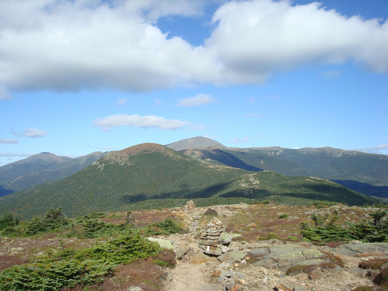
Looking at Mt. Eisenhower and Mt. Washington from near the summit of Mt. Pierce

Looking up the Mt. Eisenhower Loop trail

Looking at Mt. Carrigain from the Mt. Eisenhower summit


Directions to trailhead: Take Route 302 West from Bartlett into Carroll. Just after Saco Lake, take a right onto Mt. Clinton Road. Shortly thereafter, take a left into the WMNF fee parking area driveway and Crawford Connector trailhead.
Back to Mt. Pierce Profile
Back to Mt. Eisenhower Profile
|