Home
States
Colorado
Connecticut
Maine
Massachusetts
New Hampshire
New York
Rhode Island
Utah
Vermont
View All
Lists
NE 4,000 Footers
NE 100 Highest
NH 4,000 Footers
NH 100 Highest
NH 52 With A View
NH Belknap Range
NH Ossipee 10
Links
Trail Conditions
Trip Log
Sunrises
Sunsets
About
|
North Twin Mountain, South Twin Mountain, Galehead Mountain
Bethlehem, NH, Franconia, NH
Trailheads, measurements, times, distances, and maps are all approximate and relative to the hike(s) as shown below.

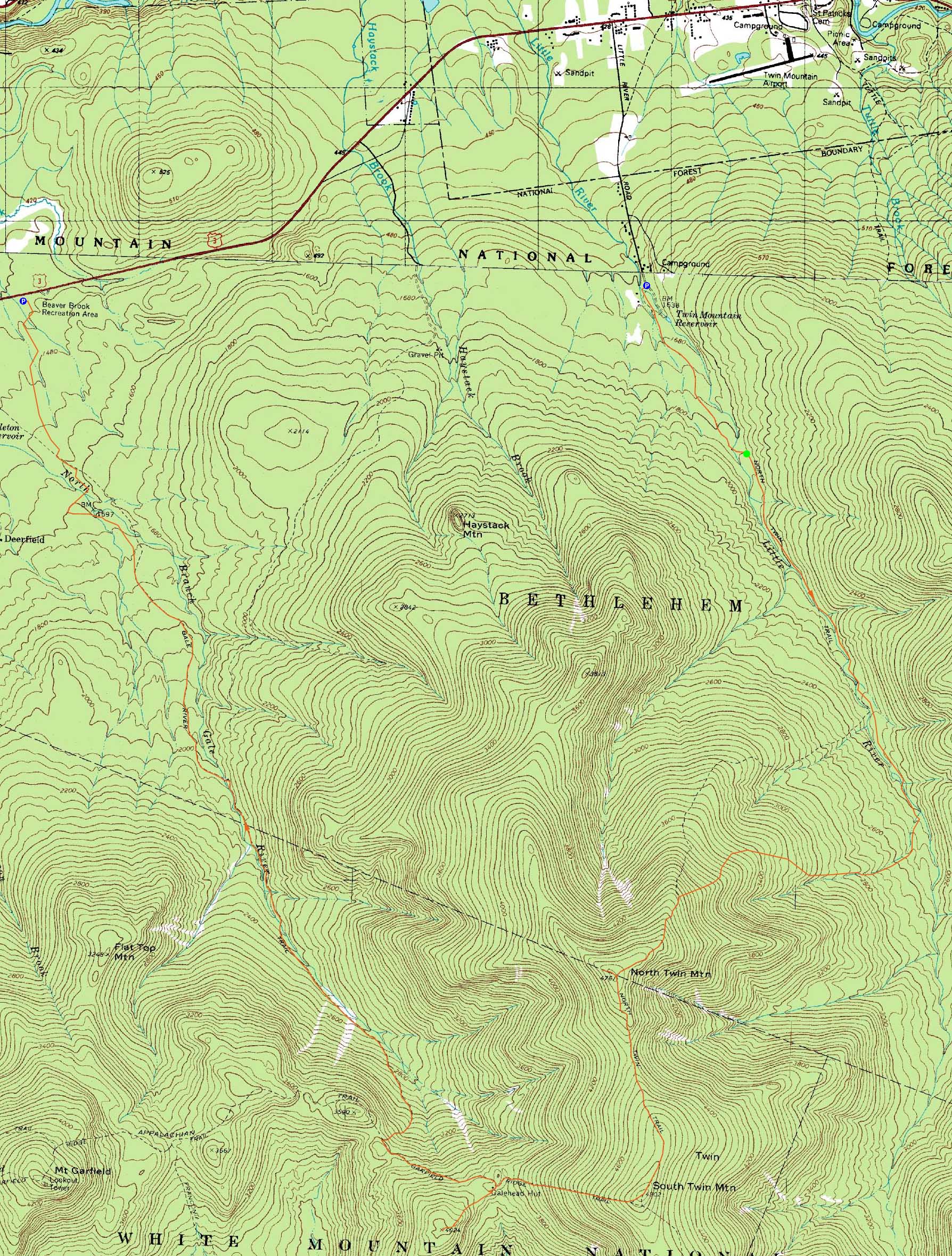
The North Twin Trail
Route: Herd path, Haystack Road, North Twin Trail, herd path, North Twin Trail, view spur path, (North Twin Mountain), view spur path, North Twin Spur, (South Twin Mountain), Twinway, Frost Trail, (Galehead Mountain), Frost Trail, Garfield Ridge Trail, Gale River Trail, Gale River Road, connector trail, Beaver Brook XC Ski Trail
While we were hoping for better weather, the Sunday forecast deteriorated as the day approached. Nonetheless, we wanted to hike the Twins and Galehead while the surface conditions were good.
After spotting a vehicle at Beaver Brook, we headed over to the end of Little River Road and soon set foot up the herd path shortcut to the North Twin summer trailhead. Using a second herd path to bypass the first two water crossings on the North Twin Trail, we were able to easily cross the Little River via a firm ice bridge.
While the overcast skies and cold temperatures were less than optimal, the weather wasn't too bad until we climbed into the upper elevations, where we were greeted by a bitter wind.
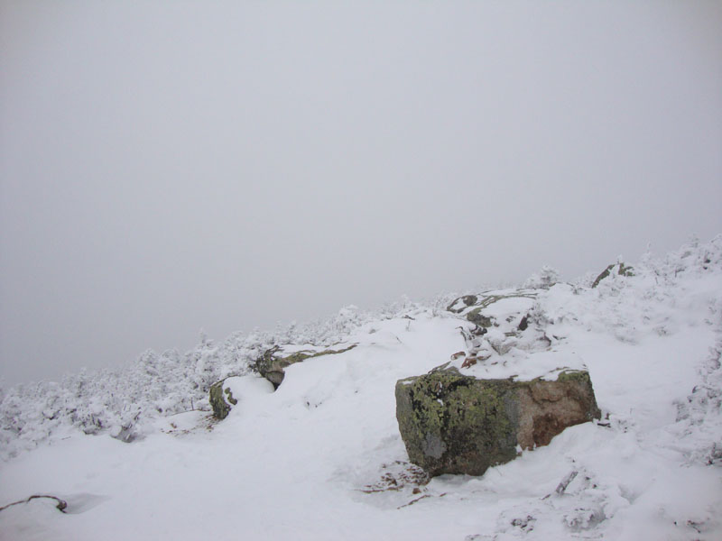
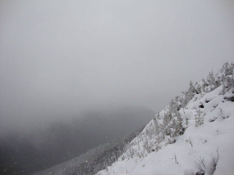
After reaching North Twin and having no views, we continued on the North Twin Spur, dealing with some snow drifting in places. The summit of South Twin also beared no views on this day, but provided a nice, strong, cold wind - enough to make us quickly drop back into the trees on the Twinway. While sometimes icy in places, the Twinway was covered in snow from top to bottom.
After a quick lunch on the porch of the Galehead Hut, we headed up the snow drifted Frost Trail to Galehead Mountain. While also in the clouds, we did have slight views from the near-summit vista.
The descent down the Gale River Trail was a bit tedious, thanks to the long flats at the bottom and a healthy amount of blowdowns. After a quick walk on the snowmobile trail (Gale River Road in summer), we hopped onto the Beaver Brook Ski Area trail system and were at the parking lot about half a mile later.
| Hike Ratings |
|
Getting To Trailhead: |
Moderate |
| Destination: |
North Twin Mountain |
|
Length: |
Moderate |
|
Steepness: |
Difficult |
|
Navigation: |
Moderate |
|
Views: |
Minimal (due to weather) |
|
Crowds: |
Minimal |
| Destination: |
South Twin Mountain |
|
Length: |
Difficult |
|
Steepness: |
Difficult |
|
Navigation: |
Difficult |
|
Views: |
Minimal (due to weather) |
|
Crowds: |
Minimal |
| Destination: |
Galehead Mountain |
|
Length: |
Difficult |
|
Steepness: |
Difficult |
|
Navigation: |
Easy |
|
Views: |
Minimal (due to weather) |
|
Crowds: |
Minimal |
|
| Hike Stats |
|
Date Hiked: |
Sunday, February 7, 2010 |
| Hike Commenced: |
7:40 AM |
| Parking Elevation: |
1,620' |
| Destination: |
North Twin Mountain |
| Ascent Commenced: |
8:01 AM |
| Summit Reached: |
10:26 AM |
| Time Elapsed: |
02:25 |
| Trailhead Elevation: |
1,800' |
| Summit Elevation: |
4,761' |
| Distance: |
4.3 miles |
| Vertical Gain: |
3,111' |
| Destination: |
South Twin Mountain |
| Ascent Commenced: |
10:27 AM |
| Summit Reached: |
11:04 AM |
| Time Elapsed: |
00:37 |
| Trailhead Elevation: |
4,761' |
| Summit Elevation: |
4,902' |
| Distance: |
1.3 miles |
| Vertical Gain: |
461' |
| Destination: |
Galehead Mountain |
| Ascent Commenced: |
11:04 AM |
| Summit Reached: |
11:54 AM |
| Time Elapsed: |
00:50 |
| Trailhead Elevation: |
4,902' |
| Summit Elevation: |
4,024' |
| Distance: |
1.3 miles |
| Vertical Gain: |
309' |
|
|
| Hike Ended: |
2:21 PM |
| Hike Time Elapsed: |
6:41 |
| Hike Vertical Gain: |
4,356' |
|

The North Twin Trail trailhead at the end of Haystack Road

Looking into the clouds from near the North Twin summit

The North Twin Spur near South Twin

Looking at the clouds from the South Twin summit

The drifted Frost Trail on the way to Galehead Mountain

Looking south from the Galehead Mountain vista


Directions to trailhead: In winter 2009-2010, take Route 3 south past Twin Mountain (from Route 302), then take a left into the Beaver Brook WMNF fee parking area, just before the five corners, spotting a car here. Then, go north on Route 3 to Twin Mountain, taking a right onto Little River Road. As of winter 2009-2010, the end of the road had room for limited parking (no parking signs removed - 7 Dwarfs Motel offers alternative fee parking in winter), and the snowmobile bridge across the Little River had been rebuilt and reopened. After crossing this bridge, take an immediate sharp left turn onto a skier path, which then leads to Haystack Road, near the North Twin Trail trailhead.
Back to North Twin Mountain Profile
Back to South Twin Mountain Profile
Back to Galehead Mountain Profile
|