Home
States
Colorado
Connecticut
Maine
Massachusetts
New Hampshire
New York
Rhode Island
Utah
Vermont
View All
Lists
NE 4,000 Footers
NE 100 Highest
NH 4,000 Footers
NH 100 Highest
NH 52 With A View
NH Belknap Range
NH Ossipee 10
Links
Trail Conditions
Trip Log
Sunrises
Sunsets
About
|
Bald Peak, Parkman Mountain, Gilmore Peak, Sargent Mountain
Mount Desert, ME
Trailheads, measurements, times, distances, and maps are all approximate and relative to the hike(s) as shown below.

Ascending the Bald Peak Trail
Route: Around-Mountain Carriage Road, Bald Peak Trail, Grandgent Trail, Sargent South Ridge Trail, Birch Spring Trail, Hadlock Brook Trail
Trails were mostly dry. Lots of wildflowers in bloom. Fantastic views on all four peaks and awesome ridge walk off Sargent.
| Hike Ratings |
|
Getting To Trailhead: |
Easy |
| Destination: |
Bald Peak |
|
Length: |
Moderate |
|
Steepness: |
Difficult |
|
Navigation: |
Easy |
|
Views: |
Excellent |
|
Crowds: |
Moderate |
| Destination: |
Parkman Mountain |
|
Length: |
Moderate |
|
Steepness: |
Difficult |
|
Navigation: |
Easy |
|
Views: |
Excellent |
|
Crowds: |
Moderate |
| Destination: |
Gilmore Peak |
|
Length: |
Moderate |
|
Steepness: |
Difficult |
|
Navigation: |
Easy |
|
Views: |
Excellent |
|
Crowds: |
Moderate |
| Destination: |
Sargent Mountain |
|
Length: |
Moderate |
|
Steepness: |
Difficult |
|
Navigation: |
Easy |
|
Views: |
Excellent |
|
Crowds: |
Moderate |
|
| Hike Stats |
|
Date Hiked: |
Sunday, June 3, 2018 |
| Parking Elevation: |
340' |
| Destination: |
Bald Peak |
| Time Elapsed: |
00:28 |
| Trailhead Elevation: |
340' |
| Summit Elevation: |
974' |
| Vertical Gain: |
634' |
| Destination: |
Parkman Mountain |
| Time Elapsed: |
00:13 |
| Trailhead Elevation: |
974' |
| Summit Elevation: |
941' |
| Vertical Gain: |
127' |
| Destination: |
Gilmore Peak |
| Time Elapsed: |
00:19 |
| Trailhead Elevation: |
941' |
| Summit Elevation: |
1,030' |
| Vertical Gain: |
290' |
| Destination: |
Sargent Mountain |
| Time Elapsed: |
00:23 |
| Trailhead Elevation: |
1,030' |
| Summit Elevation: |
1,373' |
| Vertical Gain: |
463' |
|
|
| Hike Time Elapsed: |
03:09 |
| Hike Vertical Gain: |
1,564' |
|

The spur to the Around Mountain Carriage Road off Route 3
Looking toward Blue Hill from Bald Peak
The trail between Bald Peak and Parkman Mountain
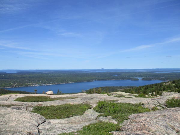
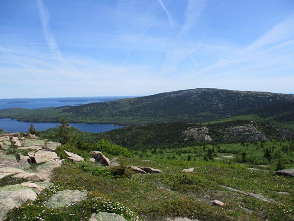
Looking south over Upper Hadlock Pond from Parkman Mountain
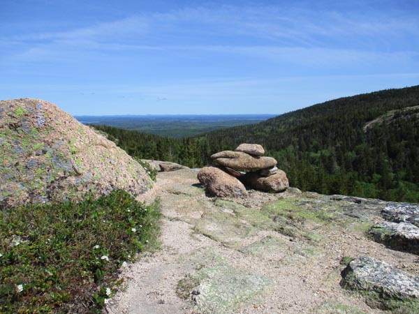
Departing Parkman Mountain
Looking west over Bald Peak (left) and Parkman Mountain (right) from Gilmore Peak

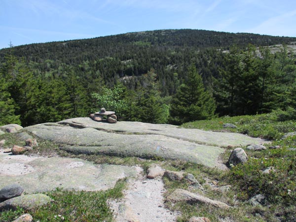
Ascending Sargent Mountain
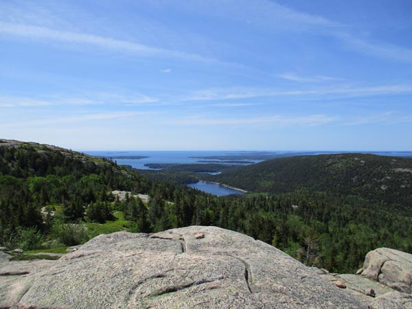
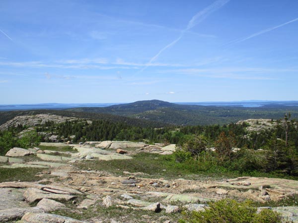
Looking east over the Bubbles at Cadillac Mountain from Sargent Mountain
Directions to trailhead: Take Route 198 south from Route 233. Shortly after passing Sargent Drive, there will be a small parking area on the left side of the road at a height of land. A short spur to the Carriage Road network is located adjacent to the restroom.
Back to Bald Peak Profile
Back to Parkman Mountain Profile
Back to Gilmore Peak Profile
Back to Sargent Mountain Profile
|


