Home
States
Colorado
Connecticut
Maine
Massachusetts
New Hampshire
New York
Rhode Island
Utah
Vermont
View All
Lists
NE 4,000 Footers
NE 100 Highest
NH 4,000 Footers
NH 100 Highest
NH 52 With A View
NH Belknap Range
NH Ossipee 10
Links
Trail Conditions
Trip Log
Sunrises
Sunsets
About
|
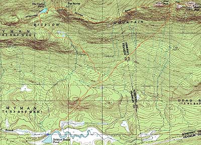
Bigelow Mountain (Avery Peak), Bigelow Mountain (West Peak), Bigelow Mountain (South Horn)
Wyman, ME, Dead River, ME
Trailheads, measurements, times, distances, and maps are all approximate and relative to the hike(s) as shown below.
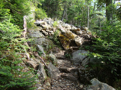
Looking up the Fire Warden's Trail on the way to Avery Peak
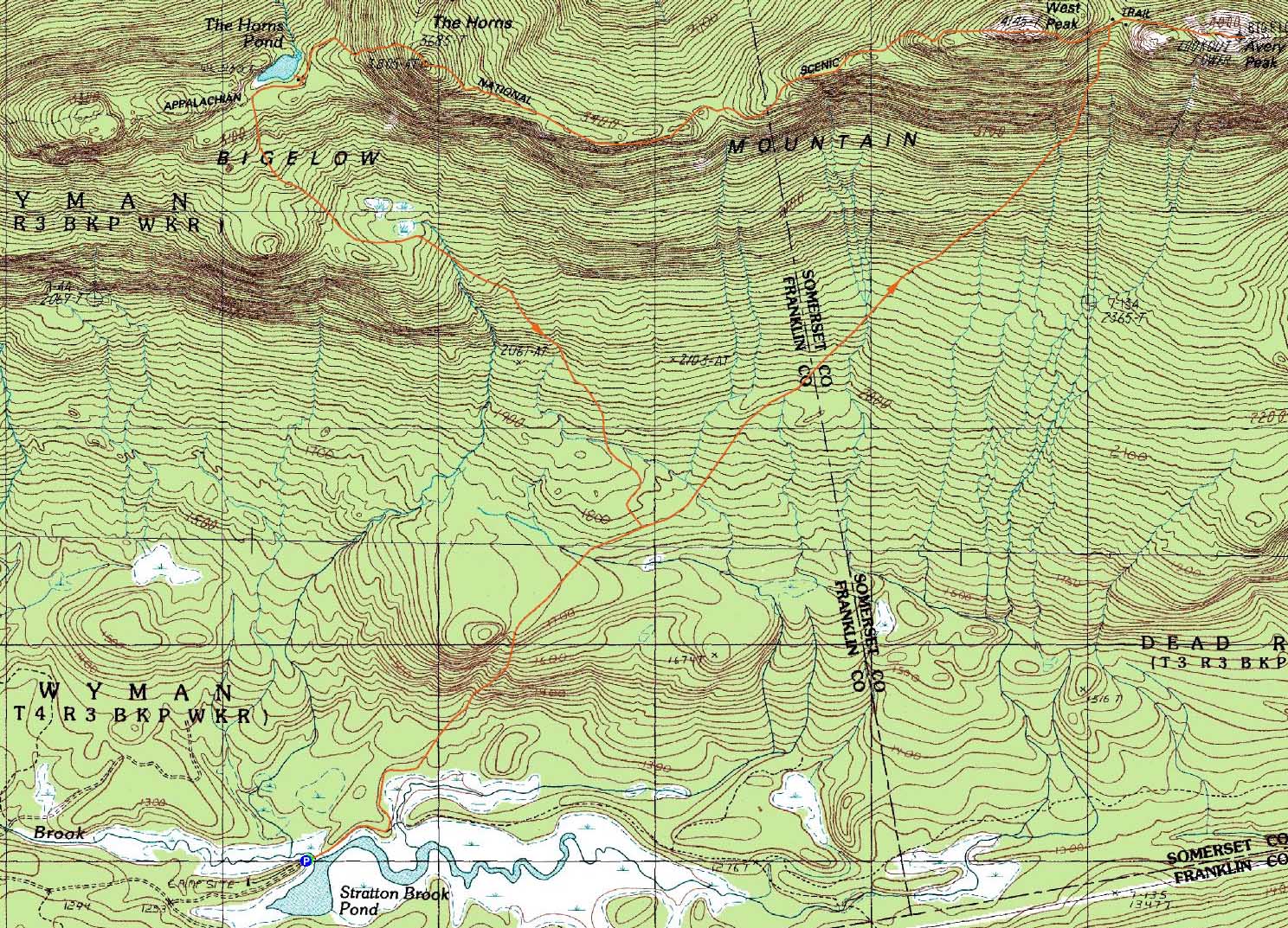
Route: Fire Warden's Trail, Appalchian Trail, (Bigelow Mountain - Avery Peak), Appalchian Trail, (Bigelow Mountain - West Peak), Appalachian Trail, (Bigelow Mountain - South Horn), Appalchian Trail, Pond Loop, (Horns Pond), Pond Loop, Appalachian Trail, Horns Pond Trail, Fire Warden's Trail
Though I was hoping to hike the Bigelows for the first time on a bluebird day, I knew the odds of that lining up this summer were slim. Thus, without a doomsday forecast, it seemed like a good enough time to give the "Iron Triangle" (the route as it is known locally) a shot.
After parking at the small parking area near Stratton Brook Pond (a few tenths of a mile drive up the roadwalk portion of the Fire Warden's Trail), we set foot up the path. Though it was hazy and foggy out, it looked like there was a chance of getting some views up high. The lower portion of the Fire Warden's Trail was a bit mucky, but generally pretty tame (aside from a short steep or two). After passing the Moose Falls Tentsite, the trail steepened up quickly and fairly relentlessly - lots of rock stairways. Finally reaching the col, the middle portion of the Appalachian Trail to Avery Peak was pretty rough footing-wise.
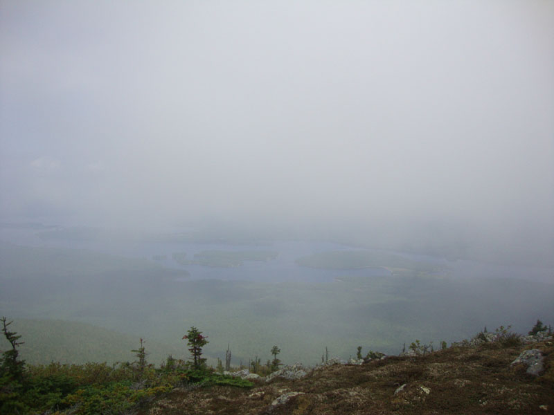
The fog still clung to Avery Peak as we reached a busy summit - by the looks of it, the views would otherwise be tremendous. Though windy, it was warm enough that we didn't need to add layers. As we departed, some views started to creep up.
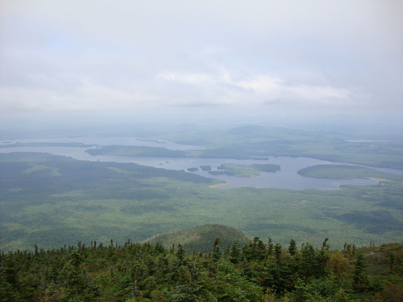
Reaching West Peak via a somewhat steep trail, we had much better views - though still hazy, the fog had moved on.
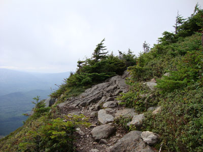
The final peak of the day was the South Horn. The descent seemed to be fairly tame for awhile - until we turned a corner and saw we had a lot more dropping to do - some of it steep and slabby. The ascent to the Horn was steep as well.
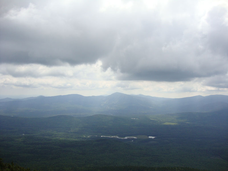
The views from South Horn, though not panoramic, were quite strong. Though the panoramic views from North Horn were tempting, we decided to call it a day and headed down the steep descent to Horn Pond, where we once again had some nice scenery.
The Horns Ponds Trail was very gradual, though it dragged on a bit longer than I would have liked. Nonetheless, it was nice to finally check out the Bigelows!
| Hike Ratings |
|
Getting To Trailhead: |
Moderate |
| Destination: |
Bigelow Mountain (Avery Peak) |
|
Length: |
Moderate |
|
Steepness: |
Difficult |
|
Navigation: |
Easy |
|
Views: |
Moderate (due to weather) |
|
Crowds: |
Heavy |
| Destination: |
Bigelow Mountain (West Peak) |
|
Length: |
Moderate |
|
Steepness: |
Difficult |
|
Navigation: |
Easy |
|
Views: |
Excellent |
|
Crowds: |
Minimal |
| Destination: |
Bigelow Mountain (South Horn) |
|
Length: |
Difficult |
|
Steepness: |
Very Difficult |
|
Navigation: |
Easy |
|
Views: |
Excellent |
|
Crowds: |
Heavy |
|
| Hike Stats |
|
Date Hiked: |
Sunday, August 23, 2009 |
| Hike Commenced: |
8:22 AM |
| Parking Elevation: |
1,235' |
| Destination: |
Bigelow Mountain (Avery Peak) |
| Ascent Commenced: |
8:22 AM |
| Summit Reached: |
11:10 AM |
| Time Elapsed: |
02:48 |
| Trailhead Elevation: |
1,235' |
| Summit Elevation: |
4,088' |
| Vertical Gain: |
2,933' |
| Destination: |
Bigelow Mountain (West Peak) |
| Ascent Commenced: |
11:20 AM |
| Summit Reached: |
11:45 AM |
| Time Elapsed: |
00:25 |
| Trailhead Elevation: |
4,088' |
| Summit Elevation: |
4,145' |
| Distance: |
0.7 mile |
| Vertical Gain: |
370' |
| Destination: |
Bigelow Mountain (South Horn) |
| Ascent Commenced: |
12:07 PM |
| Summit Reached: |
1:24 PM |
| Time Elapsed: |
01:17 |
| Trailhead Elevation: |
4,145' |
| Summit Elevation: |
3,805' |
| Vertical Gain: |
705' |
|
|
| Hike Ended: |
4:00 PM |
| Hike Time Elapsed: |
07:38 |
| Hike Vertical Gain: |
4,083' |
|
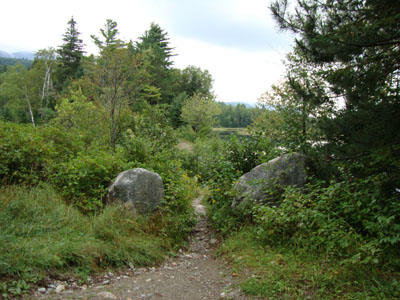
The second Fire Warden's Trail trailhead
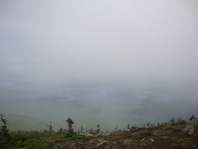
Looking at Flagstaff Lake from near the summit of Avery Peak
The Appalachian Trail on the way to Bigelow Mountain's West Peak
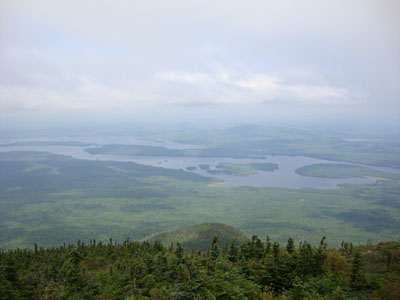
Looking at Flagstaff Lake from near the summit of Bigelow Mountain's West Peak
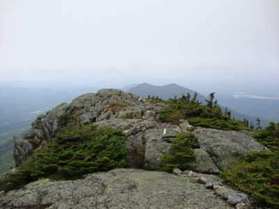
The Appalachian Trail on the way to the South Horn
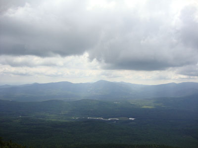
Looking south at Burnt Hill, Sugarloaf, and the Crockers from Bigelow Mountain's South Horn
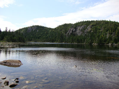
Horns Pond

Directions to trailhead: Take Route 27 northwest from the entrance to Sugarloaf USA ski area. Shortly after passing the Appalachian Trail crossing, take a right onto Stratton Brook Pond Road. There are two small Fire Warden's Trail parking areas along this road - the second of which, at the end of the road, should only be attempted by four wheel drive vehicles. The Fire Warden's Trail continues alongside Stratton Brook Pond at the end of this second parking area.
Back to Bigelow Mountain - Avery Peak Profile
Back to Bigelow Mountain - West Peak Profile
Back to Bigelow Mountain - South Horn Profile
|