Home
States
Colorado
Connecticut
Maine
Massachusetts
New Hampshire
New York
Rhode Island
Utah
Vermont
View All
Lists
NE 4,000 Footers
NE 100 Highest
NH 4,000 Footers
NH 100 Highest
NH 52 With A View
NH Belknap Range
NH Ossipee 10
Links
Trail Conditions
Trip Log
Sunrises
Sunsets
About
|
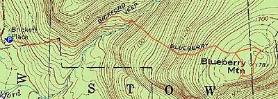
Blueberry Mountain
Stow, ME, Stoneham, ME
Trailheads, measurements, times, distances, and maps are all approximate and relative to the hike(s) as shown below.
The Bickford Brook Trail
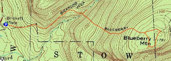
Route: Bickford Brook Trail, Blueberry Ridge Trail, Lookout Loop, (Blueberry Mountain), Lookout Loop, Blueberry Ridge Trail, Bickford Brook Trail
With the last weekday of daylight savings time here, my plan was to do a sunset hike. The day ended up completely cloudy, though, ruining those chances. I figured, with the road closing in the coming weeks, Evans Notch would be a good choice. Since peaks above 3,000 feet appeared to be in the clouds, I opted for something lower.
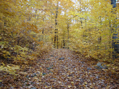
The Bickford Brook Trail was generally pretty gradual with good footing. The foliage was a tremendous golden color - quite nice for two days before November.
The Blueberry Ridge Trail then dropped down to the brook crossing - I walked down to the lower 'slides' then uphill a bit (prior to realizing I was working my way back to the Bickford Brook Trail). Back on the Blueberry Ridge Trail, things steepened up. A few extended slab areas were quite wet and slippery.
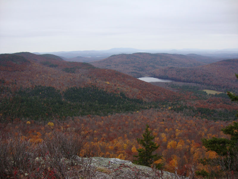
Reaching the height of land ledges, I worked my way over to the second Lookout Loop junction, crossing over the highpoint and then reaching the vista. Despite being cloudy, the views were still quite good.
After a slow, careful descent of the Blueberry Ridge Trail, I reached Brickett Place just before dark.
| Hike Ratings |
|
Getting To Trailhead: |
Easy |
| Destination: |
Blueberry Mountain |
|
Length: |
Moderate |
|
Steepness: |
Difficult |
|
Navigation: |
Easy |
|
Views: |
Excellent |
|
Crowds: |
Minimal |
|
| Hike Stats |
|
Date Hiked: |
Friday, October 30, 2009 |
| Hike Commenced: |
4:01 PM |
| Parking Elevation: |
600' |
| Destination: |
Blueberry Mountain |
| Ascent Commenced: |
4:01 PM |
| Summit Reached: |
4:55 PM |
| Time Elapsed: |
00:54 |
| Trailhead Elevation: |
600' |
| Summit Elevation: |
1,781' |
| Vertical Gain: |
1,281' |
|
|
| Hike Ended: |
5:52 PM |
| Hike Time Elapsed: |
01:51 |
| Hike Vertical Gain: |
1,401' |
|
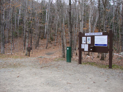
The Bickford Brook Trail trailhead
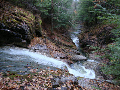
The lower Bickford Slides
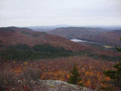
Looking at Shell Pond and Pleasant Mountain from near the summit of Blueberry Mountain

Directions to trailhead: Take Route 113 North from Fryeburg past the Baldface Loop parking lot. A few minutes later, after passing through the seasonal gate, the Brickett Place house and WMNF fee parking area will be on the right. The trailhead is adjacent to the parking lot out back.
Back to Blueberry Mountain Profile
|