Home
States
Colorado
Connecticut
Maine
Massachusetts
New Hampshire
New York
Rhode Island
Utah
Vermont
View All
Lists
NE 4,000 Footers
NE 100 Highest
NH 4,000 Footers
NH 100 Highest
NH 52 With A View
NH Belknap Range
NH Ossipee 10
Links
Trail Conditions
Trip Log
Sunrises
Sunsets
About
|
Burnt Meadow Mountain
Brownfield, ME
Trailheads, measurements, times, distances, and maps are all approximate and relative to the hike(s) as shown below.
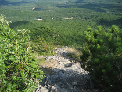
Looking down the trail to Burnt Meadow Mountain
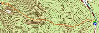
Route: Unknown trail
Today's after work hike was going to be out of state - Burnt Meadow Mountain is less than an hour away, so it was a no-brainer on a mild, sunny day.
There isn't too much out there on this hike - a few random trip reports and a lost ski area profile is about it. The summit isn't marked on topo maps as being Burnt Meadow Mountain, but rather as a peak on the 'Burnt Meadow Mountains.' Since the highest peak on this range is named (Stone Mountain) and since the unnamed peak is the closest to Burnt Meadow Pond and road, it appears that this is what people consider 'Burnt Meadow Mountain.'
I found the trailhead and parking lot on my first try, however due to the lack of signage, I decided to continue down the road and see if there was anything more formal. There wasn't, so I returned and found some light blue blazes upon looking more closely.
The trail gets to business pretty quickly with some short, steep pitches as it climbs over a small subpeak. After a dip, things get rockier. Much of the trail has great views due to the lack of significant vegetation on the southern shoulder of this ridge.
Just shy of the summit things steepen up considerably - some minor scrambling is required as the trail climbs up some steep ledges. This point of the trail has a bit of exposure - it's steep straight down and the ridge drops down at a good rate on either side. Great for views, but probably not for people who have a fear of heights.
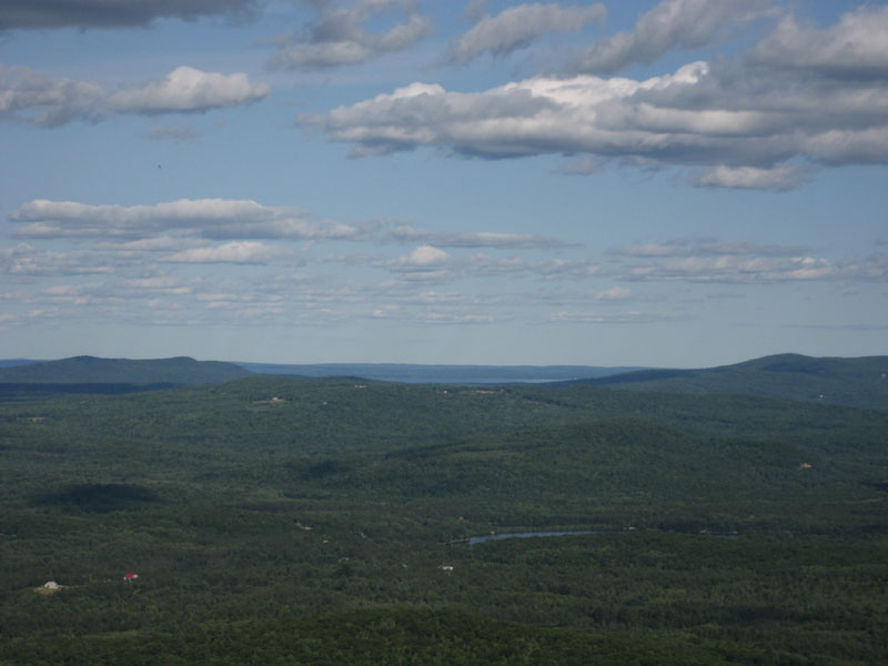
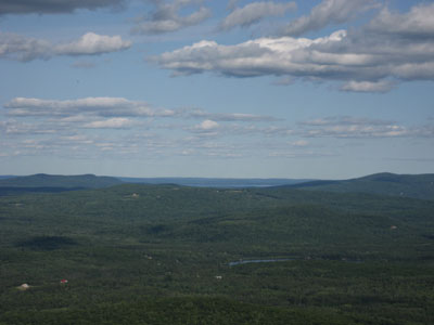
The summit is pretty much an open field with some directional views toward the southern White Mountains, Pleasant Mountain, and a wide view of Maine. The ledge looking at Maine also looks into a large ravine - some other hikers discovered it had a tremendous echo in it (while hiking up, I was worried someone was reenacting the infamous part of the movie Deliverance).
The descent was enjoyable, as you're looking out at the excellent views in the exposed areas. My guess is that this is a great sunrise hike.
Overall, this is a fun moderate hike that reminds me a lot of Negus Mountain in Massachusetts.
| Hike Ratings |
|
Getting To Trailhead: |
Moderate |
| Destination: |
Burnt Meadow Mountain |
|
Length: |
Moderate |
|
Steepness: |
Very Difficult |
|
Navigation: |
Easy |
|
Views: |
Excellent |
|
Crowds: |
Minimal |
|
| Hike Stats |
|
Date Hiked: |
Tuesday, August 14, 2007 |
| Hike Commenced: |
4:00 PM |
| Parking Elevation: |
440' |
| Destination: |
Burnt Meadow Mountain |
| Ascent Commenced: |
4:00 PM |
| Summit Reached: |
4:39 PM |
| Time Elapsed: |
00:39 |
| Trailhead Elevation: |
440' |
| Summit Elevation: |
1,575' |
| Vertical Gain: |
1,258' |
|
|
| Hike Ended: |
5:35 PM |
| Hike Time Elapsed: |
01:35 |
| Hike Vertical Gain: |
1,396' |
|
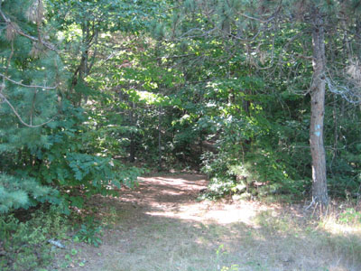
The trailhead to Burnt Meadow Mountain on Route 160
Looking east toward Sebago Lake from the Burnt Meadow Mountain summit

Directions to trailhead: Take 160 South from Brownfield. Shortly after passing the pond, just after a curve, there will be a small dirt parking lot on the right. The trailhead is to the right of this, marked with a light blue blaze.
Back to Burnt Meadow Mountain Profile
|