Home
States
Colorado
Connecticut
Maine
Massachusetts
New Hampshire
New York
Rhode Island
Utah
Vermont
View All
Lists
NE 4,000 Footers
NE 100 Highest
NH 4,000 Footers
NH 100 Highest
NH 52 With A View
NH Belknap Range
NH Ossipee 10
Links
Trail Conditions
Trip Log
Sunrises
Sunsets
About
|
Champlain Mountain
Bar Harbor, ME
Trailheads, measurements, times, distances, and maps are all approximate and relative to the hike(s) as shown below.
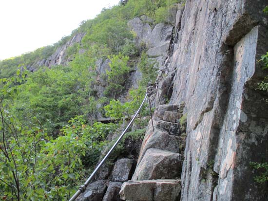
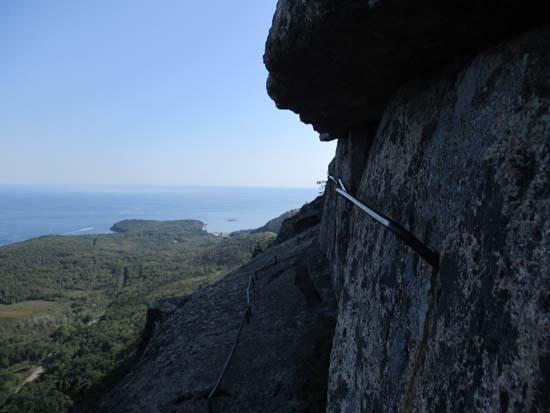
The Precipice Trail
Route: Precipice Trail, Champlain North Ridge Trail, Orange and Black Trail
First time on this trail for me (had been closed due to falcons during spring visits). Lives up to its reputation. Harder than any official White Mountain trail in my opinion.
Some scrambles were particularly tricky due to wet ledge, especially below the Orange and Black junction.
| Hike Ratings |
|
Getting To Trailhead: |
Easy |
| Destination: |
Champlain Mountain |
|
Length: |
Moderate |
|
Steepness: |
Very Difficult |
|
Navigation: |
Easy |
|
Views: |
Excellent |
|
Crowds: |
Moderate |
|
| Hike Stats |
|
Date Hiked: |
Wednesday, September 16, 2015 |
| Parking Elevation: |
110' |
| Destination: |
Champlain Mountain |
| Time Elapsed: |
00:50 |
| Trailhead Elevation: |
110' |
| Summit Elevation: |
1,058' |
| Vertical Gain: |
968' |
|
|
| Hike Time Elapsed: |
01:45 |
| Hike Vertical Gain: |
1,068' |
|
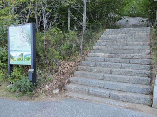
The Precipice Trail trailhead on Park Loop Road
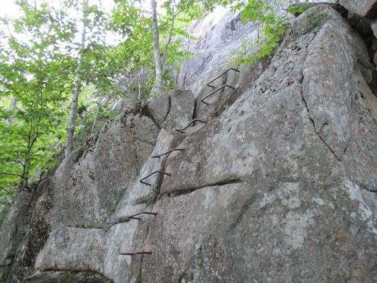
The Precipice Trail
The Precipice Trail

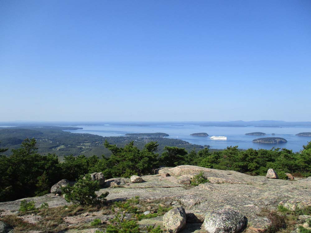
Looking at Bar Harbor from Champlain Mountain
Directions to trailhead: Take Park Loop Road toward Sand Beach. The Precipice Trail parking area and trailhead will be on the right, prior to reaching the tollbooth. The Precipice Trail generally closed spring through mid summer due to falcons nesting.
Back to Champlain Mountain Profile
|