Home
States
Colorado
Connecticut
Maine
Massachusetts
New Hampshire
New York
Rhode Island
Utah
Vermont
View All
Lists
NE 4,000 Footers
NE 100 Highest
NH 4,000 Footers
NH 100 Highest
NH 52 With A View
NH Belknap Range
NH Ossipee 10
Links
Trail Conditions
Trip Log
Sunrises
Sunsets
About
|
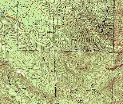
Goose Eye Mountain, ME, Mt. Carlo, ME
Success, NH, Riley, ME
Trailheads, measurements, times, distances, and maps are all approximate and relative to the hike(s) as shown below.
Looking up the Goose Eye Trail
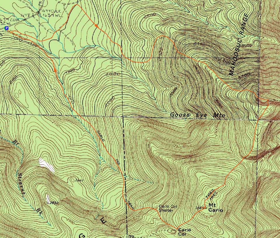
Route: Goose Eye Trail, (Goose Eye Mountain), Goose Eye Trail, Mahoosuc Trail, (Mt. Carlo), Mahoosuc Trail, Carlo Col Trail
With a beautiful fall day, I decided to head up and do only my third Mahoosuc Range hike (after Old Speck and Mt. Hayes). After glancing at Google Maps and the AMC map, I figured Success Pond Road would be easy enough to find. Wrong! While I took the proper road off Route 16 (Route 16 truck route), I couldn't seem to find a Success Pond Road sign. The AMC map, of course, had next to nothing labelled streetwise. Finally, after driving up multiple dead end roads, I decided to head down an unamed road with an 'OHRV' sign. Sure enough, I saw a Success Pond Road sign a few minutes down this.
About halfway to the trailhead, I stopped and observed a bull moose loitering around a logging landing. Continuing down the washboard road, I eventually saw the Goose Eye Trail trailhead sign on the right - with all of the random logging roads, it would have been difficult to locate this without a sign.
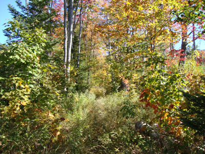
After a short walk up a logging road, the trail dropped into the woods, jogging alongside some other logging cuts. While perhaps unsightly at other times of the year, I found the area quite nice with the fall foliage. Emptying out onto another logging road, I went left, followed the road for a bit, then took a right back into the woods (signs, fortunately).
The trail continued to be fairly gradual - and seldom used. The ascent started awhile later, passing by the state border marker. It was still fairly moderate for awhile, prior to nearing treeline. At that point, the trail ascended a series of steep ledges - this would not be a fun descent in wet weather!
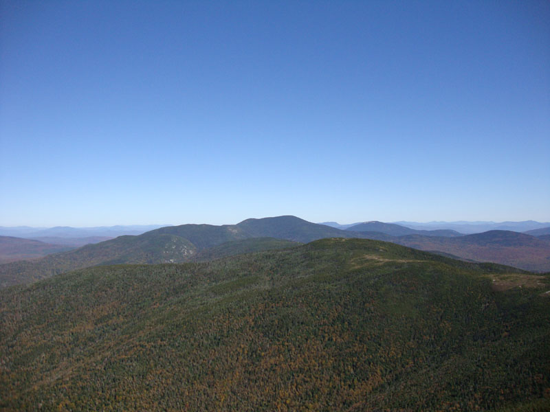
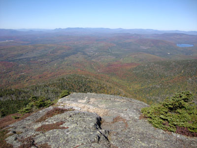
The views from the open summit were amazing - I was disappointed with myself for not visiting this peak sooner! After lingering for awhile, I decided to continue to Mt. Carlo.
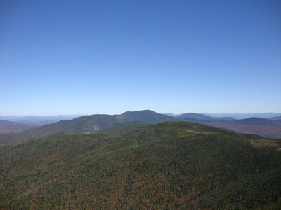
The initial descent off Goose Eye was quite steep, with a ladder and some scramble ledges. Below that initial descent was a nice little alpine zone walk.
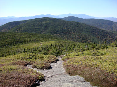
Reaching the col, the trail picked up steeply again for awhile, eventually going over a few false summits and ending up at the ledgy highpoint of Mt. Carlo. While there were descent views from the highpoint, the surrounding tree growth was encroaching a bit. Not satisfied with the view, I followed a herd path southwest for a few hundred feet to a beautiful view ledge, where I decided to have lunch.
Descending on the Carlo Col trail, I stopped by the shelter briefly - not a bad place. Back on the trail, I was cussing the poor footing - for a few tenths of a mile, the trail was essentially a brook bed. Finally departing from the brook, things improved a bit.
Awhile later, I ended up in a large logging cut. The trail cut through this at an angle, then, once passing a few remaining trees, it turned and went straight down the fall line to a logging road.
From here, the trail followed the road for awhile before dropping into the woods in some muddy terrain. The trail then eventually reached another logging road, which merged from the right to twice (if I recall correcting) to the main logging road at the trailhead - up to this point, I hadn't seen anyone the entire hike.
While both peaks were nice, I'm not sure if I'll bother to do the latter part of this loop again, due to the footing on the Carlo Trail and the maze of logging roads at the end of it.
| Hike Ratings |
|
Getting To Trailhead: |
Moderate |
| Destination: |
Goose Eye Mountain |
|
Length: |
Moderate |
|
Steepness: |
Very Difficult |
|
Navigation: |
Moderate |
|
Views: |
Excellent |
|
Crowds: |
Minimal |
| Destination: |
Mt. Carlo |
|
Length: |
Moderate |
|
Steepness: |
Very Difficult |
|
Navigation: |
Easy |
|
Views: |
Excellent |
|
Crowds: |
Minimal |
|
| Hike Stats |
|
Date Hiked: |
Saturday, September 26, 2009 |
| Hike Commenced: |
9:34 AM |
| Parking Elevation: |
1,630' |
| Destination: |
Goose Eye Mountain |
| Ascent Commenced: |
9:34 AM |
| Summit Reached: |
11:13 AM |
| Time Elapsed: |
01:39 |
| Trailhead Elevation: |
1,630' |
| Summit Elevation: |
3,870' |
| Distance: |
3.1 miles |
| Vertical Gain: |
2,300' |
| Destination: |
Mt. Carlo |
| Ascent Commenced: |
11:24 AM |
| Summit Reached: |
12:28 PM |
| Time Elapsed: |
01:04 |
| Trailhead Elevation: |
3,870' |
| Summit Elevation: |
3,565' |
| Distance: |
1.5 miles |
| Vertical Gain: |
515' |
|
|
| Hike Ended: |
2:14 PM |
| Hike Time Elapsed: |
4:40 |
| Hike Vertical Gain: |
2,875' |
|
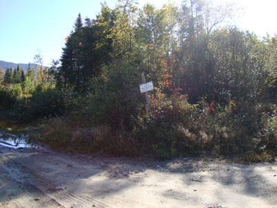
The Goose Eye Trail trailhead
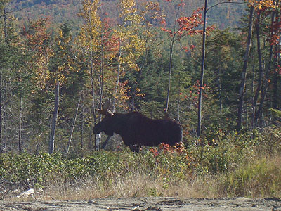
A bull moose near Success Pond Road
Looking down the Goose Eye Trail
Looking at Old Speck from Goose Eye Mountain
The Mahoosuc Trail between Goose Eye and Carlo
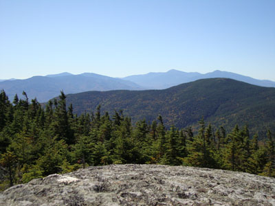
Looking at the Carters and Presidentials from near the summit of Mt. Carlo

Directions to trailhead: Take Route 16 North from Gorham, NH. Take a right onto Route 16 Truck Route. Take a right onto a road with a brown OHRV sign (Success Pond Road, no sign Sept. 2009). Head up this dirt road for some time, passing Alder Brook Road on the left. A few minutes thereafter, the Goose Eye Trail trailhead will be on the right (a logging road). There is some room to park along the beginning of the trail/logging road.
Back to Goose Eye Mountain Profile
Back to Mt. Carlo Profile
|