Home
States
Colorado
Connecticut
Maine
Massachusetts
New Hampshire
New York
Rhode Island
Utah
Vermont
View All
Lists
NE 4,000 Footers
NE 100 Highest
NH 4,000 Footers
NH 100 Highest
NH 52 With A View
NH Belknap Range
NH Ossipee 10
Links
Trail Conditions
Trip Log
Sunrises
Sunsets
About
|
Goose Eye Mountain
Riley, ME
Trailheads, measurements, times, distances, and maps are all approximate and relative to the hike(s) as shown below.
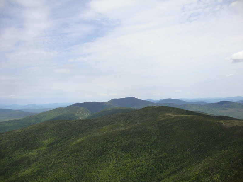
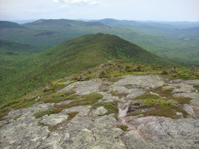
Looking down the Mahoosuc Trail at Goose Eye Mountain
Route: Wright Trail, Mahoosuc Trail, Goose Eye Trail, (Goose Eye Mountain), Goose Eye Trail, Mahoosuc Trail, Wright Trail
In effort to avoid holiday crowds and possible latter day thunderstorms, we decided to take the Wright Trail up to Goose Eye Mountain.
After parking around the corner from the trailhead, we started up the Wright Trail (a bit confusing at the trailhead, as there were blue blazes leading in two directions - left went alongside the brook and right followed a logging road, both converging later on), eventually reaching the camp site area and trail split.
While there was a sign saying the north branch was closed and dangerous, we opted to check it out anyway. Sure enough, we encountered no issues - though rough, the trail was in good shape. The smooth ledge water crossings, though, could be quite dangerous in wet or icy conditions - and there could be some potential avalanche danger in winter/early spring.
Reaching the Mahoosuc Trail, we had superb views in the vast alpine stretches. As such, we took a break on the east peak of Goose Eye, following a herd path to a nice ledge view of the Goose Eye Brook valley.
While things were clouding up by the time we reached the Goose Eye summit, we still had excellent views in all directions. In addition, there were barely any bugs - a nice departure from the New Hampshire White Mountains at the moment.
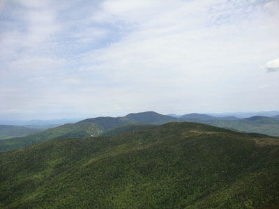
For the descent, we took the south branch of the Wright Trail. While lacking the potentially dangerous water crossings, there were nonetheless a few scrambles and open ledge descents. Nonetheless, it was an amazingly scenic section of trail - frankly, this whole loop seemed like it could be in the Franconia Ridge or Presidentials (except without the crowds of course).
Back on the lower section of the Wright Trail, we took a left onto a brookside branch of the trail (no signs, but blazed the same color), which ran alongside and on the ledge brookbed - it was amazing to see a smooth, continuous ledge down this extended brook bed with neat little gorges and pools carved into it.
Despite being a holiday weekend, we bumped into less than half a dozen people - amazing!
| Hike Ratings |
|
Getting To Trailhead: |
Easy |
| Destination: |
Goose Eye Mountain |
|
Length: |
Moderate |
|
Steepness: |
Difficult |
|
Navigation: |
Easy |
|
Views: |
Excellent |
|
Crowds: |
Minimal |
|
| Hike Stats |
|
Date Hiked: |
Saturday, May 29, 2010 |
| Hike Commenced: |
8:15 AM |
| Parking Elevation: |
1,250' |
| Destination: |
Goose Eye Mountain |
| Ascent Commenced: |
8:17 AM |
| Summit Reached: |
11:13 AM |
| Time Elapsed: |
02:56 |
| Trailhead Elevation: |
1,242' |
| Summit Elevation: |
3,870' |
| Distance: |
4.7 miles |
| Vertical Gain: |
2,878' |
|
|
| Hike Ended: |
2:31 PM |
| Hike Time Elapsed: |
06:16 |
| Hike Vertical Gain: |
3,071' |
|
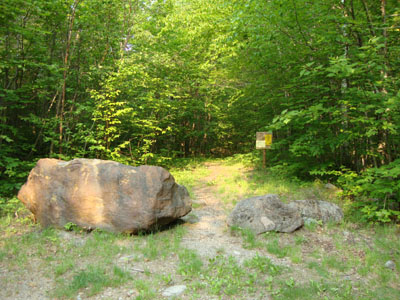
The Wright Trail trailhead
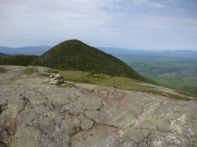
Looking toward Pleasant Mountain (left) from the southern ledges of Albany Mountain
Looking down the south branch of the Wright Trail
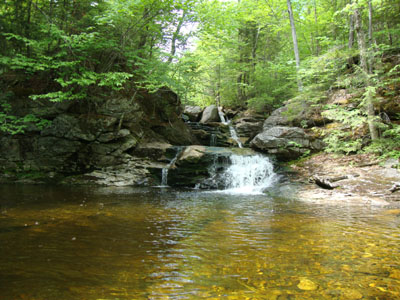
A nice pool near the Goose Eye Brook branch of the lower Wright Trail

Directions to trailhead: From US 2 east of Bethel, take a left onto the Sunday River access road. Bear right after 2.2 miles and 1.1 miles later (signs for a covered bridge). The road will eventually become a dirt road. 4 miles after passing the covered bridge, take a left onto a road with two one-lane steel bridges, then take an immediate right (Bull Branch Road). The Wright Trail will eventually be on the left (boulders in front of it), with a small dirt parking area (roadside) just past it on the right.
Back to Goose Eye Mountain Profile
|