Home
States
Colorado
Connecticut
Maine
Massachusetts
New Hampshire
New York
Rhode Island
Utah
Vermont
View All
Lists
NE 4,000 Footers
NE 100 Highest
NH 4,000 Footers
NH 100 Highest
NH 52 With A View
NH Belknap Range
NH Ossipee 10
Links
Trail Conditions
Trip Log
Sunrises
Sunsets
About
|
Little Deer Hill, Deer Hill
Chatham, NH, Stow, ME
Trailheads, measurements, times, distances, and maps are all approximate and relative to the hike(s) as shown below.
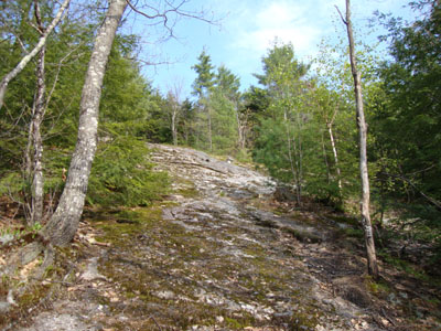
Looking up the Deer Hills Trail
Route: Deer Hill Connector, Deer Hills Trail, (Little Deer Hill), Deer Hills Trail, (Deer Hill), Deer Hills Trail, Deer Hill Bypass, Deer Hill Connector
With small, strong storm cells passing through the region, I opted to stay low once again. While my original intent was to check out Lord Hill, Deer Hill Road was closed.
Starting from the Baldface Circle parking area, I soon reached the Cold River dam crossing, where I had been turned back a few years early. The water level today was low enough to allow for crossing on the concrete steps. Beyond the dam, I headed up the Deer Hills Trail, which went from a woods walk to a quasi-ledge walk up high.
The views of the Baldfaces from Little Deer Hill were excellent. While it was tempting to hang out at the summit ledge for awhile, I opted to continue to Deer Hill. The trail dropped somewhat steeply off Little Deer Hill, before becoming a bit more tame as it worked its way to Deer Hill.
After crossing over the ledgy summit, I headed down to the near-summit view ledge, where I took in the views of the nearby lakes and mountains. While the black flies were out, they weren't yet biting at this elevation.
For the descent, I opted to try the Deer Hill Bypass. While decent at first, the route became a bit vexing in the col (a blowdown covered brook crossing) and below (somewhat steep, wet, and slippery ledges). Nonetheless, I soon arrived back at the rivers edge, for a fairly flat climb back to the dam.
Despite the nearby rain storms, I was able to spend pretty much the entire hike under blue skies.
| Hike Ratings |
|
Getting To Trailhead: |
Easy |
| Destination: |
Little Deer Hill |
|
Length: |
Moderate |
|
Steepness: |
Moderate |
|
Navigation: |
Easy |
|
Views: |
Excellent |
|
Crowds: |
Minimal |
| Destination: |
Deer Hill |
|
Length: |
Moderate |
|
Steepness: |
Difficult |
|
Navigation: |
Easy |
|
Views: |
Excellent |
|
Crowds: |
Minimal |
|
| Hike Stats |
|
Date Hiked: |
Thursday, April 22, 2010 |
| Hike Commenced: |
4:08 PM |
| Parking Elevation: |
519' |
| Destination: |
Little Deer Hill |
| Ascent Commenced: |
4:08 PM |
| Summit Reached: |
4:34 PM |
| Time Elapsed: |
00:26 |
| Trailhead Elevation: |
519' |
| Summit Elevation: |
1,090' |
| Distance: |
1.3 miles |
| Vertical Gain: |
631' |
| Destination: |
Deer Hill |
| Ascent Commenced: |
4:36 PM |
| Summit Reached: |
4:54 PM |
| Time Elapsed: |
00:18 |
| Trailhead Elevation: |
1,009' |
| Summit Elevation: |
1,367' |
| Distance: |
0.7 mile |
| Vertical Gain: |
462' |
|
|
| Hike Ended: |
5:51 PM |
| Hike Time Elapsed: |
01:43 |
| Hike Distance: |
4.3 miles |
| Hike Vertical Gain: |
1,208' |
|
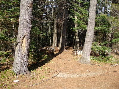
The Deer Hill Connector trailhead at the Baldface Circle parking area
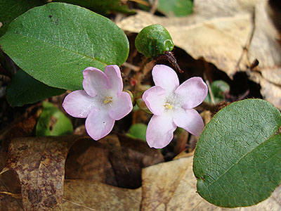
Trailing Arbutus along the Deer Hills Trail
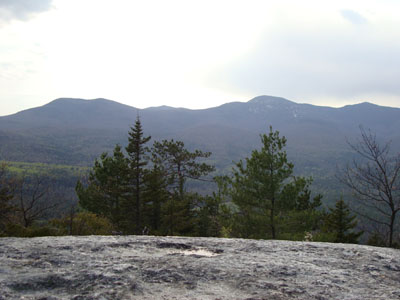
Eastman Mountain, South Baldface, and North Baldface as seen from Little Deer Hill
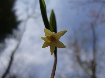
Bellwort along the Deer Hills Trail
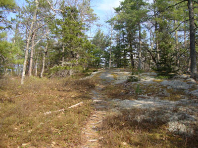
Looking up the Deer Hills Trail near Deer Hill
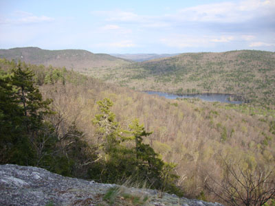
Looking at Stiles Mountain and Harndon Hill from the Deer Hill view ledge
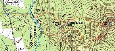

Directions to trailhead: Take Route 113 North from Fryeburg. Shortly after passing the AMC Cold River Camp entrance, the Baldface Circle WMNF fee parking area will be on the right. The Deer Hill connector trailhead is on the east side of the lot.
Back to Little Deer Hill Profile
Back to Deer Hill Profile
|