Home
States
Colorado
Connecticut
Maine
Massachusetts
New Hampshire
New York
Rhode Island
Utah
Vermont
View All
Lists
NE 4,000 Footers
NE 100 Highest
NH 4,000 Footers
NH 100 Highest
NH 52 With A View
NH Belknap Range
NH Ossipee 10
Links
Trail Conditions
Trip Log
Sunrises
Sunsets
About
|
Mt. Blue
Weld, ME, Avon, ME
Trailheads, measurements, times, distances, and maps are all approximate and relative to the hike(s) as shown below.
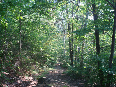
Looking down the Mt. Blue Trail
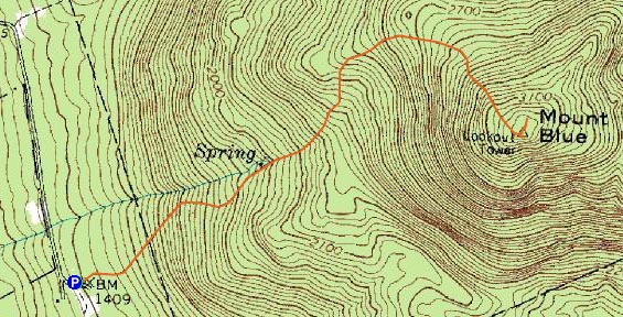
Route: Mt. Blue Trail
After hiking Mt. Abraham, I decided to give Mt. Blue a try on my way back. Mt. Blue had always caught my eye when visible from various vistas I had visited.
Arriving at a nearly empty trailhead parking area, I quickly set foot up the Mt. Blue Trail. The first part of the trail was basically an old road with decent footing and moderate grades. Soon, things became a bit more gradual. Having not consulted with the map before this random excursion, I simply checked my hike time and thought I was very close to the summit. Unfortunately, I had misread my starting time and was actually still a good half mile away - and a rather steep, rocky half mile at that. Realizing my miscalculation soon thereafter, I quickly hit a wall in terms of energy - I hadn't had a particularly big breakfast or lunch, and had done mucho driving and hiking already. While my body wasn't sore, I was definitely feeling tired. Nonetheless, I was able to make it to the summit.
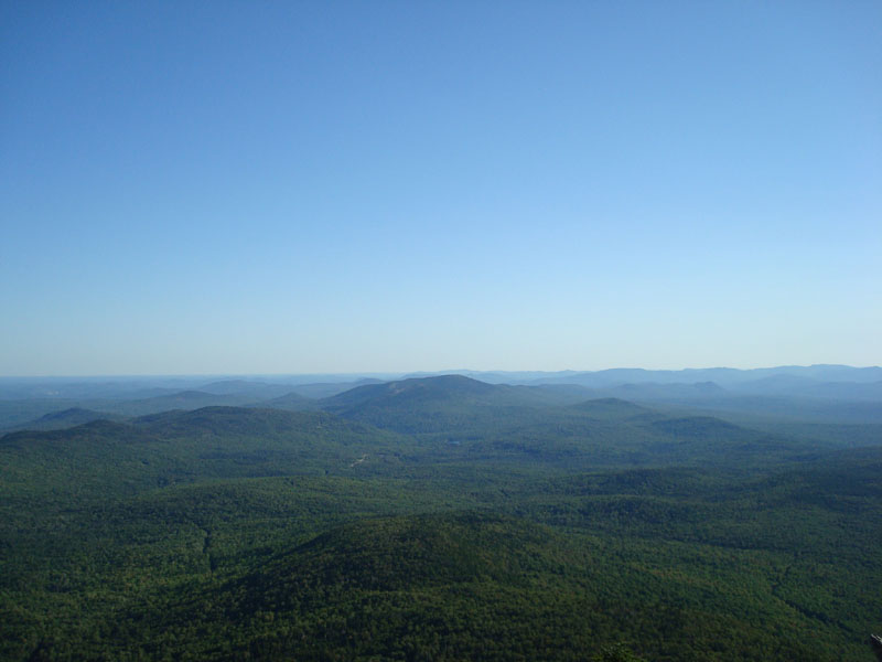
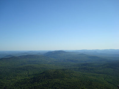
Though the views were a bit hazy late on this somewhat warm day, they were nonetheless excellent from the four different vistas I checked out. My favorite viewpoint was the ledges below the frame of the old firetower.
With more hiking and a bunch more driving yet to come, I decided to take a break at the vista overlooking Lake Webb and load up on a bunch of snacks. While I only took a few minutes, the food made quite a difference - I had my (limited) agility back and was able to make it back to the parking lot without any issues.
A nice hike and peak - perhaps I will be back someday to spend more time at the firetower ledge viewpoint.
| Hike Ratings |
|
Getting To Trailhead: |
Easy |
| Destination: |
Mt. Blue |
|
Length: |
Moderate |
|
Steepness: |
Difficult |
|
Navigation: |
Easy |
|
Views: |
Excellent |
|
Crowds: |
Minimal |
|
| Hike Stats |
|
Date Hiked: |
Monday, September 1, 2008 |
| Hike Commenced: |
4:16 PM |
| Parking Elevation: |
1,400' |
| Destination: |
Mt. Blue |
| Ascent Commenced: |
4:16 PM |
| Summit Reached: |
5:01 PM |
| Time Elapsed: |
00:45 |
| Trailhead Elevation: |
1,400' |
| Summit Elevation: |
3,187' |
| Distance: |
1.6 miles |
| Vertical Gain: |
1,792' |
|
|
| Hike Ended: |
6:01 PM |
| Hike Time Elapsed: |
01:45 |
| Hike Distance: |
3.2 miles |
| Hike Vertical Gain: |
1,847' |
|
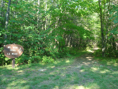
The Mt. Blue Trail trailhead
Looking south from the Mt. Blue summit
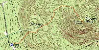

Directions to trailhead: From the Routes 142 and 156 junction in Weld, take Center Hill Road to Mt. Blue Road. The Mt. Blue Trail trailhead and parking area are located at the end of that road.
Back to Mt. Blue Profile
|