Home
States
Colorado
Connecticut
Maine
Massachusetts
New Hampshire
New York
Rhode Island
Utah
Vermont
View All
Lists
NE 4,000 Footers
NE 100 Highest
NH 4,000 Footers
NH 100 Highest
NH 52 With A View
NH Belknap Range
NH Ossipee 10
Links
Trail Conditions
Trip Log
Sunrises
Sunsets
About
|
Mt. Tom
Fryeburg, ME
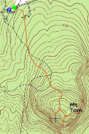
Trailheads, measurements, times, distances, and maps are all approximate and relative to the hike(s) as shown below.
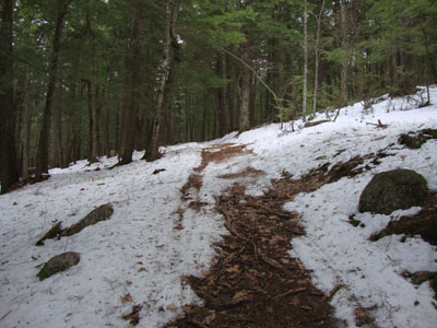
Looking up the Mt. Tom Trail
Route: Mt. Tom Trail, (Mt. Tom), bushwhack, Mt. Tom Trail
Having seen Mt. Tom from US 302 many times, I finally made the time to go check it out. After parking next to the cemetary, I walked a few hundred feet up the road, put on my snowshoes, and ascended the Mt. Tom Trail.
The first part of the trail weaved around some fields, eventually reaching a plowed road. The plowed section ended after a hundred or so feet. From there, it was essentially a walk up a generally gradual woods road (packed by snowmobiles), all the way to the summit (taking a left at a fork at one point - the right went downhill, so it was fairly obvious to go uphill via the left branch). While the first portion of the walk was through fields and old logging cuts, the upper portion was in a nicely wooded conservation plot.
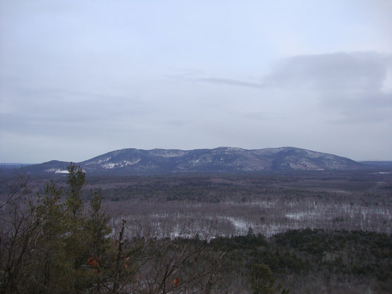
Reaching the summit, there were some directional views a little beyond the highpoint. Since I wanted to check out the massive cliffs, I took off my snowshoes and did two light bushwhacks (there was literally no snow on the southern facing slopes). The southern cliff featured nice 180 degree views, while the western cliff featured wide views that would likely be great for a sunset.
Back on the trail, I opted to leave my snowshoes on my pack and descend in my boots.
| Hike Ratings |
|
Getting To Trailhead: |
Easy |
| Destination: |
Mt. Tom |
|
Length: |
Easy |
|
Steepness: |
Easy |
|
Navigation: |
Easy |
|
Views: |
Excellent |
|
Crowds: |
Minimal |
|
| Hike Stats |
|
Date Hiked: |
Wednesday, February 3, 2010 |
| Hike Commenced: |
3:41 PM |
| Parking Elevation: |
480' |
| Destination: |
Mt. Tom |
| Ascent Commenced: |
3:45 PM |
| Summit Reached: |
4:11 PM |
| Time Elapsed: |
00:26 |
| Trailhead Elevation: |
495' |
| Summit Elevation: |
1,073' |
| Vertical Gain: |
578' |
|
|
| Hike Ended: |
5:06 PM |
| Hike Time Elapsed: |
01:25 |
| Hike Vertical Gain: |
798' |
|
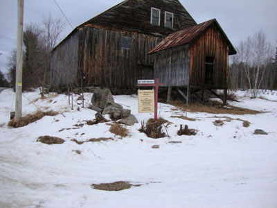
Mt. Tom Trail trailhead

Pleasant Mountain as seen from Mt. Tom

Directions to trailhead: Take US Route 302 East from Fryeburg. Take a left onto Menotomy Road. Proceed up this road for a few minutes, past a 'Dead End' sign. The Menotomy Road Cemetery will eventually be on the right - there is room to park on the side of the road near this. From there, continue on foot up Menotomy Road. The Mt. Tom Trail starts on the right, just before reaching a barn.
Back to Mt. Tom Profile
|