Home
States
Colorado
Connecticut
Maine
Massachusetts
New Hampshire
New York
Rhode Island
Utah
Vermont
View All
Lists
NE 4,000 Footers
NE 100 Highest
NH 4,000 Footers
NH 100 Highest
NH 52 With A View
NH Belknap Range
NH Ossipee 10
Links
Trail Conditions
Trip Log
Sunrises
Sunsets
About
|
Observatory Mountain
Lincoln Plantation, ME
Trailheads, measurements, times, distances, and maps are all approximate and relative to the hike(s) as shown below.
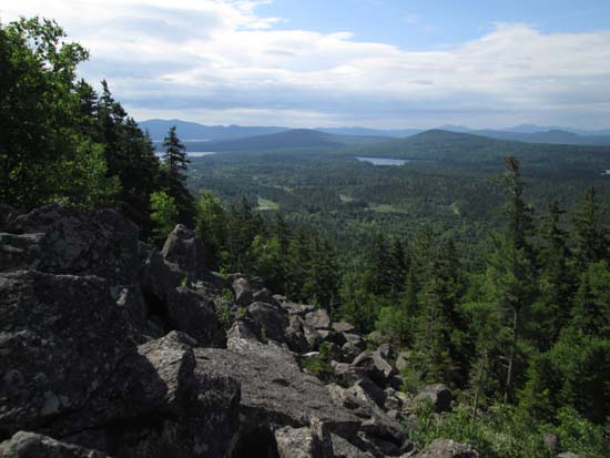
Looking across a scree field on the way up Observatory
Route: Bushwhack, herd path
For the ascent, we bushwhacked directly up from Route 16 in scrappy woods with poor footing up to the scree field. Above there, we were constantly getting cliffed out, eventually finding a way on the east to clear the ridge.
Up on the ridge, we found a very old red blazed trail that eventually connected us with a spectacular near summit view ledge over looking Aziscohos Lake, Low Aziscohos Mountain, and the White Mountains. Lots of blueberries, but not yet blue. The highpoint (some vague herd paths leading to it from the red blazed trail) had a very old container on it that had a hole in it and no logbook.
For the descent, we attempted to follow the old trail, but lost it after about a quarter of a mile, heading southeast from the summit. From there, we eventually hopped on a boundary cut (blue blazes and tape), that was rugged, but not nearly as steep/cliffy as the ascent. Nonetheless, the footing was somewhat poor and there were pockets of blowdown and spruce. We eventually popped out on Route 16 about a quarter of a mile southeast of the pulloff, opting to make better time roadwalking then trying to cut across the contour in the poor footing.
The viewpoints are rather nice, and I suspect it may be easier to bushwhack in from the logging roads to the northeast.
| Hike Ratings |
|
Getting To Trailhead: |
Easy |
| Destination: |
Observatory Mountain |
|
Length: |
Moderate |
|
Steepness: |
Very Difficult |
|
Navigation: |
Difficult |
|
Views: |
Excellent |
|
Crowds: |
Minimal |
|
| Hike Stats |
|
Date Hiked: |
Sunday, July 6, 2014 |
| Parking Elevation: |
1,540' |
| Destination: |
Observatory Mountain |
| Time Elapsed: |
01:23 |
| Trailhead Elevation: |
1,540' |
| Summit Elevation: |
2,530' |
| Vertical Gain: |
1,000' |
|
|
| Hike Time Elapsed: |
03:08 |
| Hike Vertical Gain: |
1,050' |
|
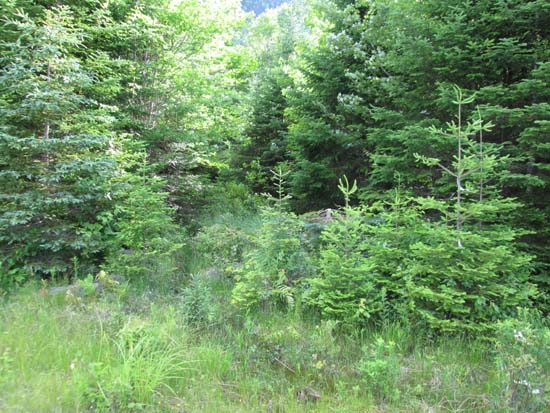
Entering the woods from the pullover on Route 16
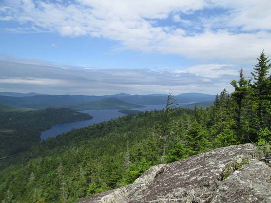
Looking northwest over Aziscohos Lake from near the summit of Observatory Mountain
Directions to trailhead: Observatory Mountain is located north of Route 16, east of the New Hampshire border.
Back to Observatory Mountain Profile
|

