Home
States
Colorado
Connecticut
Maine
Massachusetts
New Hampshire
New York
Rhode Island
Utah
Vermont
View All
Lists
NE 4,000 Footers
NE 100 Highest
NH 4,000 Footers
NH 100 Highest
NH 52 With A View
NH Belknap Range
NH Ossipee 10
Links
Trail Conditions
Trip Log
Sunrises
Sunsets
About
|
Old Speck Mountain
Grafton, ME
Trailheads, measurements, times, distances, and maps are all approximate and relative to the hike(s) as shown below.
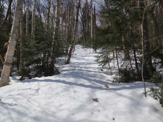
The abandoned Firewardens Trail
Route: Firewardens Trail, bushwhack, Old Speck Trail, (Old Speck Mountain), Old Speck Trail
Ascended via abandoned Firewarden's Trail...walked down Route 26 to an old roadbed (blowdown obscuring it), which leads direct to the snowmobile trail. Just to the right, there's an old outhouse. The trail is sort of behind that, but is vague at first. Once you get up the initial 50 or so vertical feet, it becomes increasingly obvious. Consistent snowpack started at this point, so we donned snowshoes. We saw quite a bit of evidence of downhill skiers using this trail at some point this winter/spring.
The trail corridor was pretty obvious all the way up to the site of the firewarden's cabin (flat spot, but didn't see any remains). Lots of old AT blazes still visible, probably more so than the current AT.
We dropped down and crossed the brook (snow bridge) and followed the blazes up the next steeps, taking the sharp right turn as described in old guidebooks. We had it for awhile after this, but then lost it in open woods. Snowpack was probably 3-4 feet at this point.
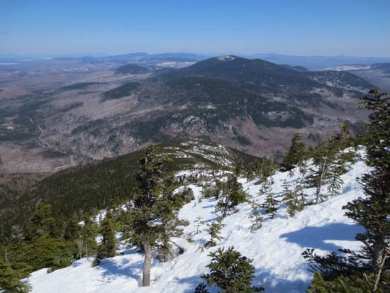
We continued up in mostly open woods until we hit scrub/snowfields, which could warrant crampons and an ice axe in less than favorable conditions. Superb views.
A little thick above these, but we eventually walked into the current trail just shy of the summit. The snowpack is still quite deep up here, with blazes a few inches to a few feet above it.
The Old Speck Trail on descent was generally monorail that was supporting snowshoes and to some extent booters. Any warmer and posthole city will grow. Consistent snowpack goes all the way down to the snowmobile trail crossing (near where we took off our snowshoes).
| Hike Ratings |
|
Getting To Trailhead: |
Difficult |
| Destination: |
Old Speck Mountain |
|
Length: |
Moderate |
|
Steepness: |
Very Difficult |
|
Navigation: |
Very Difficult |
|
Views: |
Excellent |
|
Crowds: |
Minimal |
|
| Hike Stats |
|
Date Hiked: |
Sunday, April 21, 2013 |
| Parking Elevation: |
1,496' |
| Destination: |
Old Speck Mountain |
| Time Elapsed: |
03:08 |
| Trailhead Elevation: |
1,496' |
| Summit Elevation: |
4,180' |
| Vertical Gain: |
2,694' |
|
|
| Hike Time Elapsed: |
06:28 |
| Hike Vertical Gain: |
3,309' |
|
Leaving Route 26 just south of the Old Speck Trail parking lot
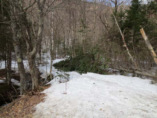
Headed through a patch of scrub adjacent to some ledges and the Firewardens Trail, near the summit of Old Speck
Looking at Goose Eye and Mahoosuc Notch from near the summit of Old Speck
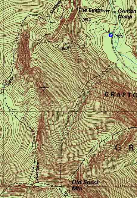

Directions to trailhead: Take US 2 East to Route 26 North into Grafton Notch. The hiker parking area is just below The Eyebrow. The Appalachian Trail departs southbound, diagonally left from the kiosk at the parking area.
Back to Old Speck Mountain Profile
|

