Home
States
Colorado
Connecticut
Maine
Massachusetts
New Hampshire
New York
Rhode Island
Utah
Vermont
View All
Lists
NE 4,000 Footers
NE 100 Highest
NH 4,000 Footers
NH 100 Highest
NH 52 With A View
NH Belknap Range
NH Ossipee 10
Links
Trail Conditions
Trip Log
Sunrises
Sunsets
About
|
Pine Hill, ME, Lord Hill, ME
Lovell, ME, Stow, ME, Stoneham, ME
Trailheads, measurements, times, distances, and maps are all approximate and relative to the hike(s) as shown below.
The Conant Trail
Route: Mine Road, Conant Trail, Mine Loop
Plan C, after turning the corner to see rain in Evans Notch. Rain eventually worked its way up here as well, resulting in wet feet on the grassy lower Mine Loop.
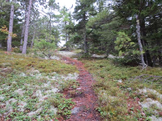
Conant Trail is flooded by beavers in the same place as it has been for a few years (the road portion west of Pine Hill). Saw a beaver swim across that portion of the road, in fact. No obvious way around the flooding without bushwhacking (flooding on both sides of the flooded road).
| Hike Ratings |
|
Getting To Trailhead: |
Moderate |
| Destination: |
Pine Hill |
|
Length: |
Moderate |
|
Steepness: |
Moderate |
|
Navigation: |
Moderate |
|
Views: |
Excellent |
|
Crowds: |
Minimal |
| Destination: |
Lord Hill |
|
Length: |
Moderate |
|
Steepness: |
Moderate |
|
Navigation: |
Moderate |
|
Views: |
Excellent |
|
Crowds: |
Minimal |
|
| Hike Stats |
|
Date Hiked: |
Wednesday, August 15, 2012 |
| Parking Elevation: |
680' |
| Destination: |
Pine Hill |
| Time Elapsed: |
00:20 |
| Trailhead Elevation: |
680' |
| Summit Elevation: |
1,250' |
| Vertical Gain: |
600' |
| Destination: |
Lord Hill |
| Time Elapsed: |
01:12 |
| Trailhead Elevation: |
1,250' |
| Summit Elevation: |
1,257' |
| Vertical Gain: |
1,167' |
|
|
| Hike Time Elapsed: |
01:58 |
| Hike Vertical Gain: |
1,807' |
|
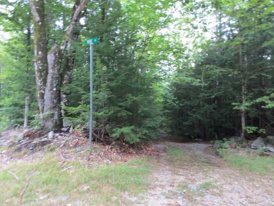
The start of the old road that connects with the Conant Trail
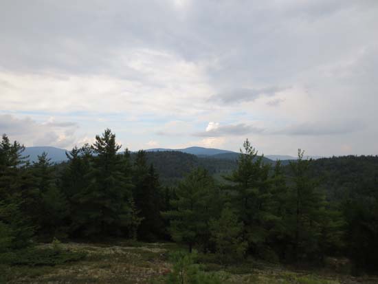
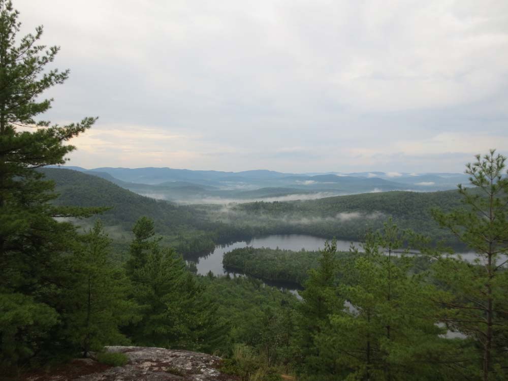
Looking toward Speckled Mountain from Pine Hill
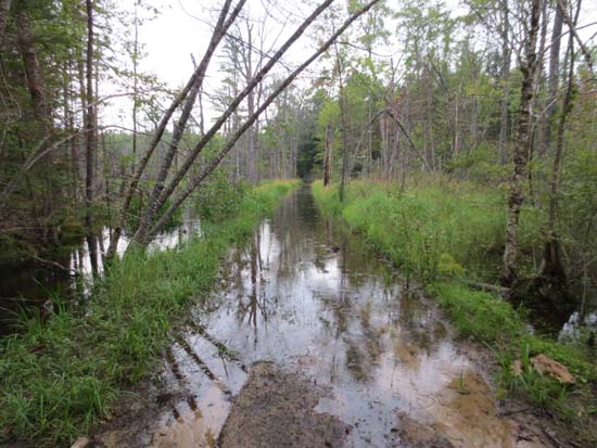
The flooded Conant Trail west of Pine Hill

Looking at Horseshoe Pond from Lord Hill
Directions to trailhead: From Route 113 in Stow, take New Road (Meadow Road) east, then take a right onto Union Hill Road (Butters Road). Eventually this leads to Foxboro Road (take a left). One should be able to drive past Lord Cemetery to a grassy area (with a left turn), where one can park and continue straight ahead, eventually reaching the Conant Trail between Pine Hill and Lord Hill.
Back to Pine Hill Profile
Back to Lord Hill Profile
|