Home
States
Colorado
Connecticut
Maine
Massachusetts
New Hampshire
New York
Rhode Island
Utah
Vermont
View All
Lists
NE 4,000 Footers
NE 100 Highest
NH 4,000 Footers
NH 100 Highest
NH 52 With A View
NH Belknap Range
NH Ossipee 10
Links
Trail Conditions
Trip Log
Sunrises
Sunsets
About
|
Pleasant Mountain
Denmark, ME
Trailheads, measurements, times, distances, and maps are all approximate and relative to the hike(s) as shown below.
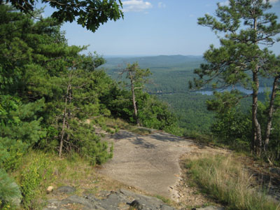
Looking down the Ledges Trail over Moose Pond
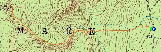
Route: Ledges Trail
Wanting to go out of state a bit, I decided to embark on a Maine hike after work. My previous hike on Pleasant Mountain was slushy/muddy/postholey, so I was determined to try it in more favorable conditions.
Not up for a particularly long hike, I decided to try the shortest ascent possible - the Ledges Trail.
After parking in the small roadside lot, I started up the rather gentle pitch. After maybe half a mile, things steepen up a bit - nothing too bad, however, as the trail as recently seen a decent amount of rerouting via new switchbacks.
After just over a mile, things get interesting, as the trail spends almost half a mile on the side of some very scenic ledges. Again, nothing more than moderate in pitch.
Shortly after the MacKay Pasture Trail junction, there are a few short, steep, ledgy areas that would not be much fun in wet conditions. Just after those is a decent size wild low bush blueberry field - peak season right now!
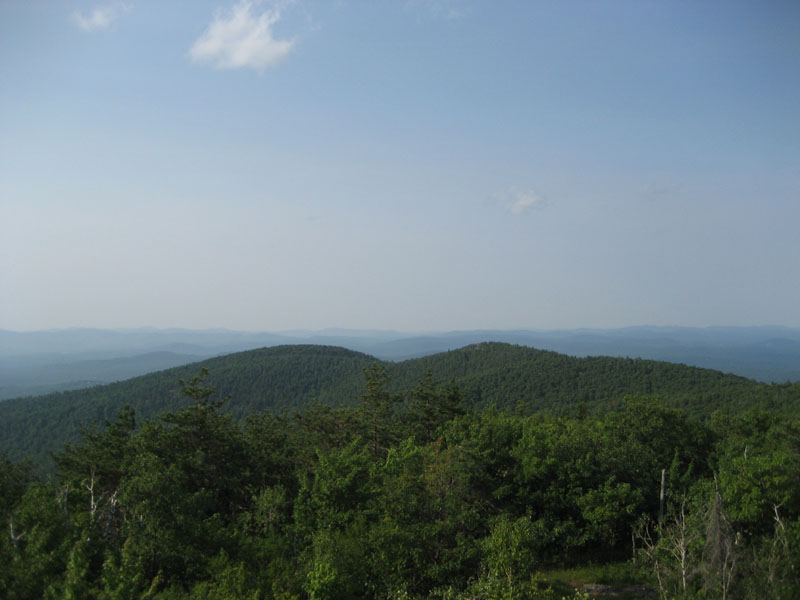
The views from the summit ledge were hazy - Mt. Washington was visible, but not as impressive as a few months earlier in more favorable temperatures. Climbing up the ladder of the abandoned fire tower, better views were available in all other directions.
The descent was slowed due to some blueberry picking. Good stuff.
| Hike Ratings |
|
Getting To Trailhead: |
Easy |
| Destination: |
Pleasant Mountain |
|
Length: |
Moderate |
|
Steepness: |
Difficult |
|
Navigation: |
Easy |
|
Views: |
Excellent |
|
Crowds: |
Minimal |
|
| Hike Stats |
|
Date Hiked: |
Wednesday, August 1, 2007 |
| Hike Commenced: |
4:18 PM |
| Parking Elevation: |
500' |
| Destination: |
Pleasant Mountain |
| Ascent Commenced: |
4:18 PM |
| Summit Reached: |
5:07 PM |
| Time Elapsed: |
00:49 |
| Trailhead Elevation: |
500' |
| Summit Elevation: |
2,006' |
| Distance: |
1.8 miles |
| Vertical Gain: |
1,526' |
|
|
| Hike Ended: |
6:11 PM |
| Hike Time Elapsed: |
01:53 |
| Hike Distance: |
3.6 miles |
| Hike Vertical Gain: |
1,546' |
|
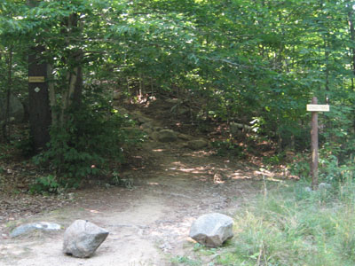
Ledges Trail trailhead
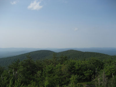
Looking north toward Shawnee Peak from the Pleasant Mountain fire tower ladder
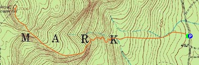

Directions to trailhead: From 302, take Mountain Road south past both base areas of Shawnee Peak Ski Area. About 2 miles after, the small parking area should be visible on the left side of the road. The Ledges Trail signs and trailhead are on the right side.
Back to Pleasant Mountain Profile
|