Home
States
Colorado
Connecticut
Maine
Massachusetts
New Hampshire
New York
Rhode Island
Utah
Vermont
View All
Lists
NE 4,000 Footers
NE 100 Highest
NH 4,000 Footers
NH 100 Highest
NH 52 With A View
NH Belknap Range
NH Ossipee 10
Links
Trail Conditions
Trip Log
Sunrises
Sunsets
About
|
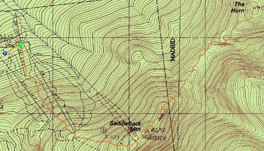
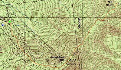
Saddleback Mountain, The Horn
Dallas, ME, Sandy River, ME, Madrid, ME
Trailheads, measurements, times, distances, and maps are all approximate and relative to the hike(s) as shown below.
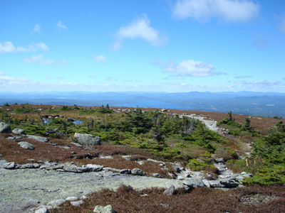
Looking down the connector trail from the Appalachain Trail to the ski area
Route: Grey Ghost ski trail, Tri Color ski trail, unnamed connector trail, Appalachian Trail, (Saddleback Mountain), Appalachian Trail, (The Horn)
Taking some comp time off from work, I decided to head up to Saddleback. Having never skied there before, I decided to ascend via the ski trails.
Starting off at the base lodge, I followed the access road up to the top of the small double chairlift, then up the race trail. This is considered the hiking trail and is marked by stakes and yellow blazes. I was amazed how much steeper the race trail at Berkshire East was having hiked it a few days earlier. Nonetheless, the ascent was still a bit of a workout.
After passing the top of the double chairlift and the top of the t-bar, I followed the cairns to the Appalachian Trail and to the summit. The views were excellent - looking into New Hampshire and at most of Maine's 4,000 footers.
Getting a bit chilly with the strong winds and 40-something degree temperatures, I put on my fleece and continued to the Horn. Though it looks very close from Saddleback's summit, it is still a good 1.75 miles away and involves a few up and downs.
Though not overly steep, there were still some scrambles involved. With much of the trail being in the open, there were views most of the way.
The views from the summit of the Horn were great - a closer, more direct view of the hoard of 4,000 footers. Again, due to the wind, I decided to not waste too much time and head back.
I took a little extra time to enjoy the views on the way back and also made a few stops to check out the top terminals of the lifts near the hiking route.
Overall, I think this is one of the more enjoyable 4,000 foot hikes I've done thus far - the ascent from the ski area is relatively brief and offers views, making just about the entire hike scenic.
| Hike Ratings |
|
Getting To Trailhead: |
Easy |
| Destination: |
Saddleback Mountain |
|
Length: |
Moderate |
|
Steepness: |
Difficult |
|
Navigation: |
Easy |
|
Views: |
Excellent |
|
Crowds: |
Minimal |
| Destination: |
Saddleback Mountain - The Horn |
|
Length: |
Moderate |
|
Steepness: |
Very Difficult |
|
Navigation: |
Easy |
|
Views: |
Excellent |
|
Crowds: |
Moderate |
|
| Hike Stats |
|
Date Hiked: |
Thursday, September 13, 2007 |
| Hike Commenced: |
9:40 AM |
| Parking Elevation: |
2,480' |
| Destination: |
Saddleback Mountain |
| Ascent Commenced: |
9:45 AM |
| Summit Reached: |
10:40 AM |
| Time Elapsed: |
00:55 |
| Trailhead Elevation: |
2,460' |
| Summit Elevation: |
4,116' |
| Vertical Gain: |
1,696' |
| Destination: |
Saddleback Mountain - The Horn |
| Ascent Commenced: |
10:42 AM |
| Summit Reached: |
11:31 AM |
| Time Elapsed: |
00:49 |
| Trailhead Elevation: |
4,116' |
| Summit Elevation: |
4,041' |
| Distance: |
1.7 miles |
| Vertical Gain: |
586' |
|
|
| Hike Ended: |
1:38 PM |
| Hike Time Elapsed: |
03:58 |
| Hike Vertical Gain: |
3,003' |
|
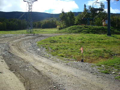
Looking up the hiking path near the base lodge of the ski area

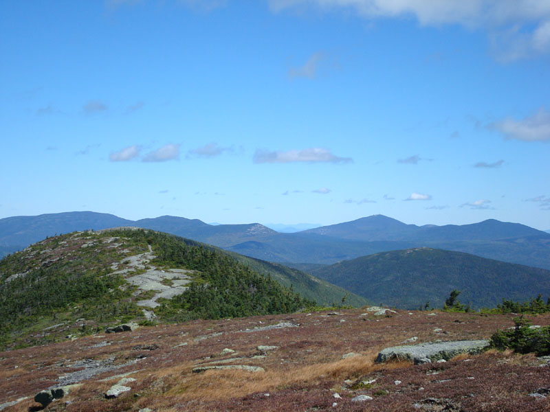
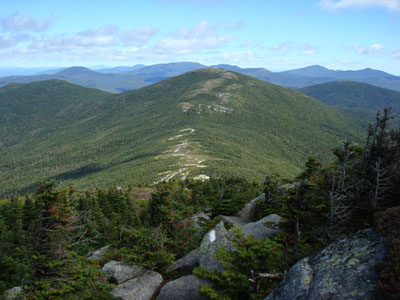
Looking northeast from the Saddleback Mountain summit at the Horn (just barely showing) and Sugarloaf Mountain, amongst others
The Appalachian Trail between Saddleback Mountain and the Horn

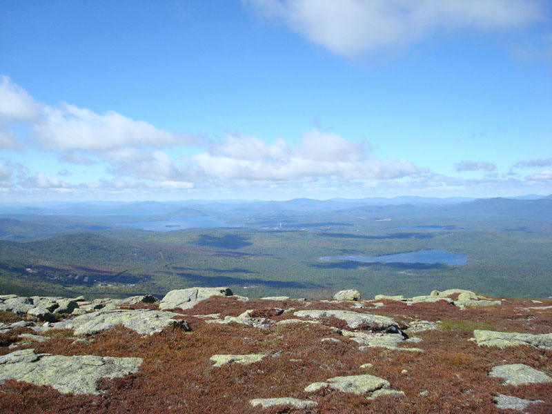
Looking west at Rangeley Lake from the Horn

Directions to trailhead: Take Route 16 North (East in Maine) to Rangeley, merging and continuing on Route 4 South. Take a left onto Dallas Hill Road, then a right onto the Saddleback Ski Area access road. Parking is available just above the Main Lodge. The hiking trail starts between the double chairlifts.
Back to Saddleback Mountain Profile
Back to Saddleback Mountain - The Horn Profile
|