Home
States
Colorado
Connecticut
Maine
Massachusetts
New Hampshire
New York
Rhode Island
Utah
Vermont
View All
Lists
NE 4,000 Footers
NE 100 Highest
NH 4,000 Footers
NH 100 Highest
NH 52 With A View
NH Belknap Range
NH Ossipee 10
Links
Trail Conditions
Trip Log
Sunrises
Sunsets
About
|
Saddleback Mountain, The Horn
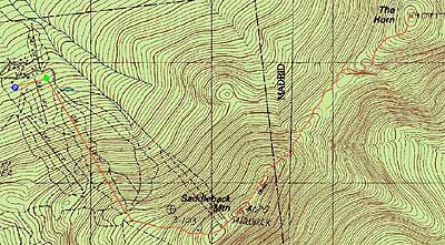
Dallas, ME, Sandy River, ME, Madrid, ME
Trailheads, measurements, times, distances, and maps are all approximate and relative to the hike(s) as shown below.

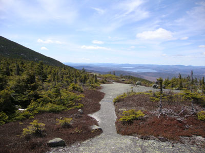
Looking down the connector trail from the Appalachain Trail to the ski area
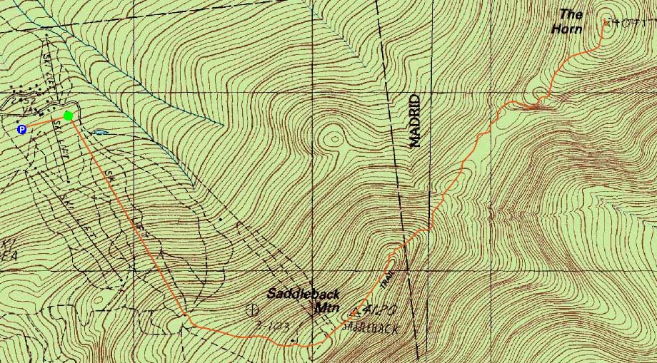
Route: Royal Coachman ski trail, Mickey Finn ski trail, Tri-Color ski trail, unnamed connector trail, Appalachian Trail, (Saddleback Mountain), Appalachian Trail, (The Horn)
With a poor forecast in New Hampshire, it seemed like a decent time to head up to the Rangeley. Departing in daylight, we still encountered six moose on Route 16 North of Gorham, two or three of them deciding to run across the road. Eventually arriving at the ski area, we opted to ascend the double chairlift liftline, as it was covered in top to bottom snow and would provide decent snowshoeing (rather than patchy snow and mud via other routes).
The weather was cloudy and windy as we climbed over Saddleback on bare ground. Dropping into the col, the snow was four to five feet deep in the sprucy areas. As we neared the Horn, the fog blew away, resulting in blue skies.
After a long lunch on the Horn while taking in panoramic views (with the Baxter State Park peaks visible in the distance), we worked our way back to Saddleback, where we once again took an extended view break.
We opted to descend the lift line, bootsliding most of the way down - a nice, fast descent.
| Hike Ratings |
|
Getting To Trailhead: |
Easy |
| Destination: |
Saddleback Mountain |
|
Length: |
Moderate |
|
Steepness: |
Very Difficult |
|
Navigation: |
Moderate |
|
Views: |
Excellent |
|
Crowds: |
Minimal |
| Destination: |
Saddleback Mountain - The Horn |
|
Length: |
Moderate |
|
Steepness: |
Very Difficult |
|
Navigation: |
Moderate |
|
Views: |
Excellent |
|
Crowds: |
Minimal |
|
| Hike Stats |
|
Date Hiked: |
Sunday, April 25, 2010 |
| Hike Commenced: |
9:42 AM |
| Parking Elevation: |
2,480' |
| Destination: |
Saddleback Mountain |
| Ascent Commenced: |
9:52 AM |
| Summit Reached: |
11:11 AM |
| Time Elapsed: |
00:55 |
| Trailhead Elevation: |
2,460' |
| Summit Elevation: |
4,116' |
| Vertical Gain: |
1,696' |
| Destination: |
Saddleback Mountain - The Horn |
| Ascent Commenced: |
11:13 AM |
| Summit Reached: |
12:35 PM |
| Time Elapsed: |
01:22 |
| Trailhead Elevation: |
4,116' |
| Summit Elevation: |
4,041' |
| Distance: |
1.7 miles |
| Vertical Gain: |
586' |
|
|
| Hike Ended: |
4:06 PM |
| Hike Time Elapsed: |
06:24 |
| Hike Vertical Gain: |
3,003' |
|
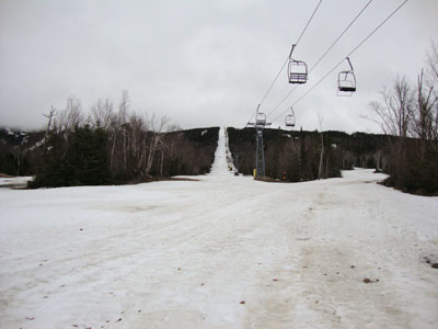
Looking up the hiking path near the base lodge of the ski area

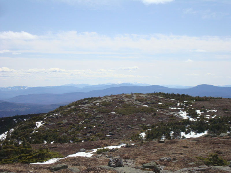
Looking southwest at the White Mountains from Saddleback Mountain
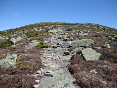
The Appalachian Trail between Saddleback Mountain and the Horn
Looking up the Appalachian Trail on the way to the Horn

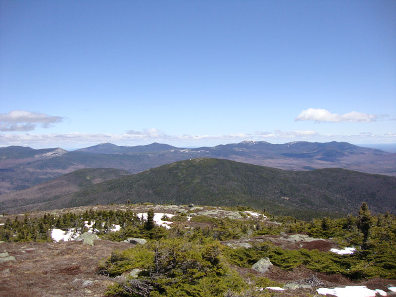
Looking at Redington, Sugarloaf, Spaulding, and Abraham from Saddleback's Horn

Directions to trailhead: Take Route 16 North (East in Maine) to Rangeley, merging and continuing on Route 4 South. Take a left onto Dallas Hill Road, then a right onto the Saddleback Ski Area access road. Parking is available just above the Main Lodge. The hiking trail starts between the double chairlifts.
Back to Saddleback Mountain Profile
Back to Saddleback Mountain - The Horn Profile
|