Home
States
Colorado
Connecticut
Maine
Massachusetts
New Hampshire
New York
Rhode Island
Utah
Vermont
View All
Lists
NE 4,000 Footers
NE 100 Highest
NH 4,000 Footers
NH 100 Highest
NH 52 With A View
NH Belknap Range
NH Ossipee 10
Links
Trail Conditions
Trip Log
Sunrises
Sunsets
About
|
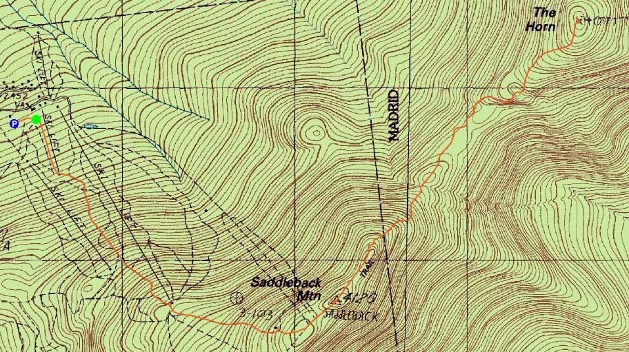
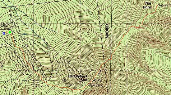
Saddleback Mountain, The Horn
Dallas, ME, Sandy River, ME, Madrid, ME
Trailheads, measurements, times, distances, and maps are all approximate and relative to the hike(s) as shown below.

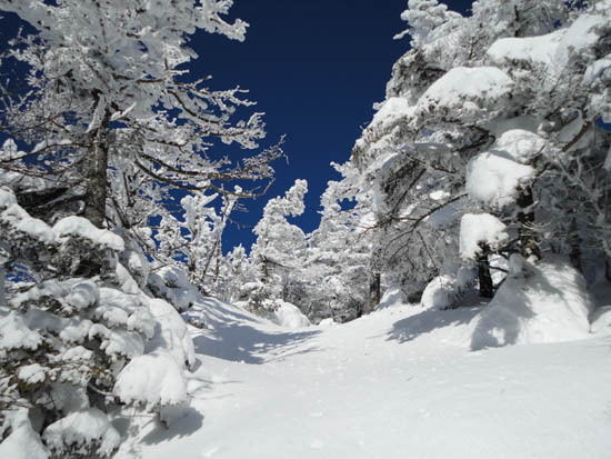
Looking down the connector trail from ski area to the Appalachain Trail
Route: Ski trails, unnamed connector trail, Appalachian Trail, (Saddleback Mountain), Appalachian Trail, (The Horn)
Starting at the ski area parking lot, we headed over to a perimeter ski trail and worked our way up the Saddleback ski area. We unfortunately ended up on a ski race course, but were able to continue up to the top of the double chairlift without issues. Beyond there, we connected to the top of the quad chairlift and headed up the connector trail above it.
At this point, the temperatures were likely at or below zero. Reaching the alpine zone, the winds were quite harsh - likely over 40 miles per hour, making it quite tough to walk.
Continuing over the summit and the subsequent false peak, we continued into the col, heading over exposed ice fields as well as some deeper snow drifts. With minimal vegetation, it took awhile to get to a treed area for a break from the winds.
The trail fortunately continued over to the otherside of the ridge for its ascent to The Horn, easing the exposure to the winds for awhile. In general, the navigation was a bit tricky due to small cairns and covered blazes.
From the summit of The Horn, we had decent views, stretching to the Whites, however Baxter didn't appear to be visible.
By the time we resummitted Saddleback, the winds had died down a bit, allowing for a few minutes to check out the views. From there, we headed back down the ski trails and to the relative warmth of the lower elevations.
| Hike Ratings |
|
Getting To Trailhead: |
Easy |
| Destination: |
Saddleback Mountain |
|
Length: |
Moderate |
|
Steepness: |
Very Difficult |
|
Navigation: |
Moderate |
|
Views: |
Excellent |
|
Crowds: |
Minimal |
| Destination: |
Saddleback Mountain - The Horn |
|
Length: |
Moderate |
|
Steepness: |
Very Difficult |
|
Navigation: |
Moderate |
|
Views: |
Excellent |
|
Crowds: |
Minimal |
|
| Hike Stats |
|
Date Hiked: |
Saturday, January 22, 2011 |
| Hike Commenced: |
10:04 AM |
| Parking Elevation: |
2,480' |
| Destination: |
Saddleback Mountain |
| Ascent Commenced: |
10:07 AM |
| Summit Reached: |
11:20 AM |
| Time Elapsed: |
01:13 |
| Trailhead Elevation: |
2,460' |
| Summit Elevation: |
4,116' |
| Vertical Gain: |
1,696' |
| Destination: |
Saddleback Mountain - The Horn |
| Ascent Commenced: |
11:22 AM |
| Summit Reached: |
12:52 PM |
| Time Elapsed: |
01:30 |
| Trailhead Elevation: |
4,116' |
| Summit Elevation: |
4,041' |
| Distance: |
1.7 miles |
| Vertical Gain: |
586' |
|
|
| Hike Ended: |
3:00 PM |
| Hike Time Elapsed: |
05:04 |
| Hike Vertical Gain: |
3,003' |
|
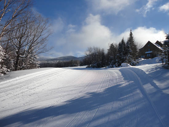
Looking up a ski trail near the base lodge parking area
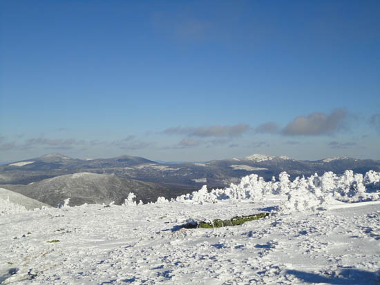
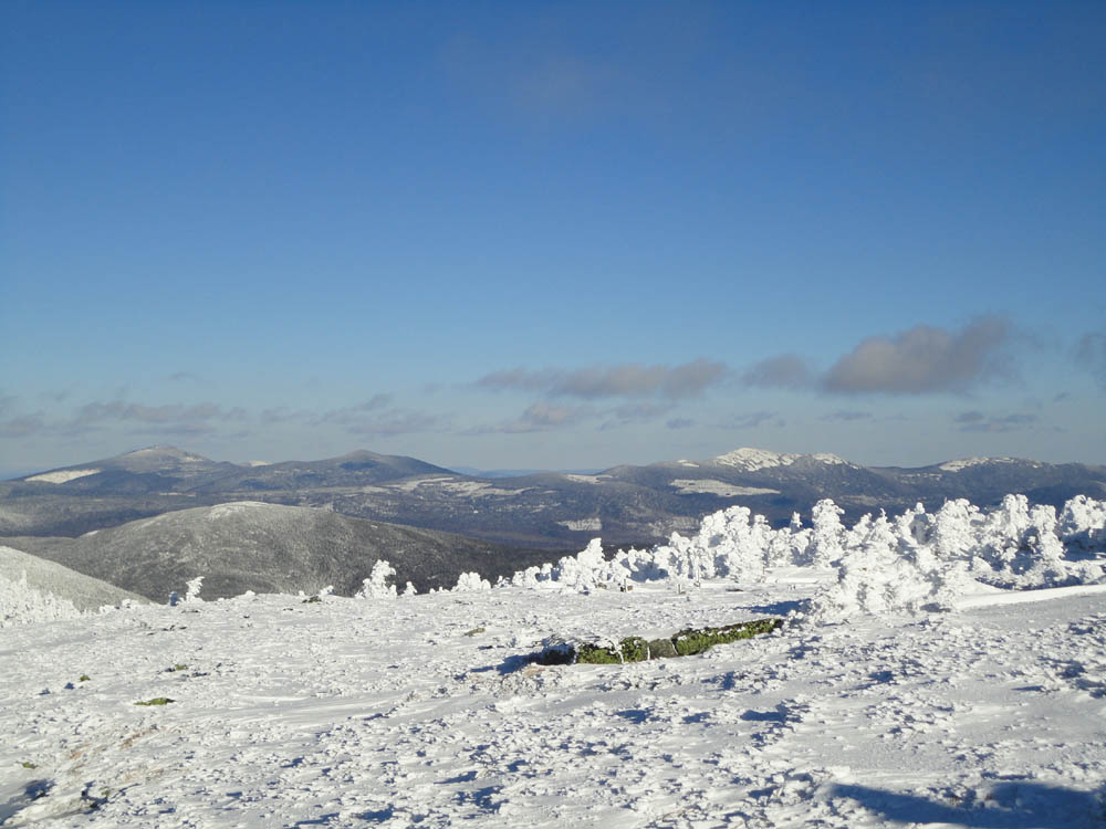
Looking at Sugarloaf, Spaulding, and Abraham from Saddleback Mountain
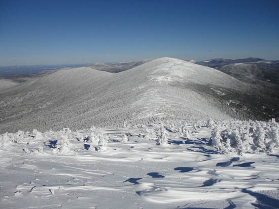
The Appalachian Trail between Saddleback Mountain and the Horn
The Appalachian Trail between Saddleback Mountain and the Horn
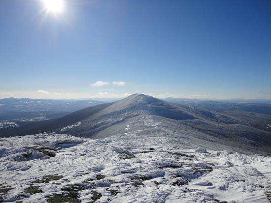
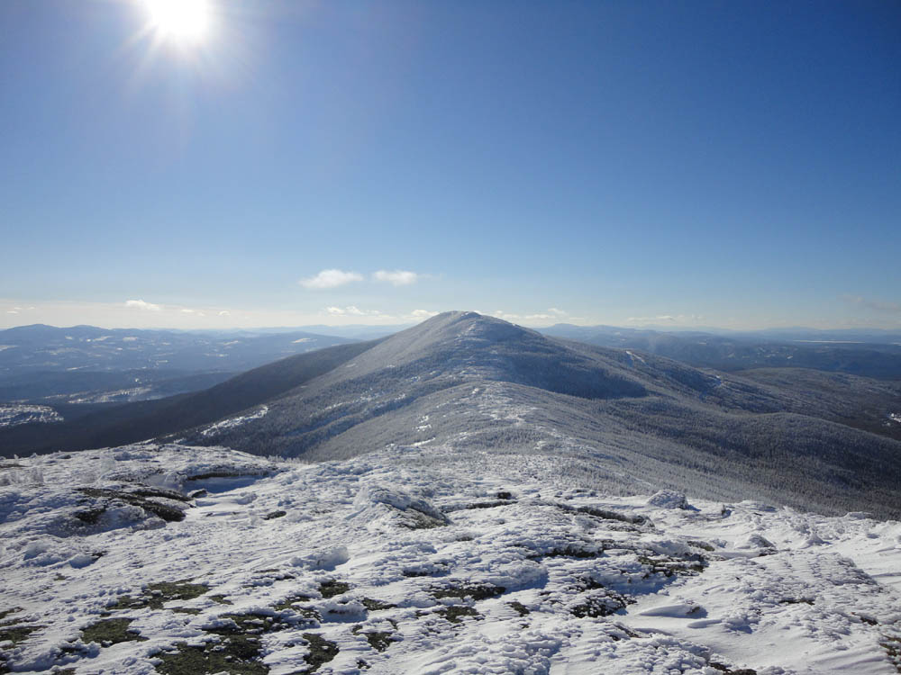
Looking at Saddleback from Saddleback's Horn

Directions to trailhead: Take Route 16 North (East in Maine) to Rangeley, merging and continuing on Route 4 South. Take a left onto Dallas Hill Road, then a right onto the Saddleback Ski Area access road. Parking is available just above the Main Lodge.
Back to Saddleback Mountain Profile
Back to Saddleback Mountain - The Horn Profile
|